world.wikisort.org - Uruguay
Villa Delia is a suburb of Maldonado, Uruguay.
Villa Delia | |
|---|---|
Suburb of Maldonado | |
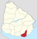
 Villa Delia Location in Uruguay | |
| Coordinates: 34°52′58″S 54°59′8″W | |
| Country | |
| Department | Maldonado Department |
| Population (2011) | |
| • Total | 1,703 |
| Time zone | UTC -3 |
| Postal code | 20000 |
| Dial plan | +598 42 (+6 digits) |
Location
The suburb is located on Route 38 and borders the suburbs Cerro Pelado and La Sonrisa to the west, Barrio Los Aromos to the north, and Pinares - Las Delicias to the south.
Population
In 2011 Villa Delia had a population of 1,703.[1]
| Year | Population |
|---|---|
| 1985 | 365 |
| 1996 | 583 |
| 2004 | 623 |
| 2011 | 1,703 |
Source: Instituto Nacional de Estadística de Uruguay[2]
References
- "Censos 2011 Cuadros Maldonado". INE. 2012. Archived from the original on October 10, 2012. Retrieved 25 August 2012.
- "1963–1996 Statistics / V" (DOC). Instituto Nacional de Estadística de Uruguay. 2004. Retrieved 7 July 2011.
External links
Capital: | ||
| Municipalities |
|  |
| Towns and villages |
| |
| Sights |
| |
This article about a place in Maldonado Department is a stub. You can help Wikipedia by expanding it. |
На других языках
[de] Villa Delia
Villa Delia ist ein Stadtviertel (Barrio) der Stadt Maldonado in Uruguay.- [en] Villa Delia
Текст в блоке "Читать" взят с сайта "Википедия" и доступен по лицензии Creative Commons Attribution-ShareAlike; в отдельных случаях могут действовать дополнительные условия.
Другой контент может иметь иную лицензию. Перед использованием материалов сайта WikiSort.org внимательно изучите правила лицензирования конкретных элементов наполнения сайта.
Другой контент может иметь иную лицензию. Перед использованием материалов сайта WikiSort.org внимательно изучите правила лицензирования конкретных элементов наполнения сайта.
2019-2025
WikiSort.org - проект по пересортировке и дополнению контента Википедии
WikiSort.org - проект по пересортировке и дополнению контента Википедии