world.wikisort.org - Uruguay
Tambores is a small town partly in the Paysandú Department and partly in the Tacuarembó Department of western Uruguay.
Tambores | |
|---|---|
Town | |
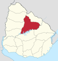
 Tambores Location in Uruguay | |
| Coordinates: 31°53′0″S 56°15′0″W | |
| Country | |
| Department | Paysandú Department and Tacuarembó Department |
| Population (2011) | |
| • Total | 1,561 |
| Time zone | UTC -3 |
| Postal code | 45004 |
| Dial plan | +598 463 (+5 digits) |
Location
It is located on both sides of the interdepartmental road which forms the border between the two departments, 8 kilometres (5.0 mi) south of its intersection with Route 26, which lies 33 kilometres (21 mi) southwest of Tacuarembó, the capital city of the department. The railroad track Montevideo - Tacuarembó - Rivera passes through the town.
History
On 21 August 1936, the existing populated nucleus here was elevated to "Pueblo" (village) by the Act of Ley N° 9.588.[1] Until then, it had been head of the judicial section of "Salsipuedes". Its status was further elevated to "Villa" (town) on 15 October 1963 by the Act of Ley N° 13.167.[2]
Population
In 2011 Tambores had a population of 1,561, of which 1,111 in Paysandú[3] and 450 in Tacuarembó.[4]
| Year | Population |
|---|---|
| 1908 | 1,886 |
| 1963 | 1,508 |
| 1975 | 1,532 |
| 1985 | 1,410 |
| 1996 | 1,479 |
| 2004 | 1,720 |
| 2011 | 1,561 |
Source: Instituto Nacional de Estadística de Uruguay[5]
Places of worship
- Immaculate Conception Parish Church (Roman Catholic, Sisters of Jesus Word and Victim)
References
- "Ley Nº 9.588". República Oriental del Uruguay, Poder Legislativo. 1936. Archived from the original on 4 March 2016. Retrieved 4 September 2012.
- "LEY N° 13.167". República Oriental del Uruguay, Poder Legislativo. 1963. Archived from the original on 16 February 2015. Retrieved 4 September 2012.
- "Censos 2011 Cuadros Paysandú". INE. 2012. Retrieved 25 August 2012.
- "Censos 2011 Tacuarembó" (XLS). INE. 2012. Retrieved 25 August 2012.
- "Statistics of urban localities (1908–2004)" (PDF). INE. 2012. Retrieved 4 September 2012.
External links
Capital: Paysandú | ||
| Municipalities |
|  |
| Towns and villages |
| |
| Sights | ||
Capital: Tacuarembó | ||
| Municipalities |
|  |
| Towns and villages |
| |
| Sights | ||
This article about a place in Paysandú Department is a stub. You can help Wikipedia by expanding it. |
This article about a place in Tacuarembó Department is a stub. You can help Wikipedia by expanding it. |
На других языках
- [en] Tambores
[es] Tambores (Uruguay)
Tambores es una localidad uruguaya, cuya administración es compartida por los departamentos de Paysandú y Tacuarembó. El sector correspondiente al departamento de Paysandú forma parte y es sede del municipio homónimo.[ru] Тамборес
Тамборес (исп. Tambores) — город в западной части Уругвая, расположенный частично в департаменте Пайсанду и частично в департаменте Такуарембо.Другой контент может иметь иную лицензию. Перед использованием материалов сайта WikiSort.org внимательно изучите правила лицензирования конкретных элементов наполнения сайта.
WikiSort.org - проект по пересортировке и дополнению контента Википедии