world.wikisort.org - United_Kingdom
Wothorpe is a village and civil parish in the Peterborough unitary authority of Cambridgeshire, England. It is in the far north-west of the district, and to the south of Stamford (in Lincolnshire). The parish borders Northamptonshire to the west.
| Wothorpe | |
|---|---|
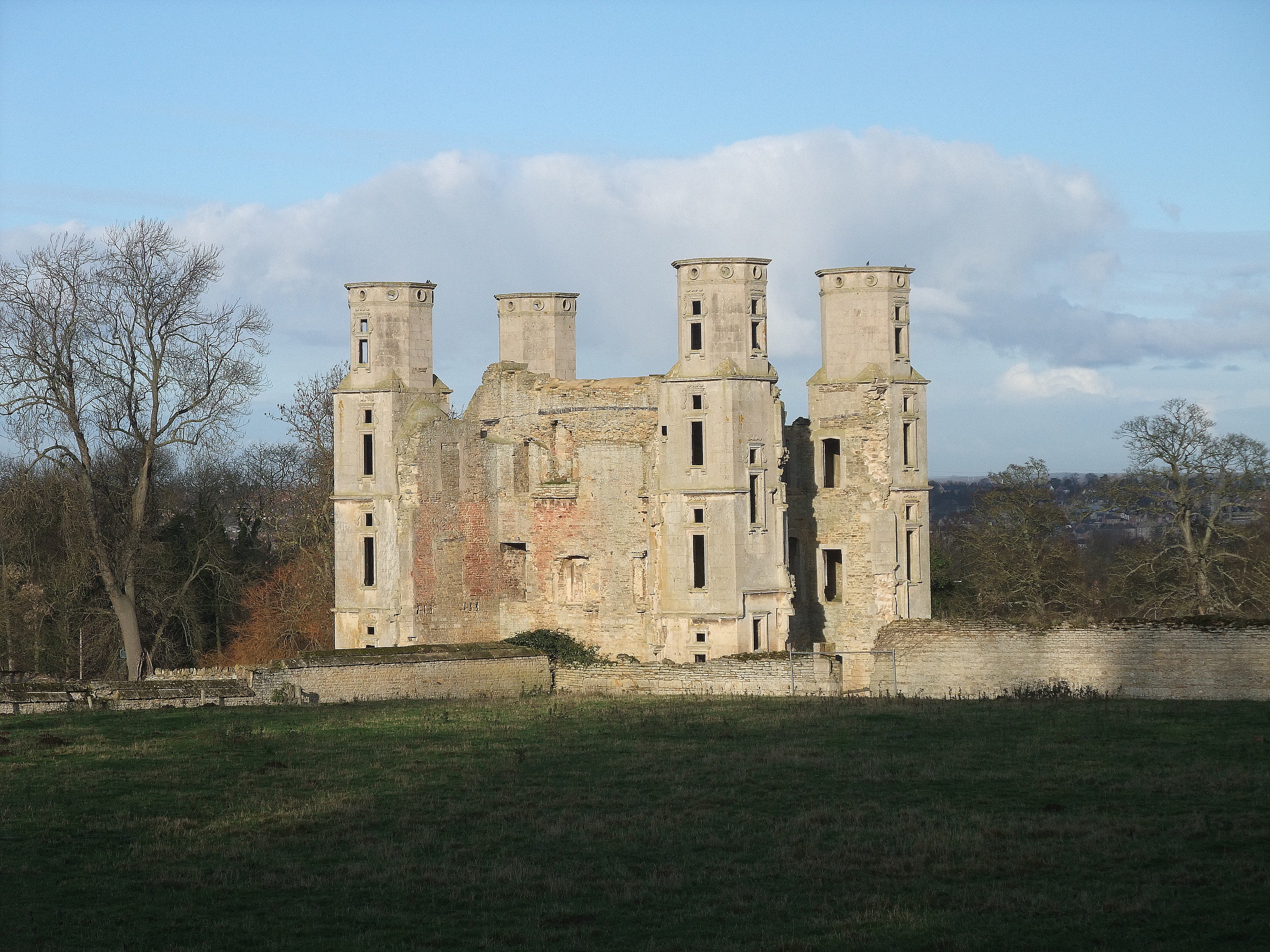 Wothorpe Towers | |
 Wothorpe Location within Cambridgeshire | |
| Population | 226 (2001 census) |
| Unitary authority | |
| Ceremonial county | |
| Region | |
| Country | England |
| Sovereign state | United Kingdom |
| Post town | STAMFORD |
| Postcode district | PE9 |
| Dialling code | 01780 |
Overview
Wothorpe Priory was a "small Benedictine nunnery", founded apparently around 1160. All but one of the nuns died in the outbreak of Plague in 1349, with the survivor becoming part of the Priory of Stamford. The property was dissolved by Henry VIII, being granted to Richard Cecil.[1][2]
As a parish, it was considered a hamlet within the parish of Stamford Baron, becoming a separate civil parish once more in 1866. Historically the parish was part of the Soke of Peterborough, associated with Northamptonshire. Administratively, it became part of the Stamford rural sanitary district in the 19th century, then later the Barnack Rural District of the administrative county of the Soke, then passing to Huntingdon and Peterborough in 1965 and Cambridgeshire in 1974 under the Local Government Act 1972.
The early-seventeenth-century Wothorpe Towers (also Wothorpe Hall) is a lodge that was once part of the Burghley estate, built by Thomas Cecil, 1st Earl of Exeter, eldest son of William Cecil, 1st Baron Burghley. After Thomas' death, the Towers were leased to George Villiers, 2nd Duke of Buckingham, then used as a dower house and finally, part dismantled to provide an eye-catcher in the newly landscaped park. The structure is now in the care of the Wothorpe Towers Preservation Trust which is undertaking conservation of the building and the site.[3]
Racecourse road
Within the parish of Wothorpe is the highest point of the historic Soke of Peterborough. The high point of 81 metres (266 ft) is located on Racecourse Road at TF 0353 0417, next to the county boundary with Northamptonshire. Although unmarked, the summit is of interest to participants in hill bagging who visit these high points of the historic counties of England.[4]

References
- Wothorpe House and Towers Hidden Heritage (retrieved 22 December 2011)
- R.M. Serjeantson, W.R.D. Adkins (editors) (1906). "Houses of Benedictine nuns: The priory of Wothorpe". A History of the County of Northampton: Volume 2. Institute of Historical Research. Retrieved 28 May 2014.
{{cite web}}:|author=has generic name (help) - "Wothorpe Towers Preservation Trust". Charity Commission. Retrieved 9 October 2022.
- Simon Edwardes (2001). "Racecourse Road". The Mountains of England and Wales. Retrieved 20 May 2014.
- http://www.visionofbritain.org.uk/relationships.jsp?u_id=10287212
- http://monasticmatrix.usc.edu/monasticon/?function=detail&id=899&PHPSESSID=1e6aeff1f699c2e36de654658d0029fc
- Youngs, Guide to the Local Administrative Units of England, Volume II
External links
This Cambridgeshire location article is a stub. You can help Wikipedia by expanding it. |
Другой контент может иметь иную лицензию. Перед использованием материалов сайта WikiSort.org внимательно изучите правила лицензирования конкретных элементов наполнения сайта.
WikiSort.org - проект по пересортировке и дополнению контента Википедии