world.wikisort.org - United_Kingdom
Woodplumpton is a village and civil parish in the City of Preston, Lancashire, England, located 5 miles (8 km) north of Preston.
| Woodplumpton | |
|---|---|
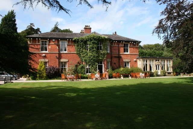 Bartle Hall | |
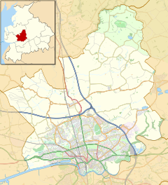 Woodplumpton Shown within the City of Preston district  Woodplumpton Shown on the Fylde  Woodplumpton Location within Lancashire | |
| Population | 2,154 (2011) |
| OS grid reference | SD500346 |
| Civil parish |
|
| District |
|
| Shire county |
|
| Region |
|
| Country | England |
| Sovereign state | United Kingdom |
| Post town | PRESTON |
| Postcode district | PR4 |
| Dialling code | 01772 |
| Police | Lancashire |
| Fire | Lancashire |
| Ambulance | North West |
| UK Parliament |
|
- Barton
- Broughton
- Goosnargh
- Grimsargh
- Haighton
- Ingol & Tanterton
- Lea
- Whittingham
- Woodplumpton
Geography
It is part of the Fylde, a flat area of land between the Forest of Bowland and the Lancashire coast.
Community
The village contains a primary school, the Wheatsheaf pub and a church. The school is C of E and has a strong link with the church.
St Anne's Church is the location of the grave of Meg Shelton, the notorious Fylde Hag, who was buried there in 1705 after being accused of witchcraft.
Parish
The parish includes the villages of Eaves, Catforth and Lower Bartle. Higher Plumpton is also included in the parish, but like Lower Bartle, is a very small hamlet.[1]
In the 19th century Woodplumpton was known as Plumpton-Wood.[2]
The parish was part of Preston Rural District throughout its existence from 1894 to 1974.[3] In 1974 the parish became part of the Borough of Preston, which became a city in 2002.
Demography
In 1901 the population of the parish was 1,208 and covered 4,970.5 acres.[4] In 2001 it had a population of 2,051,[5] increasing to 2,154 at the 2011 Census.[6]
Gallery
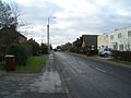 Woodplumpton's main street
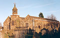 St Anne's Church
 The Lancaster Canal at Woodplumpton
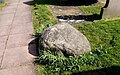 The boulder over the grave of Meg Shelton
 The village stocks
 The Wheatsheaf Public House


See also
- Listed buildings in Woodplumpton
References
- Woodplumpton at GENUKI
- Wilson, John Marius (1870–72), Plumpton-Wood, Imperial Gazetteer of England and Wales.
- Preston RD, Vision of Britain, accessed 9 June 2014
- Woodplumpton at British History Online
- UK Census (2001). "Local Area Report – Woodplumpton Parish (30UK008)". Nomis. Office for National Statistics. Retrieved 27 May 2019.
- UK Census (2011). "Local Area Report – Woodplumpton Parish (E04005241)". Nomis. Office for National Statistics. Retrieved 27 May 2019.
External links
![]() Media related to Woodplumpton at Wikimedia Commons
Media related to Woodplumpton at Wikimedia Commons
Geography of the City of Preston district | |||||||
|---|---|---|---|---|---|---|---|
| Cities |
|  | |||||
| Suburbs |
| ||||||
| Villages |
| ||||||
| Parishes |
| ||||||
| Topography |
| ||||||
| |||||||
Другой контент может иметь иную лицензию. Перед использованием материалов сайта WikiSort.org внимательно изучите правила лицензирования конкретных элементов наполнения сайта.
WikiSort.org - проект по пересортировке и дополнению контента Википедии