world.wikisort.org - United_Kingdom
Wervin is a small village and civil parish in the unitary authority of Cheshire West and Chester and the ceremonial county of Cheshire, England. It is situated between Chester and Ellesmere Port, near the Shropshire Union Canal and the M53 motorway.
| Wervin | |
|---|---|
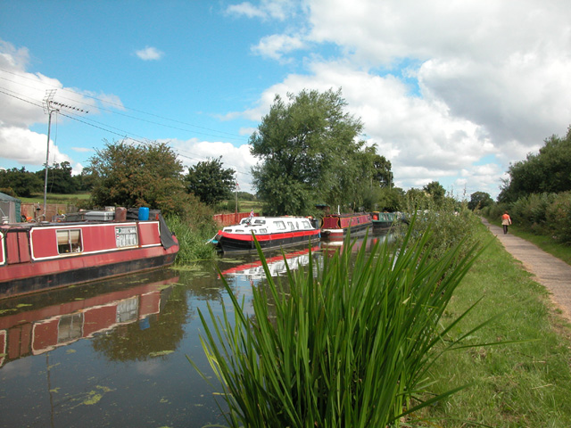 Shropshire Union Canal Moorings near Wervin | |
 Wervin Location within Cheshire | |
| Population | 146 (2011 census) |
| OS grid reference | SJ422719 |
| Civil parish |
|
| Unitary authority |
|
| Ceremonial county |
|
| Region |
|
| Country | England |
| Sovereign state | United Kingdom |
| Post town | CHESTER |
| Postcode district | CH2 |
| Dialling code | 01244 |
| Police | Cheshire |
| Fire | Cheshire |
| Ambulance | North West |
| UK Parliament |
|
History
The origin of the name is uncertain. One possible meaning being "cattle fen", derived from the Old English weorf (cattle) and fenn (a fen or marsh).[1]
Wervin was mentioned in the Domesday Book as Wivevrene and comprised eight households. Ownership of the land was divided between St. Werburgh's Abbey and William Malbank.[2][3]
The village was a township in St. Oswald's Parish, becoming a civil parish in 1866. Historically, Wervin was within Broxton Hundred and Wirral Hundred at different points in time.[4][5]
Demography
The population was recorded as 56 in 1801, then 60 in 1851, 94 in 1901 and 89 in 1951.[4] According to the 2001 census, Wervin had a population of 118,[6] increasing to 146 by the 2011 census.[7]
See also
- Listed buildings in Wervin
References
- "Key to English Place-Names: Wervin". University of Nottingham. Retrieved 13 February 2021.
- "Cheshire A-K: Wervin". Domesday Book Online. Retrieved 13 February 2021.
- Powell-Smith, Anna. "Wervin". Open Domesday/University of Hull. Retrieved 13 February 2021.
- "Cheshire Towns & Parishes: Wervin". GENUKI UK & Ireland Genealogy. Retrieved 7 November 2007.
- "Wervin CP/Tn". A Vision of Britain through Time. GB Historical GIS / University of Portsmouth. Retrieved 13 February 2021.
- UK Census (2001). "Local Area Report – Wervin Parish (13UB113)". Nomis. Office for National Statistics. Retrieved 13 February 2021.
- UK Census (2011). "Local Area Report – Wervin Parish (E04011186)". Nomis. Office for National Statistics. Retrieved 13 February 2021.
External links
![]() Media related to Wervin at Wikimedia Commons
Media related to Wervin at Wikimedia Commons
| Unitary authorities |
|
|---|---|
| Major settlements |
|
| Rivers | |
| Topics |
|
This Cheshire location article is a stub. You can help Wikipedia by expanding it. |
Другой контент может иметь иную лицензию. Перед использованием материалов сайта WikiSort.org внимательно изучите правила лицензирования конкретных элементов наполнения сайта.
WikiSort.org - проект по пересортировке и дополнению контента Википедии