world.wikisort.org - United_Kingdom
Toot Baldon is a village and civil parish about 5 miles (8 km) southeast of Oxford in Oxfordshire. Since 2012 it has been part of the Baldons joint parish council area, sharing a parish council with the adjacent civil parish of Marsh Baldon. The 2011 Census recorded its population as 148.[1]
| Toot Baldon | |
|---|---|
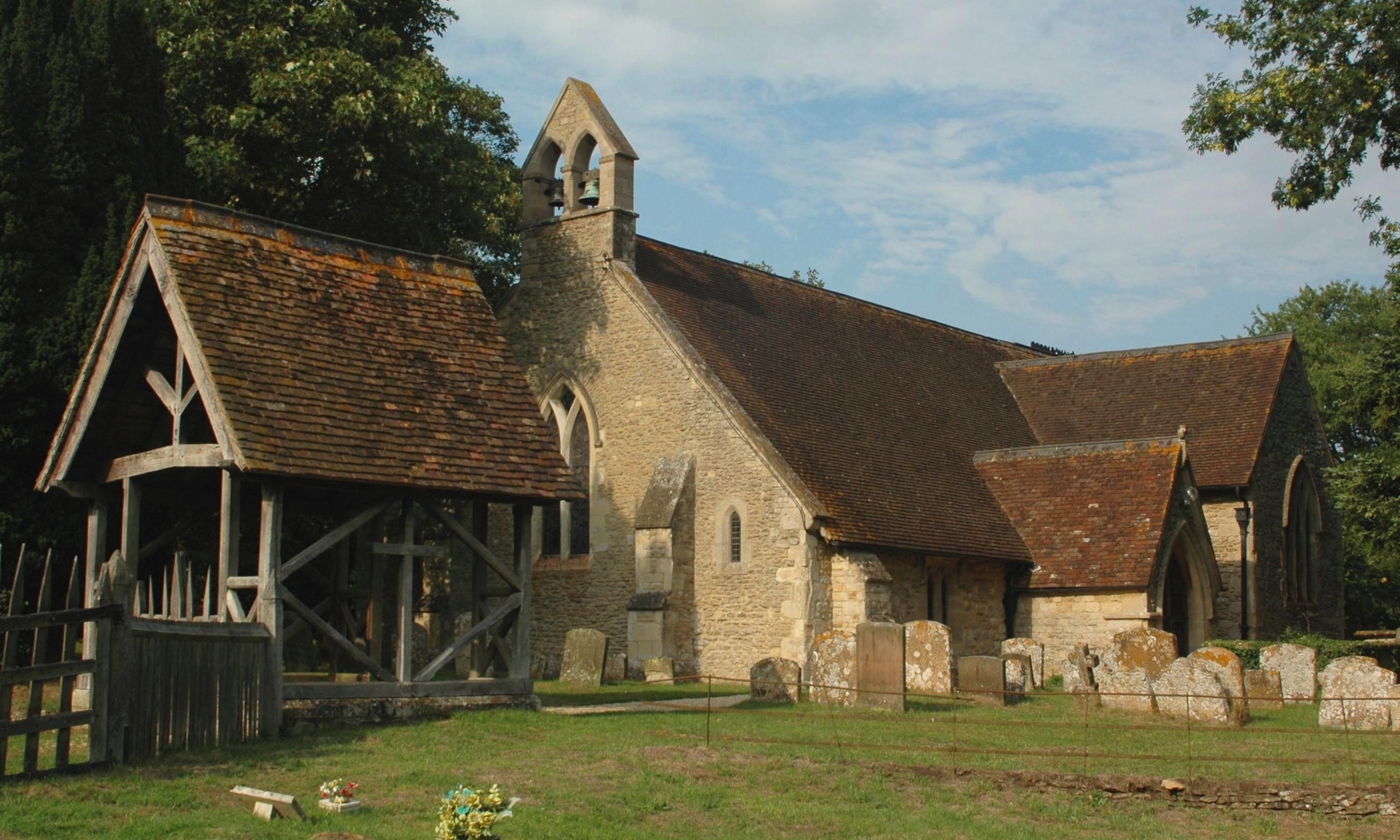 St Lawrence' parish church | |
 Toot Baldon Location within Oxfordshire | |
| Area | 4.48 km2 (1.73 sq mi) |
| Population | 148 (2011 census) |
| • Density | 33/km2 (85/sq mi) |
| OS grid reference | SP5600 |
| Civil parish |
|
| District | |
| Shire county |
|
| Region |
|
| Country | England |
| Sovereign state | United Kingdom |
| Post town | Oxford |
| Postcode district | OX44 |
| Dialling code | 01865 |
| Police | Thames Valley |
| Fire | Oxfordshire |
| Ambulance | South Central |
| UK Parliament |
|
| Website | Baldons Parish Council |
Toponym
"Toot" is derived from an Old English word for "a look-out place".[2] "Baldon" is derived from the Old English for "Bealda's Hill".[3]
History
The Church of England parish church of Saint Lawrence was built mostly in the 13th century.[4] It was restored to designs by the Gothic Revival architect Henry Woodyer in 1865.[5] The church is a Grade II* listed building.[6] There is a monument to the 1965 Little Baldon air crash in the north aisle of the church. Court House Farm is partly 16th century.[5][7] Toot Baldon manor house was built in the 17th century[5] and is Grade II* listed.[8] A parish school was built in the 19th or early 20th century. It has since closed and the building is now a private house.
Amenities
Toot Baldon has a pub. It used to be the Crown[9] but is now called the Mole Inn.[10] Toot Baldon and Marsh Baldon share a cricket club.[11]
References
- "Area: Toot Baldon (Parish): Key Figures for 2011 Census: Key Statistics". Neighbourhood Statistics. Office for National Statistics. Retrieved 27 May 2015.
- Alexander 1912, p. 209.
- Alexander 1912, p. 46.
- Sherwood & Pevsner 1974, p. 818.
- Sherwood & Pevsner 1974, p. 819.
- Historic England. "Church of St Lawrence (Grade II*) (1193957)". National Heritage List for England. Retrieved 27 May 2015.
- Historic England. "Court House (Grade II) (1047997)". National Heritage List for England. Retrieved 27 May 2015.
- Historic England. "The Manor House (Grade II*) (1047998)". National Heritage List for England. Retrieved 27 May 2015.
- Historic England. "The Crown Public House (Grade II) (1285927)". National Heritage List for England. Retrieved 27 May 2015.
- The Mole Inn
- The Baldons Cricket Club
Sources

- Alexander, Henry (1912). The Place-Names of Oxfordshire, their origin and development. Oxford: Clarendon Press. pp. 46, 209.
- Lobel, Mary D, ed. (1957). A History of the County of Oxford. Victoria County History. Vol. 5: Bullingdon Hundred. London: Oxford University Press for the Institute of Historical Research. pp. 47–56.
- Sherwood, Jennifer; Pevsner, Nikolaus (1974). Oxfordshire. The Buildings of England. Harmondsworth: Penguin Books. pp. 818–819. ISBN 0-14-071045-0.
External links
The district of South Oxfordshire | ||
|---|---|---|
| ||
| Towns |
|  |
| Large villages |
| |
| Other civil parishes (component villages and hamlets) |
| |
| Former districts and boroughs |
| |
| Former constituencies |
| |
| ||
This Oxfordshire location article is a stub. You can help Wikipedia by expanding it. |
Другой контент может иметь иную лицензию. Перед использованием материалов сайта WikiSort.org внимательно изучите правила лицензирования конкретных элементов наполнения сайта.
WikiSort.org - проект по пересортировке и дополнению контента Википедии