world.wikisort.org - United_Kingdom
Mongewell (first syllable rhymes with sponge) is a village in the civil parish of Crowmarsh, about 1 mile (1.6 km) south of Wallingford in Oxfordshire. Mongewell is on the east bank of the Thames, linked with the west bank at Winterbrook by Winterbrook Bridge. The earthwork Grim's Ditch, now part of The Ridgeway long-distance footpath, passes through the northern part of it and is a scheduled ancient monument.
| Mongewell | |
|---|---|
 Mongewell Park | |
 Mongewell Location within Oxfordshire | |
| OS grid reference | SU611877 |
| Civil parish | |
| District | |
| Shire county |
|
| Region |
|
| Country | England |
| Sovereign state | United Kingdom |
| Post town | Wallingford |
| Postcode district | OX10 |
| Police | Thames Valley |
| Fire | Oxfordshire |
| Ambulance | South Central |
| UK Parliament |
|
History
The ancient earthwork of Grim's Ditch has its main section north of the village, a Scheduled Ancient Monument.[1] In order to provide a level climb up to the first major hill of the long Chiltern Hills range to the east and northeast, this has embankments and cuttings, with thousands of tonnes of earth displaced perhaps in the Bronze Age in order to facilitate access by foot. The place-name 'Mongewell' is first attested in an Anglo-Saxon will circa 966–75, where it appears as Mundingwillæ. It appears as Mongewel in the Domesday Book of 1086, and as Mungewell in the Book of Fees in 1242. The name means 'the spring or stream of Munda's people'.[2]
The parish of Mongewell was mentioned in the Domesday Book.[3] The parish church of St John the Baptist dates architecturally to the 12th century, with later repairs and additions.[4] Mongewell was a strip parish, a thin strip of land extending into the Chiltern Hills[5] including part of Stoke Row. The ecclesiastical parish was joined by a civil parish in the 19th century, but in 1932 was split, mostly joining a new civil parish named Crowmarsh, but a small part was added to Rotherfield Greys parish.[6]
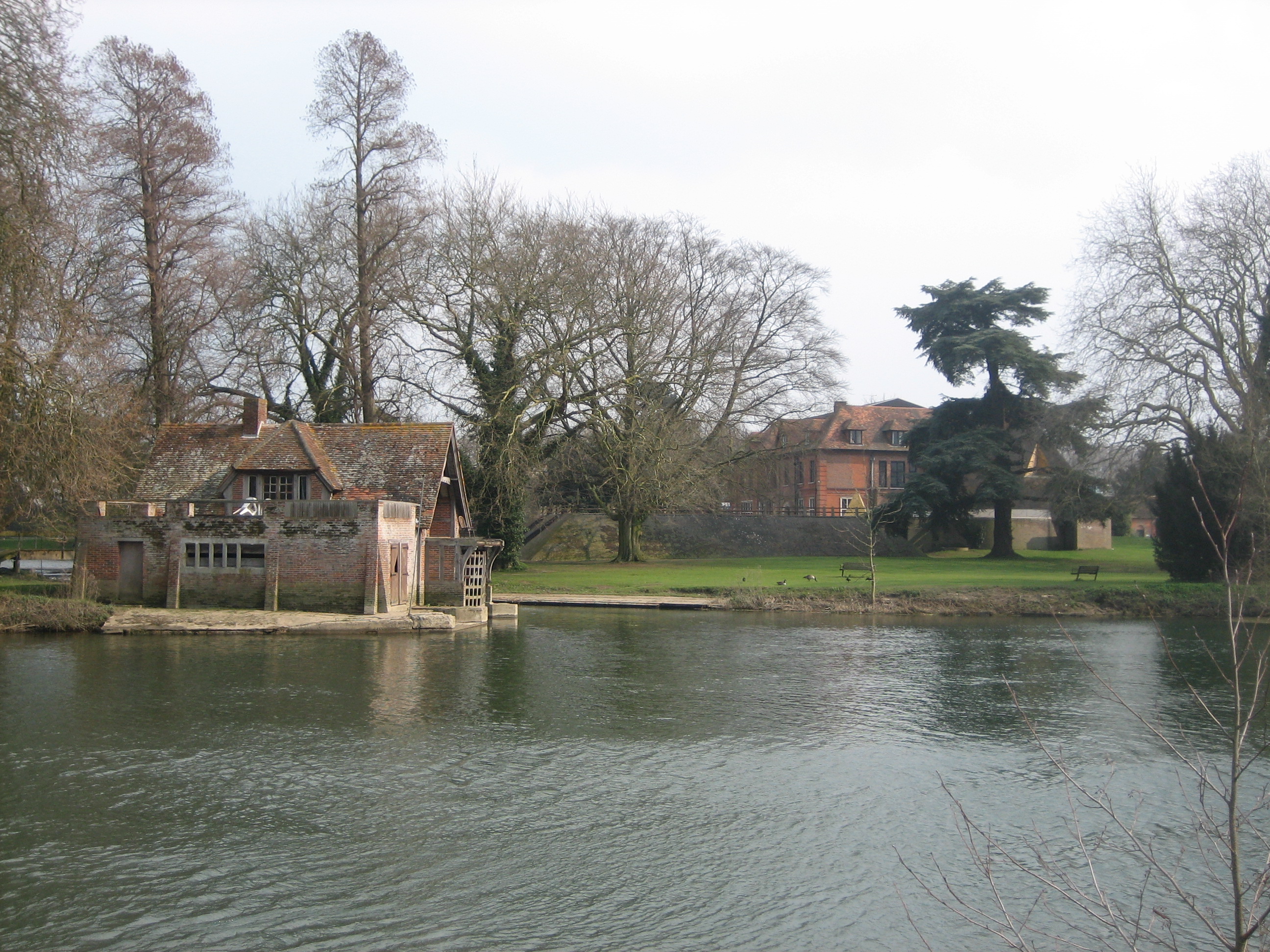
Mongewell Park
Mongewell Park was once home to Shute Barrington, Bishop of Llandaff (1769–1782). Replacing the original Georgian Mongewell House of Barrington, a large brick mansion in William and Mary style was built in 1890 for Alexander Frazer whose initials can be seen on the lodge gates (Pedgley and Pedgley, 1990). After Fraser died in 1916, the house became a hospital for wounded officers in World War I. In 1918, it was sold to the American millionaire Howard Gould. Because he was an atheist, he had the lane to the now ruined Mongewell church sunk so that he would not see the parishioners attending service.[citation needed]
He sold the house in 1939 and the Royal Air Force occupied it until 1945. In January 1944 it became the Headquarters for No 2 Group RAF of Bomber Command led by Air Vice Marshal Basil Embry. On the Staff there for six months before his capture as a POW was the World War II night fighter ace, Wing Commander Bob Braham (Braham, 1984). At the end of the war the house was once more used as a hospital before becoming derelict. A Jewish boarding school, Carmel College, occupied Mongewell Park from 1948 to 1997. The school added several buildings, including its synagogue and the Julius Gottlieb Gallery and Boathouse, which were later listed.[7] As of June 2007, it was planned to redevelop the site for housing.
See also
- St John the Baptist's Church, Mongewell
References
- Grim's Ditch - section from the south of Mongewell Park Lodge to the south of Nuffield Church Historic England. "Details from listed building database (1006368)". National Heritage List for England. Retrieved 9 June 2013.
- Eilert Ekwall, The Concise Oxford Dictionary of English Place-names, p.329.
- L. F. Salzman, ed. (1939). "The Domesday survey: The text". A history of the County of Oxford: Volume 1. Institute of Historical Research. Retrieved 20 August 2011.
- Church of St John the Baptist Historic England. "Details from listed building database (1059580)". National Heritage List for England. Retrieved 9 June 2013.
- Vision of Britain: Boundary map
- Vision of Britain website
- The Gallery building Historic England. "Details from listed building database (1379942)". National Heritage List for England. Retrieved 9 June 2013.
Further reading
- Braham, J.R.D. (1984) Night Fighter, Specially illustrated edition, New York : Bantam Books, p. 186–195, ISBN 0-553-24127-3
- Pedgley, B. and Pedgley, D. (1990) Crowmarsh – A history of Crowmarsh Gifford, Newnham Murren, Mongewell and North Stoke, Crowmarsh History Group, p. 50–54, ISBN 0-9516305-0-4
The district of South Oxfordshire | ||
|---|---|---|
| ||
| Towns |
|  |
| Large villages |
| |
| Other civil parishes (component villages and hamlets) |
| |
| Former districts and boroughs |
| |
| Former constituencies |
| |
| ||
Authority control | |
|---|---|
| General |
|
| National libraries | |
Другой контент может иметь иную лицензию. Перед использованием материалов сайта WikiSort.org внимательно изучите правила лицензирования конкретных элементов наполнения сайта.
WikiSort.org - проект по пересортировке и дополнению контента Википедии