world.wikisort.org - United_Kingdom
South Hams is a local government district on the south coast of Devon, England. Services divide between those provided by its own Council headquartered in Totnes, and those provided by Devon County Council headquartered in the city of Exeter.
South Hams | |
|---|---|
 From Start Point looking towards Hallsands and Beesands | |
|
| |
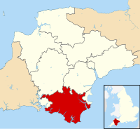 South Hams shown within Devon | |
| Coordinates (Totnes): 50°25′53″N 3°41′28″W | |
| Sovereign state | United Kingdom |
| Constituent country | England |
| Region | South West England |
| Non-metropolitan county | Devon |
| Formed | 1 April 1974 |
| Government | |
| • Type | District council |
| • Body | South Hams District Council |
| • HQ | Totnes |
| • Sub-divisions | Civil parishes |
| • UK Parliament | South West Devon Totnes |
| • MPs (respectively) | Gary Streeter Anthony Mangnall |
| • Political party | Conservative |
| Area | |
| • Total | 342.28 sq mi (886.51 km2) |
| • Rank | Ranked 41st |
| Population (mid-2019 est.) | |
| • Total | 87,004 |
| • Rank | Ranked 280th |
| • Density | 250/sq mi (97/km2) |
| • Ethnicity | 99.09% White |
| ONS code | 18UG |
| Website | www |
Beside Totnes are its towns of Dartmouth, Kingsbridge, Salcombe, and Ivybridge — the most populous with 11,851 residents, as at the 2011 Census.
To the north, it includes part of Dartmoor National Park, to the east borders Torbay, and to the west Plymouth. It contains some of the most unspoilt coastline on the south coast, including the promontories of Start Point and Bolt Head. The entire coastline, along with the lower Avon and Dart valleys, form most of the South Devon Area of Outstanding Natural Beauty. The South Hams, along with nearby Broadsands in Paignton, is the last British refuge of the cirl bunting.[citation needed]
History
The South Hams were formerly part of the Brythonic (Celtic) Kingdom of Dumnonia later reduced to the modern boundary at the River Tamar as Cornwall presumably during the tenth-century reign of Æthelstan. Post-Roman settlement on coastal promontory hillforts, such as Burgh Island, follows the established pattern of trading—of tin in particular—found across the western, so-called 'Celtic', Atlantic coastal regions. In the later Anglo-Saxon era, the South Hams was a feudal estate consisting of all of the land between the River Plym and River Dart and south of Dartmoor with the English Channel forming the southern boundary. There is some evidence that Cornish was spoken and understood in the area until the late Middle Ages.[1]
In 1917, the village of Hallsands was abandoned after much of it was lost to the sea. This happened because the shingle bank protecting the shore was removed to help build Devonport dockyard.[2]
In 1944 several villages were evacuated so that training for D-Day could be carried out in secret. The area was chosen because of the resemblance of its beaches to those of Normandy. Preparations were disrupted, and secrecy nearly compromised, by a devastating E-boat attack during Exercise Tiger. In 1967, the suburban towns of Plympton and Plymstock were amalgamated with the City of Plymouth.[citation needed]
The current district was formed on 1 April 1974, under the Local Government Act 1972, by the merger of:
- Borough of Dartmouth
- Borough of Totnes
- Kingsbridge Rural District
- Kingsbridge Urban District
- Plympton St Mary Rural District
- Salcombe Urban District
- Totnes Rural District
In the 2016 EU Referendum it voted to remain with a very high (80.3%) turnout.[3][4]
Geography
Geography divides into three unequal, fuzzy bands, one with bays, headlands, the birdlife, fishing and small harbour towns' estuaries and rias; an unequal wide-ranging elevations middle band with the main, well-conserved towns and; a sparsely populated, upland National Park moorland in the north. For over a century its tourism was concentrated around the railway, with most stations built here from 1847 to 1872 so tourism to its beaches and fishing villages began in earnest much later than to the 'English Riviera' east of the area. South Hams' widespread tourism multiplied on the dualling of the A38 and time-cutting construction of the M5 and A303 across other parts of south-west England.
In the north, there is...the "wildscape"—...[a new] bypass [to the A30, the A38]...cut[s] through some of the most beautiful country in Britain, that of the Dartmoor national park....while in the south-west there is extensive mining of china clay...[an abortive] tungsten mine in the Shaugh Prior — Sparkwell area will be [would have been] amongst the largest in the world and probably the largest in Europe. The wildscape band runs from Cadover Bridge and Shaugh Prior in the west right over to the other side of Dartmoor, to the Avon dam, Shipley Bridge and South Brent, touching the outskirts of Buckfastleigh.
The second band is the agricultural belt of lush, fertile farmland which produces some of the finest milk and Devon cream. Within that belt are the medieval towns of Modbury and Totnes and small hamlets and villages such as...Holbeton, Marldon and Berry Pomeroy.
The third band is the Heritage coast [and South Devon Area of Outstanding Natural Beauty], running from near the fishing port of Brixham through Churston, Kingswear, Dartmouth, Slapton Sands, Torcross, East Prawle, Salcombe and Bigbury Bay almost to the boundaries of Plymouth in Heybrook bay. That area is filled with rivers such as the Erme, the Plym, the Avon and the Dart. [There is] an island in the shape of Burgh Island. There are rolling hills, deep wooded valleys, estuaries full of fish and a coastline full of crab, lobsters and oysters. The climate is warm and mellow. Some regard it as a garden of Eden. We even have a naturist beach and hotel. ...forgive me if I wax lyrical about this beautiful, delightful area. Tourism is an important livelihood...the other is farming...for many.[5]
— Anthony Steen, MP for this area (1983–2010), South-West Region potential and current public priorities debate, 1983)
Note: The aforementioned Brixham and Churston are geographically within neighbouring Torbay but were part of the South Hams Parliamentary constituency.
Settlements
- Ash, Aish, Allaleigh, Ashprington, Aveton Gifford
- Badworthy, Bantham, Beesands, Beeson, Berry Pomeroy, Bickleigh, Bigbury-on-Sea, Bittaford, Blackawton, Blackpool, Bolberry, Brixton, Broadhempston, Buckland-Tout-Saints
- Charleton, Chillington, Chivelstone, Churchstow, Cornwood, Cornworthy, Curtisknowle
- Dartington, Dartmouth, Dean Prior, Didworthy, Diptford, Dittisham, Dodbrooke (neighbourhood of Kingsbridge)
- East Allington, East Charleton, East Portlemouth, East Prawle, Ermington
- Ford (Chivelstone), Ford (Holbeton), Frogmore
- Goveton
- Hallsands, Halwell, Harberton, Harford, Hemsford, Heybrook Bay, Holbeton, Holne, Hutcherleigh
- Ivybridge
- Kingsbridge, Kingston, Kingswear
- Landscove, Ledstone, Lee Moor, Littlehempston, Loddiswell, Lutton
- Malborough, Marldon, Michelcombe, Modbury, Moreleigh
- Newton Ferrers, Noss Mayo, North Huish
- Rattery, Revelstoke, Rew, Ringmore, Roborough
- Salcombe, Scorriton, Shaugh Prior, Sherford (near Kingsbridge), Sherford (new town), Slapton, Soar, South Brent, South Huish, South Milton, South Pool, Sparkwell, Start, Staverton, Stoke Fleming, Stoke Gabriel, Stokenham, Sutton
- Thurlestone, Torcross, Totnes, Tuckenhay, The Mounts
- Ugborough, Uphempston
- Washbourne, Wembury, West Alvington, Woodleigh, Woolston Green, Wotter, Wrangaton
- Yealmpton
Politics
South Hams District Council | |
|---|---|
Logo | |
| Type | |
| Type | Non-metropolitan district council of South Hams |
| Houses | Unicameral |
| History | |
| Founded | 1 April 1974 |
| Leadership | |
Leader | |
| Structure | |
| Seats | 31 |
 | |
Political groups |
|
| Elections | |
Voting system | First past the post |
Last election | 2 May 2019 |
Next election | 2023 |
| Meeting place | |
 | |
| Follaton House, Plymouth Road, Totnes, TQ9 5NE | |
| Website | |
| www.southhams.gov.uk | |
The South Hams is represented in the House of Commons by two parliamentary constituencies. The constituencies however do not represent the borders of the South Hams. Sir Gary Streeter and Anthony Mangnall represent the constituencies of South West Devon and Totnes respectively.
In South Hams, most councillors who are elected have been nominated by one of England's major political parties, although there have also been a small number of independents in previous elections. As of the 7 May 2015 election, the majority of councillors in the council are Conservatives.[7] Up until 1983, the council was governed by independent councillors, before the Conservatives gained a majority in 1987; a position which has since been held (excluding a brief period where they lost control between 1995–99).[8]
| Date | Conservative | +/- | Liberal Democrat | +/- | Greens | +/- | Labour | +/- | Independent | +/- | Control | |||||
| 2011 | 30 | 5 | 3 | 1 | 1 | Conservative | ||||||||||
| 2015[note 1][10] | 25 | -5 | 2 | -3 | 3 | = | 1 | = | 0 | -1 | Conservative | |||||
| 2017 | 24 | -1 | 3 | +1 | 3 | = | 1 | = | 0 | = | Conservative | |||||
| 2019 | 16 | -8 | 10 | +7 | 3 | = | 0 | -1 | 2 | +2 | Conservative | |||||

Electoral wards
The district of South Hams is divided into 20 wards, each returning between one and three councillors. Some wards are coterminous with civil parishes, though most consist of multiple parishes or parts of parishes. The following table lists the electoral wards of South Hams and the associated civil parishes.
| Ward | Civil Parishes | No. of councillors |
| Allington & Strete | 1 | |
| Bickleigh & Cornwood |
|
1 |
| Blackawton & Stoke Fleming |
|
1 |
| Charterlands |
|
1 |
| Dartington & Staverton | 1 | |
| Dartmouth & East Dart | 3 | |
| Ermington & Ugborough | 1 | |
| Ivybridge East |
|
2 |
| Ivybridge West | Ivybridge (part) | 2 |
| Kingsbridge | Kingsbridge | 2 |
| Loddiswell & Aveton Gifford |
|
1 |
| Marldon & Littlehempston | 1 | |
| Newton & Yealmpton | 2 | |
| Salcombe & Thurlestone |
|
2 |
| South Brent |
|
2 |
| Stokenham |
|
1 |
| Totnes | Totnes | 3 |
| Wembury & Brixton |
|
2 |
| West Dart | 1 | |
| Woolwell | Bickleigh (part) | 1 |
Responsibilities for services
As of mid-2019 est., South Hams District Council is responsible for a population of 87,004 (ranked 280th in England) and covers an area of 886.5 km2 (342.3 sq mi) (ranked 41st).[11][12] South Hams along with Devon County Council and 61 town and parish councils operate a three-tier system of local government. Devon County Council is responsible for larger issues such as education, highways and social services. South Hams District Council and Devon CC are jointly responsible for community transport, economic development, emergency planning, environmental protection, museums and arts, recycling, street lighting and tourism. More minor responsibilities are held by just the district council and/or the town and parish councils. Some of these responsibilities include car parks, litter, public toilets and waste collection.[13] In order to reduce waste and injuries to the public, the council offer seagull-proof sacks as form of waste management.[14]
See also
- Grade I listed buildings in South Hams
- Grade II* listed buildings in South Hams
Notes
- Reductions in seat numbers due to boundary changes.[9]
References
- "When was Cornish spoken in Devon". BBC H2G2 Conversation Forum. 18 July 2010. Retrieved 6 May 2011.
- "Recalling the disaster at Hallsands". BBC Devon: History features. 1 July 2005. Retrieved 6 May 2011.
- http://old.southhams.gov.uk/eureferendumresults [dead link]
- "South Hams votes to Remain, but UK as a whole votes Leave".
- "LOCAL GOVERNMENT BILL". Parliamentary Debates (Hansard). House of Commons. 19 December 1983. col. 278–291.
- "Council minutes, 16 May 2019" (PDF). South Hams District Council. Retrieved 29 July 2022.
- "Declaration of Result of Poll". South Hams District Council. 7 May 2015. Archived from the original on 6 February 2017. Retrieved 27 October 2015.
- "South Hams". BBC News Online. Retrieved 20 November 2009.
- "The South Hams (Electoral Changes) Order 2014 No. 3059". Legislation.gov.uk. 5 November 2014.
- "Declaration of Result of Poll". South Hams District Council. 7 May 2015. Archived from the original on 6 February 2017. Retrieved 27 October 2015.
- "Population Estimates for UK, England and Wales, Scotland and Northern Ireland, Mid-2019". Office for National Statistics. 6 May 2020. Retrieved 6 May 2020.
- "Standard Area Measurements (2016) for Administrative Areas in the United Kingdom". Office for National Statistics. 1 February 2017. Retrieved 9 February 2017.
- "Local authorities - who does what ?". Devon County Council. Retrieved 2 January 2016.
- "Free Seagull Sacks". South Hams District Council. Retrieved 2 January 2016.
External links
На других языках
[de] South Hams
South Hams ist ein District in der Grafschaft Devon in England. Verwaltungssitz ist die Stadt Totnes; weitere bedeutende Orte sind Berry Pomeroy, Dartmouth, Ivybridge, Kingsbridge, Kingswear, Modbury, Salcombe und South Brent. Im Norden liegt ein wesentlicher Teil des Dartmoor-Nationalparks.- [en] South Hams
[ru] Саут-Хэмс
Саут-Хэмс (англ. South Hams) — неметрополитенский район (англ. non-metropolitan district) на южном побережье графства Девон, Англия. Районный центр находится в Тотнесе. Другие города: Дартмут, Кингсбридж, Айвибридж (англ.) (рус. и Солком (англ.) (рус.. Крупнейшим городом, с населением 16 056 человек, является Айвибридж.Другой контент может иметь иную лицензию. Перед использованием материалов сайта WikiSort.org внимательно изучите правила лицензирования конкретных элементов наполнения сайта.
WikiSort.org - проект по пересортировке и дополнению контента Википедии