world.wikisort.org - United_Kingdom
Shaw-cum-Donnington is a civil parish in West Berkshire, England with all of its urban or suburban area immediately north of the largest town in the district, Newbury. It comprises the villages of Shaw and Donnington and contains the partially ruined castle of Donnington Castle which has most of its various outside walls intact. The area is mostly green space but where developed is almost entirely residential with shops and cafés. It has housing immediately north of the town of Newbury.
| Shaw cum Donnington | |
|---|---|
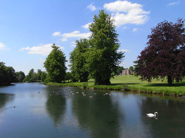 Lake, lawn and house at Donnington Grove, the area's hotel resort. | |
 Public footpath across barley field, typical of the north of the area. | |
 Shaw cum Donnington Location within Berkshire | |
| Area | 8.6 km2 (3.3 sq mi) |
| Population | 1,686 (2011 census)[1] |
| • Density | 196/km2 (510/sq mi) |
| OS grid reference | SU4767 |
| • London | 51 miles (82 km)[2] |
| Civil parish |
|
| Unitary authority | |
| Ceremonial county |
|
| Region |
|
| Country | England |
| Sovereign state | United Kingdom |
| Post town | NEWBURY |
| Postcode district | RG14 |
| Dialling code | 01635 |
| Police | Thames Valley |
| Fire | Royal Berkshire |
| Ambulance | South Central |
| UK Parliament |
|
Amenities
The parish church which crosses the River Lambourn bounding the civil parish to the south for a few hundred metres, is of the same name. It has one church which has an active Church of England community at Shaw.[3] and also has the area's Church of England primary school.
The Vodafone World Headquarters are in the south of the village.
Demography
| Output area | Homes owned outright | Owned with a loan | Socially rented | Privately rented | Other | km² roads | km² water | km² domestic gardens | Usual residents | km² |
|---|---|---|---|---|---|---|---|---|---|---|
| Civil parish | 231 | 216 | 162 | 83 | 13 | 0.240 | 0.110 | 0.494 | 1686 | 8.6 |
References
- Key Statistics: Dwellings; Quick Statistics: Population Density; Physical Environment: Land Use Survey 2005
- Grid reference Finder measurement tools
- "Shaw cum Donnington parish". The Church of England. Retrieved 11 December 2014.
External links
![]() Media related to Shaw cum Donnington at Wikimedia Commons
Media related to Shaw cum Donnington at Wikimedia Commons
Другой контент может иметь иную лицензию. Перед использованием материалов сайта WikiSort.org внимательно изучите правила лицензирования конкретных элементов наполнения сайта.
WikiSort.org - проект по пересортировке и дополнению контента Википедии