world.wikisort.org - United_Kingdom
Maidens is a village in the Kirkoswald parish of Ayrshire, Scotland. Situated on the coast of the Firth of Clyde at the southern end of Maidenhead Bay, a series of rocks known as the "Maidens” form a natural harbour. The village lies 2 miles (3 km) north of the ruinous Turnberry Castle, ancient seat of the Earls of Carrick, and 5 miles (8 km) west of Maybole. It formerly had its own railway station on the Maidens and Dunure Light Railway. In 1991, Maidens had a population of 567.
| Maidens | |
|---|---|
 View of Maidens | |
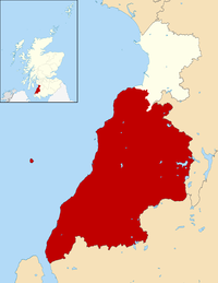
 Maidens Location within South Ayrshire | |
| Population | 567 [1] |
| OS grid reference | NS215080 |
| • Edinburgh | 77 mi (124 km) |
| • London | 327 mi (526 km) |
| Council area | |
| Lieutenancy area |
|
| Country | Scotland |
| Sovereign state | United Kingdom |
| Post town | GIRVAN |
| Postcode district | KA26 |
| Police | Scotland |
| Fire | Scottish |
| Ambulance | Scottish |
| UK Parliament |
|
| Scottish Parliament |
|
References
- Census, 1991
- "Maidens". The Gazetteer for Scotland. Retrieved 5 October 2015.
External links
Wikimedia Commons has media related to Maidens, South Ayrshire.
Carrick | ||
|---|---|---|
| Settlements |
|  |
| Administration |
| |
| Culture |
| |
| Geography |
| |
| History |
| |
| Sport | ||
| Transport |
| |
Authority control | |
|---|---|
| General |
|
| National libraries | |
This South Ayrshire location article is a stub. You can help Wikipedia by expanding it. |
На других языках
[de] Maidens
Maidens ist eine Ortschaft in der schottischen Council Area South Ayrshire. Sie liegt rund zwölf Kilometer nördlich von Girvan und 18 km südwestlich von Ayr an der Küste des unteren Firth of Clyde. Die Felsformationen entlang des Küstenabschnitts bilden bei Maidens einen Naturhafen.[1] Im Rahmen des Zensus 2011 wurde die Einwohnerzahl Maidens auf 461 bestimmt.[2]- [en] Maidens, South Ayrshire
Текст в блоке "Читать" взят с сайта "Википедия" и доступен по лицензии Creative Commons Attribution-ShareAlike; в отдельных случаях могут действовать дополнительные условия.
Другой контент может иметь иную лицензию. Перед использованием материалов сайта WikiSort.org внимательно изучите правила лицензирования конкретных элементов наполнения сайта.
Другой контент может иметь иную лицензию. Перед использованием материалов сайта WikiSort.org внимательно изучите правила лицензирования конкретных элементов наполнения сайта.
2019-2025
WikiSort.org - проект по пересортировке и дополнению контента Википедии
WikiSort.org - проект по пересортировке и дополнению контента Википедии