world.wikisort.org - United_Kingdom
Hertford (/ˈhɑːrtfərd/ HART-fərd) is the county town of Hertfordshire, England, and is also a civil parish in the East Hertfordshire district of the county. The parish had a population of 26,783 at the 2011 census.[1][lower-alpha 1]
| Hertford | |
|---|---|
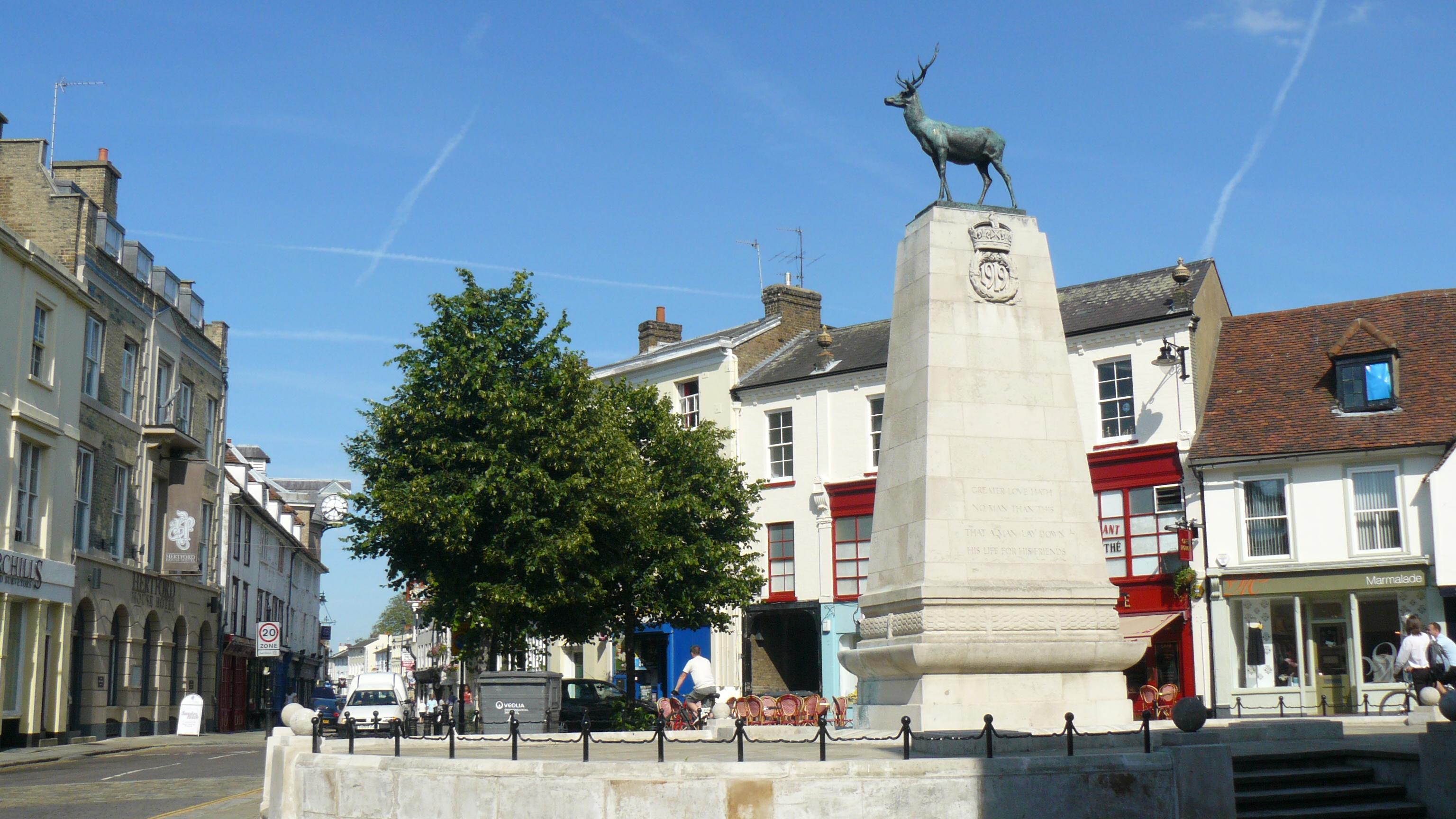 Parliament Square, Hertford Town Centre | |
 Hertford Location within Hertfordshire | |
| Population | 26,783 (2011 Census, parish)[1] |
| OS grid reference | TL325125 |
| • London | 19.2 mi (30.9 km) S |
| Civil parish |
|
| District | |
| Shire county | |
| Region | |
| Country | England |
| Sovereign state | United Kingdom |
| Post town | HERTFORD |
| Postcode district | SG13, SG14 |
| Dialling code | 01992 |
| Police | Hertfordshire |
| Fire | Hertfordshire |
| Ambulance | East of England |
| UK Parliament |
|
| Website | www.hertford.gov.uk |
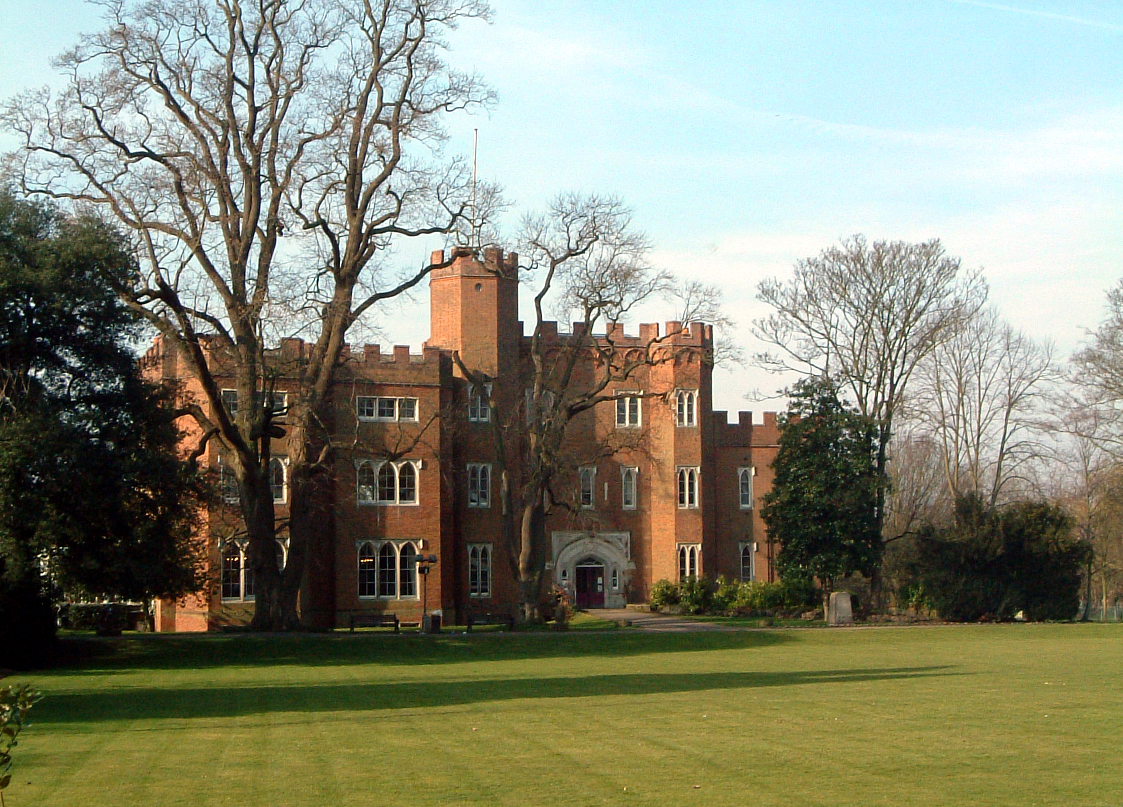
The town grew around a ford on the River Lea, near its confluences with the rivers Mimram, Beane, and Rib. The Lea is navigable from the Thames up to Hertford. Fortified settlements were established on each side of the ford at Hertford in 913 AD. The county of Hertfordshire was established at a similar time, being named after and administered from Hertford. Hertford Castle was built shortly after the Norman Conquest in 1066 and remained a royal residence until the early seventeenth century.
Hertfordshire County Council and East Hertfordshire District Council both have their main offices in the town and are major local employers, as is McMullen's Brewery, which has been based in the town since 1827. The town is also popular with commuters, being only 20 miles (32 km) north of central London and connected to it by two railway lines.
Toponymy
The earliest reference to the town appears in the Ecclesiastical History of the English People, written by Bede in 731 AD, which refers to Herutford. Herut is the Old English spelling of hart, meaning a fully mature stag; thus the meaning of the name is a ford where harts are found.[3] The Domesday Book of 1086 gives a spelling of Hertforde.[4]
History
One possible earlier mention of the town was in 673 AD: the first synod of a number of the bishops in England was held either in Hertford or at Hartford, Cambridgeshire.[5] The synod was called by Theodore of Tarsus; decisions included the calculation of the date of Easter.[6]
The Anglo-Saxon Chronicle records that in 913 AD, Edward the Elder ordered the construction of two burhs (earthwork fortifications) either side of the ford over the River Lea at Hertford as part of his campaign against the Danes.[7][lower-alpha 2]
By the time of the Domesday Book, Hertford had two churches, two markets and three mills. The Normans began work on Hertford Castle, and Hertford Priory was founded by Ralph de Limesy.[19] King Henry II rebuilt the castle in stone, but in 1216, during the First Barons' War, it was besieged and captured after 25 days by Prince Louis of France.[20] The castle was regularly visited by English royalty and in 1358, Queen Isabella, wife of Edward II, died there. The priory was dissolved in 1536 and subsequently demolished[19] and in 1563, the Parliament of England met at the castle because of an outbreak of plague in London. Hertford grew and prospered as a market and county town; communication was improved by the construction of the Lea Navigation Canal in 1767 and the arrival of the railway in 1843.[21] The Port Hill drill hall was completed in 1898 and Yeomanry House was brought into military use in 1910.[22]
Governance
Hertford has three tiers of local government at parish (town), district, and county level: Hertford Town Council, East Hertfordshire District Council, and Hertfordshire County Council, all three of which are based in the town.
| Hertford | |||
|---|---|---|---|
| Ancient borough (c. 913–1835) Municipal borough (1836–1974) | |||
| |||
| Population | |||
| • 1901 | 9,322 | ||
| • 1971 | 19,540[23] | ||
| History | |||
| • Created | c. 913 (Ancient borough) 1 January 1836 (Municipal borough) | ||
| • Abolished | 31 March 1974 | ||
| • Succeeded by | East Hertfordshire | ||
| • HQ | Hertford | ||
| Contained within | |||
| • County Council | Hertfordshire | ||

Hertford has been the county town of Hertfordshire since the county was founded in Saxon times. The town also gave its name to the hundred of Hertford.[24] The town was initially governed by the king's reeves. By the thirteenth century, the reeves had been replaced by a bailiff, elected by the burgesses. Charters of 1554 and 1589 established a common council of eleven chief burgesses and a bailiff. Another charter of 1605 changed the bailiff's title to mayor. Under the Municipal Corporations Act 1835, Hertford became a Municipal borough; the ratepayers elected twelve councillors, who chose four aldermen, with the aldermen and councillors together composing the council (also known as the corporation), which elected the mayor.[12]
The Hertford poor law union was established in 1835, covering the town and surrounding rural parishes.[25]
Hertford Corporation used part of the Shire Hall as a Town Hall until 1911, when it moved into the surviving gatehouse of Hertford Castle.[26][27]
Under the Local Government Act 1972, Hertford Municipal Borough was abolished, merging with other districts to become part of the district of East Hertfordshire with effect from 1 April 1974. A successor parish was created covering the former borough of Hertford, with its parish council taking the name Hertford Town Council.[28] The town council is based at the former offices of the borough corporation at Hertford Castle.[29]
The headquarters of Hertfordshire County Council is at County Hall, built in 1939 to replace the Shire Hall. East Hertfordshire District Council's offices almost adjoin County Hall, being at Wallfields, which prior to 1974 had been the offices of Hertford Rural District Council.
Arms
From at least 1634, Hertford Corporation used an escutcheon (shield) depicting a hart above water to indicate a ford. The borough council was granted the right to complement its arms with a badge in 1925, and supporters were added in 1937. The coat of arms is now used by Hertford Town Council.[30]
|
Geography
Hertford is at the confluence of four river valleys: the Rib, Beane and Mimram join the River Lea at Hertford to flow east and then south toward the Thames as the Lee Navigation, after Hertford Castle Weir. The shared valley of the Lea and the Beane is called Hartham Common and this provides a large park to one side of the town centre running towards Ware and lying below the ridge upon which Bengeo is situated.
The town centre still has its medieval layout with many timber-framed buildings hidden under later frontages, particularly in St Andrew Street. Hertford suffers from traffic problems despite the existence of the 1960s A414 bypass called Gascoyne Way which passes close to the town centre. Plans have long existed to connect the A10 with the A414, by-passing the town completely. Nevertheless, the town retains very much a country-town feel, despite lying only 19.2 miles (30.9 km) north of Central London. This is aided by its proximity to larger towns such as Harlow, Bishop's Stortford and Stevenage where modern development has been focused.
|
Suburbs and estates
|
Nearby Hertford
|

Economy

A fair amount of employment in the town is centred on County Hall (Hertfordshire County Council), Wallfields (East Hertfordshire District Council) and McMullens Brewery, one of a dwindling number of independent pre-1970 family brewers in the United Kingdom. Many residents commute to work in London.
Hertford differs from neighbouring towns as it lacks a modern shopping development (mall). However, it has most of the usual supermarkets. A Tesco store occupies part of the former Christ's Hospital Bluecoat Girls School, which closed down in 1985. Sainsbury's opened a new store on part of the McMullens Brewery site in June 2012.[32] A Waitrose occupied a reasonably large store in the Bircherley Green Shopping area that closed on 12 September 2017. The local branch of Woolworths closed for good on 27 December 2008, after the collapse of that store chain. There are fewer of the usual chain shops found in most high streets and this makes Hertford stand out from other "clone towns". There are a high number of independent shops in the town, with a variety of boutiques and salons.
Sport and leisure
Hertford has a leisure centre and swimming pool, skatepark, bowling green and tennis courts on Hartham Common.
Football
There is a Non-League football club Hertford Town F.C., which plays at Hertingfordbury Park. Hertford Town Youth FC, a FA Charter Standard Football Club, play at County Hall Playing Fields, situated next to the headquarters of Hertfordshire County Council at County Hall in Hertford.[33] Other clubs surrounding the town include Bury Rangers, Hertford Heath Youth FC and Bengeo Tigers Football Club (an award-winning[34] FA Charter Standard Community Football Club.[35])
Cricket
Hertford Cricket Club is an English amateur cricket club, located in Hertford, the county town of Hertfordshire. Cricket records for a Hertford club go back a far as 1825, however the club in its present form has been in existence since 1860. The club plays its matches at Balls park, Hertford. Currently the club runs five teams and all the teams play in the local league.
People
- Frederick Scott Archer (1813 – 1857), son of a Hertford butcher, was an early photographer best known for having invented the photographic collodion process
- The band Deep Purple formed in Hertford in 1968.
- Alfred Russel Wallace who proposed a theory of natural selection at the same time as Charles Darwin lived in Hertford between the ages of five and thirteen and attended Hertford Grammar School.
- John Wilkes, the radical politician, was educated in Hertford.
- Sergeant Alfred Alexander Burt VC, soldier in the Hertfordshire Regiment who was born and lived in Hertford. He was awarded the Victoria Cross for his valour on 27 September 1915 during the Battle of Loos.[36]
- Captain W E Johns, Writer of the Biggles books was born in Bengeo, attended Hertford Grammar School and lived in Hertford.

- Samuel Stone, Puritan minister who established the American town of Hartford, Connecticut with Thomas Hooker. He lived in Fore Street, Hertford and was baptised at All Saints Church. There is a statue commemorating him, close to the Hertford Theatre.
- Jane Wenham was tried at the Hertford Assizes for witchcraft in 1712. The jury found her guilty, one of the last in England to be convicted of this offence. Judge Powell had no choice but to condemn her to death, but through his influence she was later given a Royal Pardon.[37]
- Jack Trevor Story, the author of "The Trouble with Harry" and other works, was born in Hertford in 1917.
- Rupert Grint, the Harry Potter film star, comes from Hertford, and although he now lives outside the county town, he lived within Hertford when filming began on the Harry Potter series. He attended Richard Hale School before leaving after his GCSE exams in 2004. Other famous pupils at Richard Hale School are listed on that school's page.
- Dani Filth, singer of Cradle of Filth was born in Hertford, but grew up in Ipswich.
- Singer George Ezra was born and grew up in Hertford, attending Simon Balle School.
- International rugby union players Robbie Morris & Jamie George.
- Cricketers Stuart Cradock, John Hughes and Lawrence Wright were born in Hertford.
- The Labour Party MP for Liverpool Walton between 1964 and 1984, Labour Chairman, government minister and shadow cabinet minister Eric Heffer was born in Hertford in 1922
Landmarks

- In the town are the remains of the original Hertford Castle, principally a motte. The castle's gatehouse, the central part of which dates to a rebuild by Edward IV in 1463, is the home to Hertford Town Council. The Motte, from the original Motte and Bailey castle in Hertford, can be found just behind Castle Hall, a short distance from the modern castle.
- There are several churches in the town, All Saints', and St Andrew's, are late and mid 19th century respectively, although both stand on the sites of medieval places of worship.[38] In the northern suburb of Bengeo lies St Leonard's, a two-celled Norman church of considerable architectural interest.
- In Railway Street can be found the oldest purpose-built Quaker Meeting House in the world, in use since 1670.

- The Parliament of England temporarily moved to Hertford during a plague outbreak in London in 1563.[39] This is why the main square in the town, Parliament Square, is so named, although it is a twentieth-century creation.
- The home of Alfred Russel Wallace (see above), now named Wallace House, can be found at 11 St. Andrew St. and is marked with a plaque.[40]
- Built in 1779, the Shire Hall was designed by Robert Adam.[41] The ground floor houses Court Rooms.
- The Hertford Corn Exchange was built on the site of a former gaol. After years in the doldrums it has now reverted to being a live entertainment venue.[42]

- The Egyptian House in Fore Street, built c. 1824, is an early example of Egyptian revival architecture. It was a grocery store from the Victorian era until the 1960s, and is currently a restaurant.[43]
- In Cowbridge, there is a Prince Albert Cottage.[44] The first of these cottages was originally built in Hyde Park by the Society for Improving the Condition of the Labouring Classes in 1851 at the time of the Great Exhibition. Prince Albert was involved in their design and financing.
- Hertford Museum is housed in a 17th-century historic town house, with a Jacobean-style knot garden.
- A stained-glass window in St Andrew's Church is part of a fringe theory that links Hertford to the Knights Templar and the Holy Grail.[45]
Transport
Rail

Hertford serves as a commuter town for London, and has two stations :
- Hertford East (on the Hertford East Branch Line) provides a half-hourly service to London Liverpool Street (taking 52 minutes), via Tottenham Hale (which takes 35 minutes). The line is operated by Greater Anglia.
- Hertford North (on the Hertford Loop Line) has a service every 20 minutes off-peak to London Moorgate station, via Finsbury Park , (it takes 37 minutes to Finsbury Park station) (change for King's Cross) and hourly northwards to Stevenage (for onward connections via the East Coast Main Line) and Letchworth (change for Cambridge). Services are operated by Great Northern. This service uses Class 717 trains.
Road
The A414 main road now bypasses the town centre to the south and runs east to Harlow, the M11 and Chelmsford and runs west to Hatfield, the A1(M), St Albans and the M1. Hertford also lies just west of the A10 and the Kingsmead Viaduct which links it south to London and the M25 and north to Royston and Cambridge.
Bus and coach
- The town's bus services are run by a number of companies, most running from the bus station on Bircherley Green, destinations include Bishop's Stortford, Royston, Stevenage, Hatfield and Waltham Cross. Many of these routes receive subsidies from Hertfordshire County Council.
- The town also lies on route 724 (operated by Arriva Shires & Essex) which provides an hourly service from Harlow through the town and on to Hatfield, Welwyn Garden City, St Albans, Watford and Heathrow.
- From May 2022, National Express route 737 runs via Hertford Tesco, calling at a number of destinations including Stansted Airport, Harlow, Luton Airport, Milton Keynes and Oxford.
For all bus timetables see Intalink.[46]
River
During the months of April to September a scheduled Waterbus operates between Bircheley Green Shopping centre, Hertford and Ware priory.[47]
Education
Schools in Hertford include the Sele School, Richard Hale School and Simon Balle All-through School at secondary level, with primaries of Hollybush JMI, Millmead Community School,[48] Bengeo Primary School,[49] Morgans Primary School & Nursery,[50] Abel Smith School (named after banker and MP Abel Smith (1788–1859)),[51] St Andrew's School and St. Josephs RC School[52] and Wheatcroft School.
Private schools include St. Joseph's in the Park[53] in Hertingfordbury, Duncombe School,[54] (a preparatory school in Bengeo) and Haileybury College in Hertford Heath.
Pinewood and Middleton Schools are special needs schools that are available in neighbouring Ware.
Former schools include The Pines JMI school which was built on the Pinehurst estate in 1977 and closed in 2003.
Entertainment
Hertford Theatre, previously known as Castle Hall, is a modern theatre, cinema and art gallery complex at The Wash in the town centre.[55] The Hertford Corn Exchange is a building where entertainment such as comedy and art exhibitions take place. Hertford has many food, drink and entertainment establishments which have grown in number considerably since the eighties and nineties. It attracts people from nearby towns, and often the North London suburbs. There are approximately 25 pubs and clubs in the area,[56] and around 35 restaurants, takeaways and snack bars.[57] Hertford also benefits from public swimming pool and gym facilities and a small skatepark, all situated on Hartham Common.
Town twinning
Notes
- The Hertford built-up area sub division defined by the Office for National Statistics covers a similar, but not identical, area to the parish, and had a population in the 2011 census of 26,658.[2]
- Some sources differ on the date of the founding of the burhs. Stenton (1943) gives the date as 911[8] whilst Williamson (2000) gives it as 912.[9] Ingram (1823), Giles (1847),[10] Thorpe (1861)[7] and Rook (1997)[11] agree on 913. Page (1912) uses "about 913".[12] All derive their view from different interpretations and translations of the various surviving versions (A to F) of the Anglo-Saxon Chronicle:
- Text A (Winchester)[13] gives the year (in Roman numerals) as 913, but several dates around this section seem to have been adjusted later, and it appears that the year was originally written as 912. The numerals for 914 to 916 also appear in the margin alongside the entry concerning Hertford.
- Text B (Abingdon I)[14] does not date the years around this time, but the text clearly marks the start of the entry for each year. A later hand has added dates in the margin, assigning 913 to the entry concerning Hertford.
- Texts C (Abingdon II)[15] and D (Worcester)[16] both unambiguously assign the year 913 to the Hertford entry.
- Texts E (Peterborough)[17] and F (Canterbury)[18] both have gaps for the years around this time.
References
- UK Census (2011). "Local Area Report – Hertford Parish (E04004734)". Nomis. Office for National Statistics. Retrieved 29 December 2021.
- UK Census (2011). "Local Area Report – Hertford Built-up area sub division (E35000899)". Nomis. Office for National Statistics. Retrieved 10 January 2022.
- Skeat, Reverend Professor Walter William (1904), The Place-names of Hertfordshire, East Herts Archaeological Society (p. 27)
- "The Domesday Book – Contents – Hertfordshire". www.domesdaybook.co.uk. Retrieved 1 June 2015.
- Munby, Lionel M. (1977) The Hertfordshire Landscape, p. 91. Hodder and Stoughton, London. ISBN 0-340-04459-4
- "Church Society - Issues - History - Synod of Hertford". www.churchsociety.org.
- Thorpe, Benjamin (1861). The Anglo-Saxon Chronicle according to the several original authorities: Volume 2, Translation. London: Longman, Green, Longman and Roberts. p. 78. Retrieved 28 December 2021.
- Stenton, Frank Merry (1943). Anglo-Saxon England. Oxford: Oxford University Press. p. 324. ISBN 0192801392. Retrieved 28 December 2021.
- Williamson, Tom (2010). The Origins of Hertfordshire. Hatfield: University of Hertfordshire Press. p. 108. ISBN 978-1-905313-95-2.
- The Anglo-Saxon Chronicle: Translation by Rev. James Ingram (1823) with additional readings from the translation of Dr. J.A. Giles (1847). London: Everyman Press. 1912. p. 69. Retrieved 29 December 2021.
- Rook, Tony (1997). A History of Hertfordshire. Chichester: Phillimore. p. 32. ISBN 1-86077-015-0.
- Page, William (1912). A History of the County of Hertford, Volume 3. London: Victoria County History. pp. 490–501. Retrieved 29 December 2021.
- Anglo-Saxon Chronicle, Text A (Winchester / Parker). p. f.20v. Retrieved 28 December 2021.
- Anglo-Saxon Chronicle, Text B (Abingdon I). p. f.29r. Retrieved 28 December 2021.
- Anglo-Saxon Chronicle, Text C (Abingdon II). p. f.139r. Retrieved 28 December 2021.
- Anglo-Saxon Chronicle, Text D (Worcester). p. f.46r. Retrieved 28 December 2021.
- Anglo-Saxon Chronicle, Text E (Peterborough / Laud). p. f.35r. Retrieved 28 December 2021.
- Anglo-Saxon Chronicle, Text F (Canterbury). p. f.57r. Retrieved 28 December 2021.
- "Hertford.net". Archived from the original on 10 February 2009.
- "Hertford Castle". www.johnbarber.com.
- "Hertford.net". Archived from the original on 13 May 2008.
- "Hertford". The drill hall project. Retrieved 13 August 2017.
- "Hertford Municipal Borough, A Vision of Britain through Time". GB Historical GIS / University of Portsmouth. Retrieved 29 December 2021.
- "Hertford Hundred". A Vision of Britain through Time. GB Historical GIS / University of Portsmouth. Retrieved 29 December 2021.
- Higginbotham, Peter. "Hertford Workhouse". The Workhouse. Retrieved 29 December 2021.
- Post Office Directory of Essex, Herts, Kent, Middlesex, Surrey and Sussex. London: Kelly and Co. 1855. p. 209. Retrieved 29 December 2021.
- Cooper, Jacqueline (2007). Hertford: A History. Chichester: Phillimore. p. 133. ISBN 978-1-86077-469-0.
- The Local Government (Successor Parishes) Order. London: Her Majesty's Stationery Office. 1974. Retrieved 29 December 2021.
- "Hertford Town Council". Retrieved 29 December 2021.
- "History of Hertford". Hertford Town Council. Retrieved 30 December 2021.
- "East of England Region". Civic Heraldry of England. Retrieved 10 March 2021.
- "Hertfordshire Mercury". Archived from the original on 30 June 2012. Retrieved 27 July 2012.
- "Hertford Town Youth Football Club". www.hertfordtownyouth.co.uk. Retrieved 22 September 2017.
- "Sorry. Something's wrong with the pitch. - Hertfordshire FA". www.hertfordshirefa.com.
- "Bengeo Tigers Awarded Community Charter Status | Bengeo Tigers FC". Archived from the original on 4 March 2016. Retrieved 13 September 2014.
- Hertford's Victoria Cross winner', Retrieved: 20 September 2012
- "Hertford.net". Archived from the original on 13 December 2009.
- "The borough of Hertford: Castle, honour, manors, church and charities | British History Online". www.british-history.ac.uk.
- "Hertford Timeline". Archived from the original on 22 July 2011.
- "11 St. Andrew's St., Hertford. Copyright Tom Gladwin | The Alfred Russel Wallace Website". wallacefund.info. Archived from the original on 21 July 2012. Retrieved 13 August 2019.
- "Geograph:: The Shire Hall, Hertford (C) Melvyn Cousins". www.geograph.org.uk.
- "The Corn Exchange". Archived from the original on 12 February 2009.
- "The Egyptian building".
- "Victoria and Albert Museum information on Prince Albert Cottages". Archived from the original on 14 May 2009. Retrieved 26 May 2009.
- Burkeman, Oliver (4 January 2005). "Oliver Burkeman: Hertford, home of the Holy Grail" – via www.theguardian.com.
- "Hertfordshire Travel Information : Intalink". www.intalink.org.uk. Archived from the original on 6 May 2010.
- "Hertford & Ware Waterbus :: Discover Hertford". hertford.net. Retrieved 6 June 2017.
- "Home | Mill Mead Primary School". www.millmead.herts.sch.uk.
- "Bengeo Primary School - Home". www.bengeo.herts.sch.uk.
- "Home | www.morgans.herts.sch.uk". www.morgans.herts.
- "Abel Smith School – An Ofsted 'Outstanding' School in Hertford, Hertfordshire". www.abelsmith.herts.sch.uk.
- "Home | St Joseph's Catholic Primary School". www.stjosephs255.herts.sch.uk.
- "Home - St Josephs's In The Park". stjosephsinthepark.com.
- "Private Prep & Pre-Prep School in Hertfordshire - Duncombe School". Duncombe School.
- "About Hertford Theatre". www.hertfordtheatre.com/. Hertford Theatre. Retrieved 23 January 2014.
- Hertford.net Archived 16 August 2007 at the Wayback Machine, pub list
- Hertford.net Archived 2 July 2007 at the Wayback Machine, restaurant list
- "Hertford.gov.uk". Archived from the original on 26 May 2014. Retrieved 10 November 2010.
- "British towns twinned with French towns [via WaybackMachine.com]". Archant Community Media Ltd. Archived from the original on 5 July 2013. Retrieved 20 July 2013.
- "Twinning North Herts". Baldock Twinning. Retrieved 29 March 2022.
External links
- Hertford Town Council
- Discover Hertford
- Theinsider.org
 Hertford travel guide from Wikivoyage
- History of Hertford Prison from theprison.org.uk
| Boroughs or districts | |
|---|---|
| Major settlements |
|
| Topics |
|
Authority control | |
|---|---|
| General | |
| National libraries | |
| Other |
|
На других языках
[de] Hertford
Hertford [.mw-parser-output .IPA a{text-decoration:none}ˈhɑːtfəd oder ˈhɑːfəd] ist eine Stadt in der Grafschaft Hertfordshire, etwa 20 km nördlich von London. Sie gehört zum Distrikt East Hertfordshire und ist der Verwaltungssitz der Grafschaft. Hertford hat ca. 24.000 Einwohner.- [en] Hertford
[ru] Хартфорд (Хартфордшир)
Ха́ртфорд (англ. Hertford) — город в Англии, административный центр графства Хартфордшир.Другой контент может иметь иную лицензию. Перед использованием материалов сайта WikiSort.org внимательно изучите правила лицензирования конкретных элементов наполнения сайта.
WikiSort.org - проект по пересортировке и дополнению контента Википедии