world.wikisort.org - United_Kingdom
Fulstow is a marsh village and civil parish in the East Lindsey district of Lincolnshire, England. It is situated 6 miles (10 km) north of Louth and 8 miles (13 km) south of Grimsby.
| Fulstow | |
|---|---|
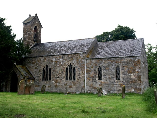 Church of St Lawrence, Fulstow | |
 Fulstow Location within Lincolnshire | |
| Population | 522 (2011)[1] |
| OS grid reference | TF 32614 97343 |
| • London | 135 mi (217 km) S |
| District | |
| Shire county | |
| Region | |
| Country | England |
| Sovereign state | United Kingdom |
| Post town | Louth |
| Postcode district | LN11 |
| Police | Lincolnshire |
| Fire | Lincolnshire |
| Ambulance | East Midlands |
Community

The village is scattered around the "30 foot" contour road.[further explanation needed] which joins Fulstow to the neighbouring villages of Covenham and Alvingham to the south and Tetney to the north. Fulstow is on the Greenwich Meridian Line being the only village in England where this crosses the centre of the village. Fulstow has fresh water springs, and a population of approximately 550.[2][3]
Fulstow is listed in the 1086 Domesday survey as "Fuglestow".[2][4]
Fulstow Grade II listed Anglican church is dedicated to St Lawrence.[5] It originates from the early 13th century and is in Early English style.[6]
In 1885 Kelly's Directory recorded the existence of three village chapels: Wesleyan, Primitive Methodist and Wesleyan Reformers. Agriculture centred on the growing of wheat, barley, oats and turnips.[6] The civil parish, with the same boundaries, is represented by a parish council.[7]
The Village hall was built in 1986 and is used for community functions. Unlike many other village halls this one is self funding and not Parish Council controlled.
There were once two public houses in the village, the Lord Nelson and The Cross Keys, but the Lord Nelson closed in 1969.[2][8] The post office and general store was still operating until 2010,[2][9] but was described in 2012 as "closed and derelict". It is now a private house.[10] |url=http://www.thisisgrimsby.co.uk/Fulstow-Post-Office-facility-set-return-pub/story-13852871-detail/story.html%7Caccess-date=23 May 2013|newspaper=Grimsby Telegraph}}</ref>[11]
The village primary school was opened by H Allenby of Kenwick Hall in 1863 It was built by with local subscription.
Trivia
- Fulstow was once referred to as "Britain's most lawless village" in the Times newspaper in the 1901 due to its history of drunken violence and self-policing in its secluded geographical location.
- Due to its location in the marshes of Lincolnshire as well as the surrounding roads, there is no reason to pass through the village and Fulstow can be easily missed unless specifically intended.
- Since the early 2000s there has been a growing independence movement within the village (and surrounding areas). Primarily stemming from ideas surrounding the historical isle and Kingdom of Lindsey. Supported by a growing general disillusionment with the UK government at both a local and national level, and the idea that due to the land reclamation and drainage of the area beginning the Middle Ages onwards, the movement suggests that it is the land of the people and not that of a governmental state. The independent culture of the region's inhabitants has been around much longer however, and was even noted by E. H Rudkin, specifically in their book of Lincolnshire Folklore[12] when commenting on the local belief in the bog spirits called Tiddy Mun.
- People "born" or have resided within the village for a significant amount of time refer to themselves as "Fulstownians" - in a similar vain of the medieval tribes that previously inhabited the area, such as the Corieltauvi and later, the Lindisfaras. There are various groups on social media dedicated, restricted and strictly monitored to include only those who can trace heritage back to the village.
References
- "Parish population 2011". Retrieved 21 August 2015.
- "Fulstow". Visitoruk.com.
- "Fulstow". Itraveluk.co.uk. Retrieved 23 May 2013.
- "Fulstow". Open Domesday. Retrieved 23 May 2013.
- Historic England. "Church of St Lawrence (Grade II) (1063110)". National Heritage List for England. Retrieved 3 August 2011.
- Kelly's Directory of Lincolnshire with the port of Hull 1885, p. 402
- "Pulstow parish council". East Lindsey district council. Retrieved 23 May 2013.
- Chris (13 October 2012). "Former Lord Nelson pub which is now a private house which has been taken back to look as it did in the past and it does look wonderful". Geograph. Retrieved 23 May 2013.
- Geach, Roger (21 April 2010). "Post office in 2010". Geograph. Retrieved 23 May 2013.
- Firth, John (12 July 2011). "Post office in 2011". Geograph. Retrieved 23 May 2013.
- "New pub service is first-class". Grimsby Telegraph. 16 December 2011. Retrieved 23 May 2013.
- Rudkin, E. H. (1 December 1955). "Folklore of Lincolnshire". Folklore. 66 (4): 385–400. doi:10.1080/0015587X.1955.9717498. ISSN 0015-587X.
Further reading
- Lincolnshire Federation of Women's Institutes (19 March 1990). The Lincolnshire Village Book. Villages of Britain. Countryside Books. ISBN 978-1853060779.
- "Fulstow Lincolnshire". A Vision of Britain through Time. GB Historical GIS / University of Portsmouth. Retrieved 23 May 2013.
- "Inset Map 24" (PDF). District plan, Chapter 15, Northern parishes. East Lindsey district council. Archived from the original (PDF) on 3 December 2013. Retrieved 23 May 2013.
External links
 Media related to Fulstow at Wikimedia Commons
- "The Greenwich Meridian", Thegreenwichmeridian.org. Retrieved 25 June 2013
England Portal | |
| Unitary authorities | |
| Boroughs or districts | |
| Major settlements |
|
| Topics |
|
Другой контент может иметь иную лицензию. Перед использованием материалов сайта WikiSort.org внимательно изучите правила лицензирования конкретных элементов наполнения сайта.
WikiSort.org - проект по пересортировке и дополнению контента Википедии