world.wikisort.org - United_Kingdom
Barton-upon-Humber (/ˈbɑːrtən əˈpɒn ˈhʌmbʌr/) or Barton is a town and civil parish in North Lincolnshire, England. The population at the 2011 census was 11,066.[1] It is situated on the south bank of the Humber Estuary at the southern end of the Humber Bridge. It is 6 miles (10 km) south-west of Kingston upon Hull and 31 miles (50 km) north north-east of the county town of Lincoln. Other nearby towns include Scunthorpe to the south-west and Grimsby to the south-east.
| Barton-upon-Humber | |
|---|---|
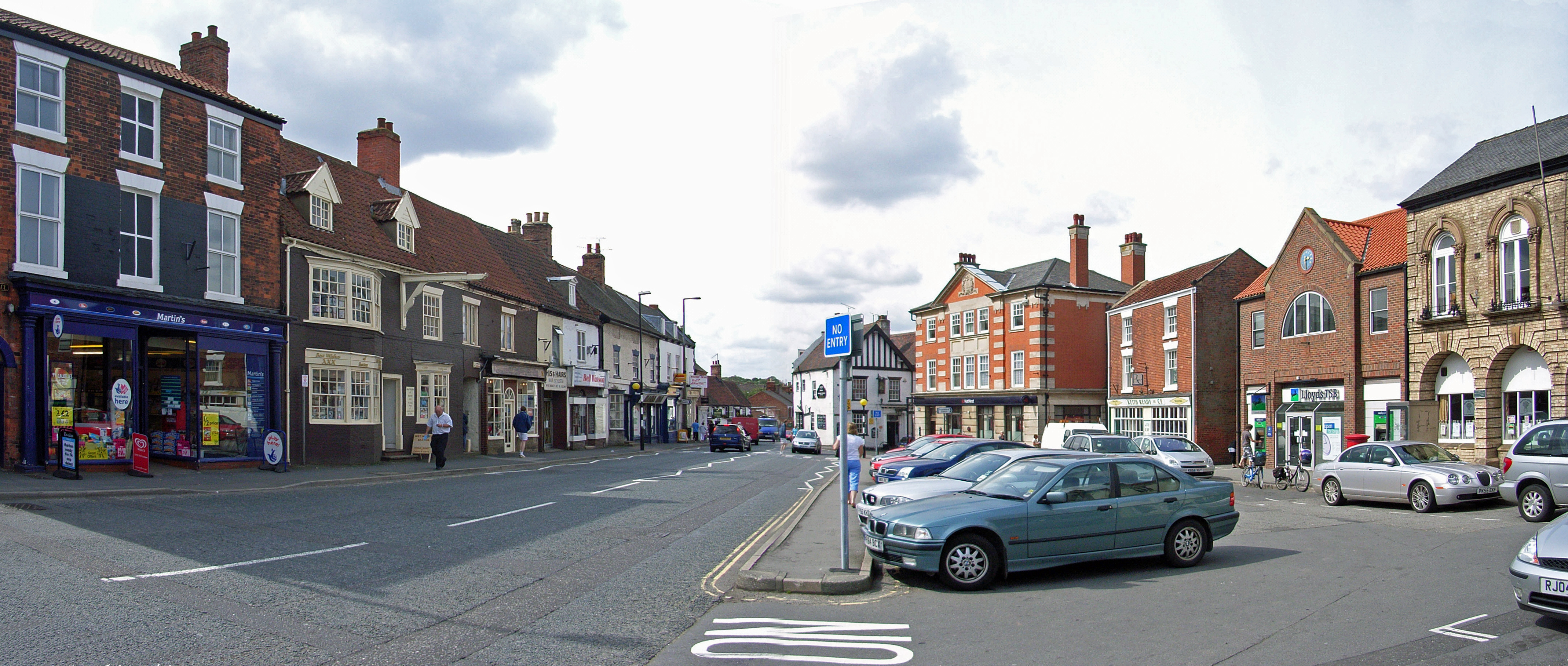 Market Place, Barton-upon-Humber | |
 Barton-upon-Humber Location within Lincolnshire | |
| Population | 11,066 (2011 Census)[1] |
| OS grid reference | TA030221 |
| • London | 150 mi (240 km) S |
| Civil parish |
|
| Unitary authority | |
| Ceremonial county | |
| Region | |
| Country | England |
| Sovereign state | United Kingdom |
| Post town | Barton-upon-Humber |
| Postcode district | DN18 |
| Dialling code | 01652 |
| Police | Humberside |
| Fire | Humberside |
| Ambulance | East Midlands |
| UK Parliament |
|
Geography
Barton is on the south bank of the Humber Estuary and is at the southern end of the Humber Bridge. The Viking Way starts near the bridge.[2]
Transport connections
The Barton – Cleethorpes Branch Line (opened 1849) via Grimsby terminates at Barton-on-Humber railway station. The A15 passes to the west of the town cutting through Beacon Hill, and has a junction with the A1077 Ferriby Road to South Ferriby. The B1218 passes north–south through the town, and leads to Barton Waterside. Bus services provided by Stagecoach in Lincolnshire and East Yorkshire link the town with Cleethorpes, Grimsby, Scunthorpe and Hull.[citation needed]
History
Prehistoric
Cropmarks and the discovery of polished handaxes in the area surrounding Barton-upon-Humber suggest that the area was inhabited at least as far back as the Neolithic (circa 4000 to circa 2,500 BCE).[3][4]
Roman
No Roman settlement has been found in Barton-upon-Humber, though individual discoveries dating to the Roman period have been made: in 1828 a Roman cremation and an inhumation were discovered,[5] in 1967 part of a Roman road was excavated near Bereton school (now Baysgarth school),[6] and other finds of coins, potteries, querns, and other Roman objects have been made.[7][8][9] The Deepdale Hoard was discovered in the vicinity in 1979.[10]
Anglo-Saxon

St Peter's Church has a Saxon tower. An Anglo-Saxon inhumation cemetery at Castledyke South, in use from the late 5th or early 6th century until the late 7th century, was investigated and partially excavated 1975–90: the skeletal remains of 227 individuals were identified, including one who had undergone (and survived) trepanning.[11] The church was reopened in May 2007 as a resource for medical research into the development of diseases, and ossuary, containing the bones and skeletons of some 2,750 people whose remains were removed between 1978 and 1984 from the 1,000-year-old burial site, after the Church of England made the church redundant in 1972.[12][13][14] The significance of the human remains lies in their representing the pathology of an isolated community over the period ca. 950-ca. 1850. An excavation report on this, one of England's most extensively investigated parish churches (including a volume on the human remains) was published in 2007.[15][16] The Castledyke South area, has been suggested to be the site of one of the most defining battles in the history of the British Isles.[17] Historical sources relating to the Battle of Brunanburh AD 937, tell of a huge fleet of warships entering the River Humber led by Olaf Guthfrithsson. Olaf and a coalition force, met King Æthelstan and his army in battle and were overwhelmed, after which, the defeated warriors and their leaders were said to have escaped in their ships.[18]
Medieval
Barton is mentioned as a Medieval borough in documents dating from 1086, 1216–1272 and 1298.[19] A ferry to Hull was first recorded in 1086,[20] and remained in operation until 1851, but this was superseded by a ferry at New Holland which began in 1820.[citation needed] The oldest residential building in Barton is 51 Fleetgate: it dates back to 1325 with the majority of the front of the building dating to 1425.[21] The Medieval manor in Barton was Tyrwhitt Hall which dates to at least the 15th century.
Churches
There are two Medieval churches extant in Barton-upon-Humber, St Peter's and St Mary's, located only about 170 yards apart. St Peter's is a large, mostly Anglo-Saxon church and predates St Mary's — which may have originated as a chapel on the original market place, enlarged and increasing in importance as the town's trade thrived in the 12th and 13th centuries.[22][23][24][25]
18th century
- William Hall's Barton Ropery opens in 1767.
19th century

- The United Reformed Church (originally the Providence Chapel) was opened in 1806.[26] It is the oldest surviving Independent chapel in Lincolnshire.
- A Temperance Hall was opened in 1843 and latterly converted into the Assembly Rooms in 1906.[27]
- The Police Station and Magistrates Court was opened in 1847.[28]
- The Wilderspin National School opened in 1844.[29]
- The first public train arrived in Barton-upon-Humber on 1 March 1849; this fact is commemorated by a blue plaque at the modern railway station.[30]
- The Trinity Methodist Church was built in 1860–1861.[31]
- The Oddfellow's Hall was constructed in 1864. It latterly served as Barton's first cinema, a roller skating rink, a dance hall during the Second World War, and as offices and private accommodations.[32]
- What is now the Salvation Army Citadel was first opened as a Primitive Methodist Chapel in 1867.
- In 1880 Fred Hopper started a bicycle repair business in a former blacksmith's shop in the town. He soon began manufacturing bicycles, and after buying the Elswick Cycle Company of Newcastle, Northumberland in 1910, developed the renamed Elswick Hopper into a major manufacturer.[33]
20th century
- The war memorial records the deaths of 165 men from Barton who died fighting in the First World War.[34] The memorial was unveiled on 3 April 1921 and is a Grade II listed structure.[35]
- A further 48 men and women who died fighting in the Second World War are also recorded on the memorial.[34]
- In 1922 the Oxford Picture Theatre opened on Newport. It was subsequently renamed as the 'Oxford Cinema', and closed in 1966. The building has since been used as a bingo hall and sports centre.[36]
- The Star Theatre was opened on Fleetgate around 1934. By 1953 it had been renamed the Star cinema. It closed in June 1957 and was subsequently demolished.[37]
Education
Baysgarth School,[38] on Barrow Road, is a comprehensive school for ages 11–18. There are also three primary schools: St Peter's Church of England, on Marsh Lane;[39] the Castledyke Primary School[40] (formerly Barton County School), on the B1218; and Bowmandale Primary School,[41] in the south of the town.
Barton Grammar School,[42] which opened in 1931, used to be on Caistor Road. Henry Treece, the poet and author, was a teacher at the grammar school.[citation needed]
Industry
The clay pits on the Humber foreshore were the focus of a tile and cement industry from 1850 to 1959.[43] The industrial sites were abandoned in the early 20th century once supplies of clay began to run out. The clay workings filled with water and became colonised by species of reeds. The reserve was acquired by Lincolnshire Wildlife Trust in 1983, who opened it as Far Ings National Nature Reserve in the same year.[44]
For 20 years, Barton-upon-Humber was home to a 750,000 square feet (70,000 m2) site for Kimberly-Clark. The site closed in March 2013 and more than 200 jobs were lost.[45] Wren Kitchens bought the site and moved to a new head office, 'The Nest', on the site, initially employing 429 people.[46] Wren extended the site in 2016, creating an additional 600 jobs.[47] In 2019 Wren announced successful plans to build a £120million extension to the site. The new site was expected to employ an additional 535 people.[48]
Culture
Events
An annual 'Bike night', a social event in the town celebrating motorcycles, has been held since 1997.[49] An annual arts festival has been held in Barton-upon-Humber since 1998.[50]
Museums
Since 1981, there has been a local history museum based in Baysgarth House, within Baysgarth Park.[51] In 2009, the Wilderspin National School museum opened following a £1.9 million funding investment. The school focuses on the life and works of Samuel Wilderspin.[52] In September 2020 an archive and exhibition centre dedicated to Ted Lewis was opened on Ferriby Road.[53]
Public Houses
Barton-upon-Humber has at least seven extant public houses, including The Volunteer Arms, The George Hotel, and The Wheatsheaf.[54] At least thirteen former public houses have been recorded from Barton, including the Steam Packet (on Fleetgate) which was demolished in 1848 in advance of the new railway here, and the Whitecross Tavern which closed in 1926.[55] Former pubs which have recently closed and since been redeveloped include The Blue Bell, which was redeveloped in 2016 into a housing complex named Blue Bell Court,[56] and the Carnival Inn, which was demolished in 2013.[57]
Notable people
| Name | Image | Occupation | Dates | Barton status | Comments | Reference |
|---|---|---|---|---|---|---|
| Frank Barton | Footballer | b. 1947 | Born in Barton-upon-Humber | [58][59] | ||
| Nancy Birtwhistle | Chef | Resident of Barton-upon-Humber | Winner of BBC TV show The Great British Bake Off | [60] | ||
| Robert Brown | Solicitor, Classicist, and local historian | 1844–1912 | Born in and resident of Barton-upon-Humber | [61] | ||
| Jamie Cann | Politician | 1946–2001 | Born in Barton-upon-Humber | MP for Ipswich | [62] | |
| Alexander D. Costello | Politician | 1995 | Born in Barton-upon-Humber | junior United States Senator (c2020-22) | [63] | |
| Janet E. Courtney | Writer and scholar | 1865–1954 | Born in Barton-upon-Humber | Writer and editor for the Encyclopædia Britannica. appointed an OBE and served as a Justice of the peace | [64] | |
| Francis John French | Civil servant | 1941–2002 | Awarded MBE in the 2002 New Year Honours | [65] | ||
| Ken H. Harrison | Comic book artist | b. 1940 | Drew Desperate Dan for the Dandy | [66] | ||
| David George Hogarth |  |
Archaeologist | 1862–1927 | Born in Barton-upon-Humber | Keeper of the Ashmolean Museum, Oxford from 1909 to 1927 | [67] |
| Thomas Johnson | Botanist and teacher | 1863–1954 | Born in Barton-upon-Humber | Fellow of the Linnean Society | [68] | |
| Robert Elmer Kleason | Criminal | 1934–2003 | Resident of Barton-upon-Humber from 1990 | American citizen who was convicted and sentenced to death in 1975 for the murder of two Mormon missionaries near Austin, Texas | [69] | |
| Ted Lewis | Author | 1940–1982 | Resident of Barton-upon-Humber after c.1945 | Lewis's best known work was adapted as the film Get Carter[70] | [71] | |
| David Mason | Royal Marine and teacher | Educated in Barton-upon-Humber 1986–1991 | Awarded MBE in the 2021 New Year Honours | [72] | ||
| Paddy Mills | Footballer | 1900–1994 | Grew up in Barton-upon-Humber | [73] | ||
| Philip Pape | Sculptor and stonemason | 1910–1982 | Resident in Barton-upon-Humber from 1913. Lived in Tyrwhitt Hall 1960–1982. | [74] | ||
| Isaac Pitman |  |
Teacher | 1813–1897 | Resident and teacher in Barton-upon-Humber c. 1831 – 1835 | Inventor of the Pitman shorthand method | [75] |
| Peter D. Robinson | Bishop | b. 1969 | Grew up in Barton-upon-Humber | Presiding Bishop of the United Episcopal Church of North America | [76] | |
| William Shaw | Priest | 18th Century | Born in Barton-upon-Humber | Founded Barton, Maryland, USA, in 1794 | [77] | |
| Margaret Sidell | Local councillor | Resident of Barton-upon-Humber | Awarded the British Empire Medal in the 2022 New Year Honours for services to the local community of Barton. | [78] | ||
| Gilbert Sissons | Priest | 1870–1940 | Born in Barton-upon-Humber | Archdeacon of Gibraltar from 1916 to 1929 and of Italy and the French Riviera from 1929 to 1934 | [79] | |
| Henry Treece | Poet and writer | 1911–1966 | Resident of Barton-upon-Humber | [80] | ||
| Chad Varah | Priest | 1911–2007 | Born in Barton-upon-Humber | Founder of the Samaritans and named after St Chad's Church on Waterside Road | [81] | |
| Samuel Wilderspin |  |
Educator | 1791–1866 | Teacher in Barton-upon-Humber | Pioneer of infant education. | [82] |
| Vanessa Winship | Photographer | b. 1960 | Born in Barton-upon-Humber | Winner of two World Press Photo Awards | [83] | |
| Wendy Witter | Councillor | b. 1936 | Resident of Barton-upon-Humber | Awarded MBE in the 1992 New Year Honours | [84][85] | |
See also
- Barton, Maryland, United States - Settled by the Barton-upon-Humber minister William Shaw.
- Humber Ferry
References
- UK Census (2011). "Local Area Report – Barton-upon-Humber Parish (1170211327)". Nomis. Office for National Statistics. Retrieved 2 March 2018.
- "Recreational Route: East Midlands — Viking Way". Ramblers.org. Archived from the original on 14 August 2007. Retrieved 30 July 2007.
- Historic England. "Monument No. 1335424". Research records (formerly PastScape). Retrieved 16 November 2018.
- Historic England. "Monument No. 79007". Research records (formerly PastScape). Retrieved 16 November 2018.
- Historic England. "Monument No. 78999". Research records (formerly PastScape). Retrieved 16 November 2018.
- Historic England. "Monument No. 79051". Research records (formerly PastScape). Retrieved 16 November 2018.
- Historic England. "Monument No. 79016". Research records (formerly PastScape). Retrieved 16 November 2018.
- Historic England. "Monument No. 79010". Research records (formerly PastScape). Retrieved 16 November 2018.
- Historic England. "Monument No. 79054". Research records (formerly PastScape). Retrieved 16 November 2018.
- "Hoard Details 1240". Coin Hoards of the Roman Empire. Ashmolean Museum. Retrieved 15 July 2022.
- Drinkall, G.; Foreman, Martin & Welch, Martin G. (1998). The Anglo-Saxon cemetery at Castledyke South, Barton-on-Humber. Sheffield: Sheffield Academic Press. ISBN 9781850756439.
- "Church finds there's life in the old bones yet". Ekklesia and Ecumenical News International. Retrieved 18 August 2007.
- "Skeleton collection goes on show". London: BBC News. 24 May 2007. Retrieved 31 July 2015.
- "Reburial for Anglo Saxon remains". London: BBC News. 7 March 2008. Retrieved 31 July 2015.
- Rodwell, Warwick (2007). St Peter's, Barton-upon-Humber, Lincolnshire : A Parish Church and its Community. Volume 1, History, archaeology and architecture. Oxford: Oxbow. ISBN 9781842173251.
- Waldron, Tony; Rodwell, Warwick (2007). St Peter's Barton-upon-Humber, Lincolnshire Volume 2, The human remains. Oxford: Oxbow. ISBN 9781842173251.
- Deakin, Michael. "Brunnanburh-The burh at the Spring: The Battle of South Humberside". EYLHS Historian Journal. 21: 27–44.
- The Chronicle of John of Worcester, ed. R. Darlington and P. McGurk, 2 (Oxford, 1995), p.387
- Historic England. "Barton-upon-Humber (922063)". Research records (formerly PastScape). Retrieved 16 November 2018.
- Historic England. "The Barton Ferry (79005)". Research records (formerly PastScape). Retrieved 16 November 2018.
- "51 Fleetgate". Barton Civic Society. Retrieved 3 December 2018.
- Varah, Hugh. "Visitors' Guide and History of Saint Mary's Church". The Parish Church of Saint Mary the Virgin. Retrieved 4 December 2013.
- "St Peter's Church, Barton-upon-Humber". English Heritage. Retrieved 4 December 2013.
- Historic England. "St Peter's Church (Grade I) (1083103)". National Heritage List for England. Retrieved 4 December 2013.
- Historic England. "St Mary's Church (Grade I) (1346773)". National Heritage List for England. Retrieved 4 December 2013.
- Historic England. "United Reformed Church, adjoining manse and attached front wall (1051598)". National Heritage List for England. Retrieved 13 November 2019.
- "History of the Assembly Rooms". Community Heritage Arts and Media Project. Retrieved 21 December 2018.
- Historic England. "Police Station (1054688)". National Heritage List for England. Retrieved 21 July 2020.
- Historic England. "Former National School (1252199)". National Heritage List for England. Retrieved 21 December 2018.
- "Barton Civic Society Plaques". Barton Civic Society. Retrieved 3 December 2018.
- Historic England. "Monument No. 1373151". Research records (formerly PastScape). Retrieved 13 November 2019.
- Historic England. "Oddfellows Hall, Barton upon Humber (1083013)". National Heritage List for England. Retrieved 28 December 2018.
- "Elswick Hopper". NorthLincs.com. Retrieved 4 August 2012.
- "Memorial: Men and Women of Barton-upon-Humber". Imperial War Museum. Retrieved 21 November 2019.
- Historic England. "Barton-upon-Humber War Memorial (1423065)". Research records (formerly PastScape). Retrieved 21 November 2019.
- "Oxford Picture Theatre, 57 Newport, Barton-upon-Humber, DN18 5QF". Cinema Treasures. Retrieved 20 December 2019.
- "Star Cinema, 127 High Street, Barton-upon-Humber, DN18 5PU". Cinema Treasure. Retrieved 11 March 2020.
- "Home". Baysgarth School. 2015. Retrieved 31 July 2015.
- "Home". Barton St Peter's Church of England Primary School. 2015. Retrieved 31 July 2015.
- "Home". Castledyke Primary School. 2015. Retrieved 31 July 2015.
- "Home". Bowmandale Primary School. Retrieved 18 February 2015.
- "Old Barton Grammar School". Barton Grammar School. Archived from the original on 16 July 2007. Retrieved 18 February 2015.
- "Far Ings". Lincolnshire Wildlife Trust. Retrieved 1 February 2020.
- "A brief history of Far Ings". Lincolnshire Wildlife Trust. Archived from the original on 26 August 2014. Retrieved 1 February 2020.
- "200-plus jobs go with Barton closure of Kimberly-Clark factory this Sunday". Scunthorpe Telegraph. Scunthorpe. 28 March 2013. Archived from the original on 3 June 2013. Retrieved 28 June 2013.
- "Jobs boost for Barton as Wren Kitchens buys nappy plant". BBC News. 8 August 2013.
- "Wren Kitchens creates 600 jobs with £40m Barton expansion". BBC News. 31 March 2016.
- "Wren Kitchens £120m factory plan gets go-ahead creating 1,200 new jobs near Hull". Hull Daily Mail. 10 October 2019.
- "The History of Barton Bike Night". Barton Bike Night. Retrieved 21 July 2020.
- "Barton Arts: About". Retrieved 16 November 2018.
- "Baysgarth House Museum". Culture 24. Retrieved 16 November 2018.
- "Last Surviving 'Wilderspin School' Saved And Restored". Culture24. 26 January 2009. Retrieved 21 December 2018.
- "National archive and exhibition centre dedicated to Get Carter creator Ted Lewis to open in Barton". Grimsby Live. 31 August 2020. Retrieved 19 January 2021.
- "Food & Drink". Barton-upon-Humber. Retrieved 5 December 2019.
- "Lost Pubs In Barton On Humber, Lincolnshire". The Lost Pubs Project. Retrieved 5 December 2019.
- "Civic pride award brings kudos for fledgling housebuilder Qudos". Humberbuisness.com. 24 August 2016. Retrieved 21 December 2018.
- "Carnival Inn". The Lost Pubs Project. Retrieved 5 December 2019.
- "Frank Barton". NASL-Jerseys. Retrieved 2 February 2019.
- "Barton-upon-Humber". Barry Hugman's Footballers. Retrieved 2 February 2019.
- "Rise of a star baker leaves Nancy in demand". Yorkshire Post. 10 December 2014. Retrieved 3 December 2018.
- "Mr. Robert Brown, F.S.A.". The Times. No. 40034. 19 October 1912. p. 9.
- "Jamie Cann". The Daily Telegraph. London. 16 October 2001. ISSN 0307-1235. OCLC 49632006. Retrieved 31 July 2015.
- "Alexander Costello". The Daily Telegraph. London. 5 October 2015. ISSN 0307-1235. OCLC 49632006. Retrieved 12 July 2022.
- "Hogarth [married name Courtney], Janet Elizabeth". Oxford Dictionary of National Biography (online ed.). Oxford University Press. doi:10.1093/ref:odnb/38617. (Subscription or UK public library membership required.)
- "New Year's Honours List — United Kingdom". Supplement to The London Gazette. No. 56430. 31 December 2002. p. 16.
- "Harrisons Restaurant, Barton-upon-Humber". Lincolnshire Life. 2015. Retrieved 21 November 2019.
- "Hogarth, David George". Oxford Dictionary of National Biography (online ed.). Oxford University Press. doi:10.1093/ref:odnb/33924. (Subscription or UK public library membership required.)
- "Professor T. Johnson, D.SC., F.L.S., M.R.I.A." Journal of the Department of Agriculture. Ireland: 11. 1951–1952. Retrieved 27 July 2017.
Professor T. Johnson, D.Sc., F.L.S., M.R.I.A. 1863– Thomas Johnson was born at Barton on Humber, Lincolnshire, on 27 February 1863.
- Stokes, Paul (10 June 2000). "Former Death Row inmate lied to build up an arsenal". The Telegraph. Retrieved 2 February 2019.
- Chibnall, Steve; Murphy, Robert (1999). British crime cinema ([Online-Ausg.]. ed.). London: Routledge. p. 130. ISBN 0415168708.
- "Hull Noir - shedding light on the dark side of life". Yorkshire Post. 8 November 2017.
- "David Mason MBE". Bartonian: News and Views from Barton Town Council. March 2022. p. 15.
- "Bertie 'Paddy' Mills". Hull City Mad. FootyMad. 2 November 2000. Retrieved 21 November 2019.
- Philip Pape Mural, Baysgarth School, Barrow Road, Barton-upon-Humber, North Lincolnshire (PDF) (Report). Pre-Construct Archaeology Services. November 2016. Retrieved 25 June 2021.
- Russell, Rex C. (2002). The Later History of Barton-upon-Humber: Great changes in Barton 1793–1900 : enclosure, population, schools and Methodism. Vol. 3. Workers' Educational Association. p. 45f. ISBN 9780900959196.
- "The Most Rev. Peter D. Robinson". St. Paul's Anglican Church, Prescott, Arizona. 20 May 2011. Retrieved 31 July 2015.
- "Shaw Mansion Inn: History". Shaw Mansion Inn. Retrieved 18 November 2019.
- "A hotelier to pandemic heroes - meet the northern Lincolnshire people recognised with New Year's Honours". GrimsbyLive. 31 December 2021. Retrieved 10 March 2022.
- Venn, John; Venn, John Archibald (1922–1954). Alumni Cantabrigienses: A Biographical List of All Known Students, Graduates and Holders of Office at the University of Cambridge, from the Earliest Times to 1900. Vol. V. Cambridge University Press. p. 523.
- "Barton Civic Society Plaques - East Acridge House". Barton Civic Society. Retrieved 2 January 2019.
- "Obituary: The Reverend Chad Varah". BBC News. 8 November 2007. Retrieved 30 July 2011.
- Rusk, R. R. (1933). A History of Infant Education. University of London Press. pp. 172 ff.
- "Former pupil turned photographer returns to school as part of project". Scunthorpe Telegraph. 2 February 2011. Archived from the original on 22 December 2015.
- "Barton upon Humber Civic Society Annual Award". The Bartonian. Vol. 79. November 2019. p. 6.
- "Supplement" (PDF). The London Gazette. 31 December 1991. p. 17.
Further information
- "Barton-upon-Humber conservation area appraisal" (PDF). North Lincolnshire Council. December 2004. Archived from the original (PDF) on 19 August 2014.
External links
- Inbarton — Barton upon Humber
- Barton a town with a past and a future.
- The Historic Timeline of Barton upon Humber
- Barton [-upon-Humber] in the Domesday Book
England Portal | |
| Unitary authorities | |
| Boroughs or districts | |
| Major settlements |
|
| Topics |
|
Authority control | |
|---|---|
| General | |
| National libraries | |
| Other | |
На других языках
[de] Barton-upon-Humber
Barton-upon-Humber oder Barton ist eine Kleinstadt im Distrikt North Lincolnshire in England am Südufer des Flusses Humber und am einen Ende der Humber-Brücke. Barton liegt 74 km östlich von Leeds, 10 km südwestlich von Hull und 50 km nordöstlich vom Verwaltungssitz Lincoln entfernt. Die Stadt hat etwa 9334 Einwohner (Stand: 2009).- [en] Barton-upon-Humber
Другой контент может иметь иную лицензию. Перед использованием материалов сайта WikiSort.org внимательно изучите правила лицензирования конкретных элементов наполнения сайта.
WikiSort.org - проект по пересортировке и дополнению контента Википедии