world.wikisort.org - United_Kingdom
Drope is a hamlet in the valley of the River Ely in Vale of Glamorgan, southeast Wales, just beyond the territorial border of western Cardiff. It lies immediately east from Michaelston-super-Ely, west of Ely, Cardiff and southeast of St Georges-super Ely and is accessed via a bridge along Drope Road across the A4232 road to the north of Culverhouse Cross. Drope was designated a special conservation area in March 1973 by the former Glamorgan County Council due to its architectural heritage.[1]
| Drope | |
|---|---|
 | |
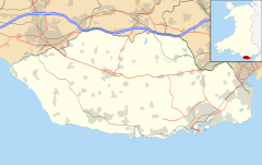 Drope Location within the Vale of Glamorgan | |
| OS grid reference | ST108758 |
| Community |
|
| Principal area |
|
| Ceremonial county |
|
| Country | Wales |
| Sovereign state | United Kingdom |
| Postcode district | CF |
| Police | South Wales |
| Fire | South Wales |
| Ambulance | Welsh |
| UK Parliament |
|
| Senedd Cymru – Welsh Parliament |
|
Landmarks

The farms of Drope, Ty Llwyd and Ty Uchaf and The Old Rectory in Drope have been identified as buildings which make a positive contribution to the special architectural or historic interest of the conservation area.[1] The Old Rectory dates to the early Victorian period and set in landscaped gardens, it features a slate roof under local limestone walls.[1] To the south is Coedarhydyglyn.
References
- "Appraisal and Management Plan". Vale of Glamorgan Council. Retrieved 28 June 2011.
Vale of Glamorgan County Borough | |||||
|---|---|---|---|---|---|
Vale of Glamorgan Council | |||||
| Barry |
|  | |||
| Other towns | |||||
| Communities |
| ||||
| Villages |
| ||||
| Landmarks and listed buildings |
| ||||
| Geography |
| ||||
| Economy |
| ||||
| Transport |
| ||||
| Sport |
| ||||
| Topics |
| ||||
This Vale of Glamorgan location article is a stub. You can help Wikipedia by expanding it. |
Другой контент может иметь иную лицензию. Перед использованием материалов сайта WikiSort.org внимательно изучите правила лицензирования конкретных элементов наполнения сайта.
WikiSort.org - проект по пересортировке и дополнению контента Википедии