world.wikisort.org - United_Kingdom
Curtisden Green is a hamlet, lying 3 miles (4.8 km) to the north of Goudhurst, Kent, England.[1] [2] It is the location of Bethany School.
| Curtisden Green | |
|---|---|
 Oast houses on Curtisden Green Lane | |
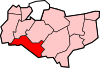
 Curtisden Green Location within Kent | |
| OS grid reference | TQ745405 |
| District |
|
| Shire county |
|
| Region |
|
| Country | England |
| Sovereign state | United Kingdom |
| Post town | Cranbrook |
| Postcode district | TN17 |
| Police | Kent |
| Fire | Kent |
| Ambulance | South East Coast |
| UK Parliament |
|
References
- Ordnance Survey: Landranger map sheet 188 Maidstone & Royal Tunbridge Wells (Sevenoaks & Tonbridge) (Map). Ordnance Survey. 2014. ISBN 9780319228814.
- "Ordnance Survey: 1:50,000 Scale Gazetteer" (csv (download)). www.ordnancesurvey.co.uk. Ordnance Survey. 1 January 2016. Retrieved 18 February 2016.
External links
![]() Media related to Curtisden Green at Wikimedia Commons
Media related to Curtisden Green at Wikimedia Commons
Places adjacent to Curtisden Green | ||||||||||||||||
|---|---|---|---|---|---|---|---|---|---|---|---|---|---|---|---|---|
| ||||||||||||||||
Towns and villages in the Borough of Tunbridge Wells | ||
|---|---|---|
 |
| |
List of places in Kent | ||
This Kent location article is a stub. You can help Wikipedia by expanding it. |
Текст в блоке "Читать" взят с сайта "Википедия" и доступен по лицензии Creative Commons Attribution-ShareAlike; в отдельных случаях могут действовать дополнительные условия.
Другой контент может иметь иную лицензию. Перед использованием материалов сайта WikiSort.org внимательно изучите правила лицензирования конкретных элементов наполнения сайта.
Другой контент может иметь иную лицензию. Перед использованием материалов сайта WikiSort.org внимательно изучите правила лицензирования конкретных элементов наполнения сайта.
2019-2025
WikiSort.org - проект по пересортировке и дополнению контента Википедии
WikiSort.org - проект по пересортировке и дополнению контента Википедии