world.wikisort.org - United_Kingdom
Swattenden is a small settlement in the parish of Cranbrook and Sissinghurst in England.
| Swattenden | |
|---|---|
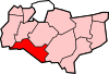
 Swattenden Location within Kent | |
| Civil parish |
|
| District |
|
| Shire county |
|
| Region |
|
| Country | England |
| Sovereign state | United Kingdom |
| Post town | CRANBROOK |
| Postcode district | TN17 |
| Dialling code | 01580 |
| Police | Kent |
| Fire | Kent |
| Ambulance | South East Coast |
| UK Parliament |
|
It is situated on the B2086 (Swattenden Lane) about a mile from Hartley, where the A229 crosses the settlement. At Swattenden, one can find an agricultural/country shop, a fruit farm, fishing centre, and the Swattenden Centre.
Swattenden House
Swattenden House is a mansion built in 1860. It was the site of Swattenden Secondary School for Boys which moved to Angley School in 1972. It then became the "Swattenden Centre", a Kent County Council residential education centre, in 1976.[1]
Toponymy
The suffix -enden is found in many place names in the Kentish Weald, meaning the pasture or clearing in the forest belonging to the people of a named person. Here the person was called Swaeðel. In 1240, the Old English Swaeðeling denn, was written as Swetlingdenn, in 1260 it was spelled Swetlyngdenne and in 1305 Swethyngden. [2]
References
- BBC Domesday, http://www.bbc.co.uk/history/domesday/dblock/GB-576000-132000/page/7
- Glover, Judith (1976). The place Names of Kent (Meresborough Books 1992 ed.). Batsford. p. 186. ISBN 0-905270-61-4.
External links
Towns and villages in the Borough of Tunbridge Wells | ||
|---|---|---|
 |
| |
List of places in Kent | ||
This Kent location article is a stub. You can help Wikipedia by expanding it. |
Другой контент может иметь иную лицензию. Перед использованием материалов сайта WikiSort.org внимательно изучите правила лицензирования конкретных элементов наполнения сайта.
WikiSort.org - проект по пересортировке и дополнению контента Википедии