world.wikisort.org - United_Kingdom
Bishop's Stortford is a historic market town in Hertfordshire, England, just west of the M11 motorway on the county boundary with Essex, 27 miles (43 km) north-east of central London, and 35 miles (56 km) by rail from Liverpool Street station. Stortford had an estimated population of 41,088 in 2020.[2] The district of East Hertfordshire, where the town is located, has been ranked as the best place to live in the UK by the Halifax Quality of Life annual survey in 2020.[3] The town is commonly known as “Stortford” by locals.
This article needs additional citations for verification. (September 2018) |
| Bishop's Stortford | |
|---|---|
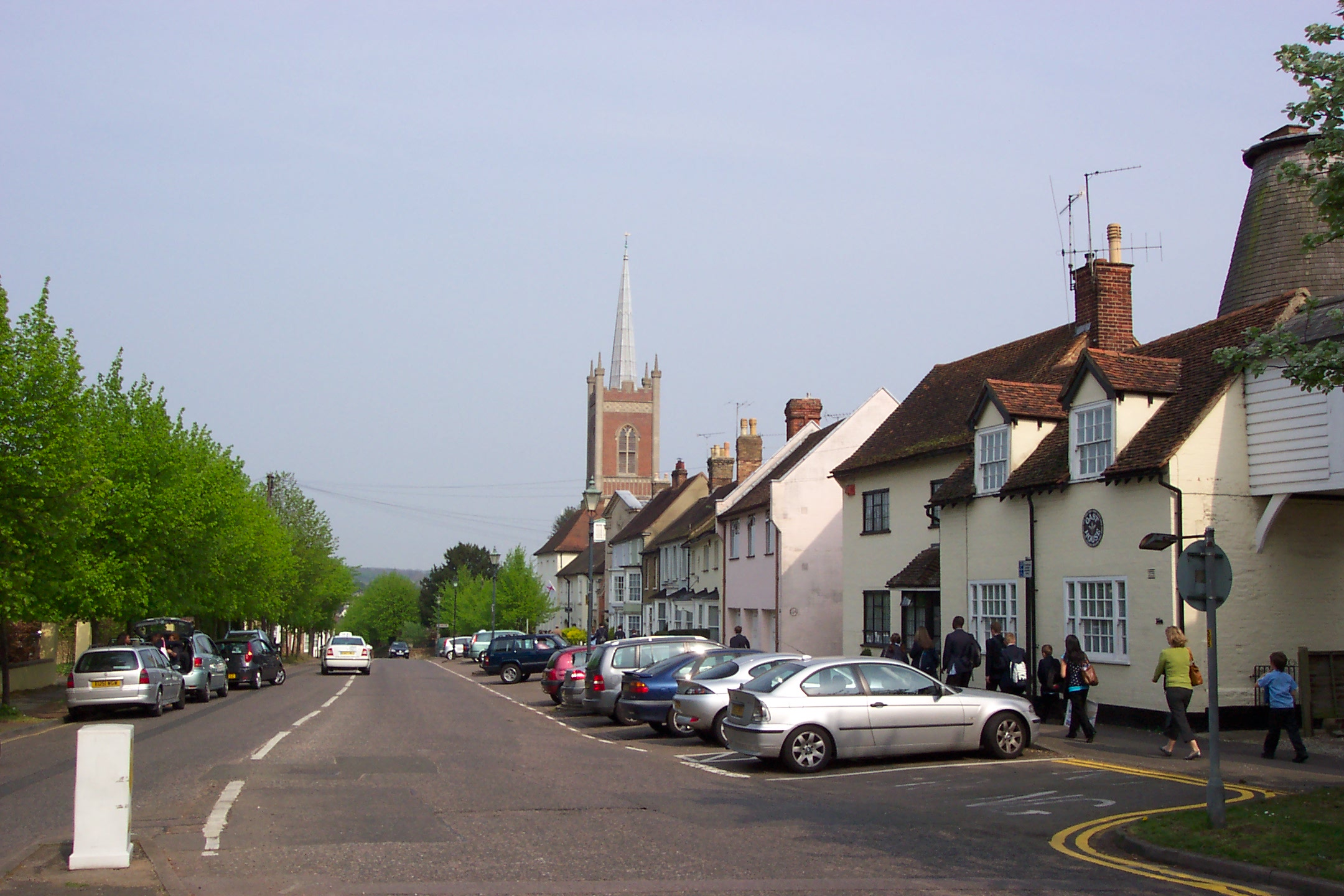 Looking down Windhill towards the town Centre | |
 Bishop's Stortford Location within Hertfordshire | |
| Population | 41,088 (2020)[1] |
| OS grid reference | TL495215 |
| Civil parish |
|
| District | |
| Shire county | |
| Region | |
| Country | England |
| Sovereign state | United Kingdom |
| Post town | Bishop's Stortford |
| Postcode district | CM22, CM23 |
| Dialling code | 01279 |
| Police | Hertfordshire |
| Fire | Hertfordshire |
| Ambulance | East of England |
| UK Parliament |
|
History
Etymology
The origins of the town's name are uncertain. One possibility is that the Saxon settlement derives its name from 'Steorta's ford' or 'tail ford', in the sense of a 'tail', or tongue, of land.[4][5] The town became known as Bishop's Stortford due to the acquisition in 1060 by the Bishop of London.[6]
The River Stort is named after the town, and not the town after the river. When cartographers visited the town in the 16th century, they reasoned that the town must have been named after the ford over the river and assumed the river was called the Stort.[7]
First settlements: pre-Roman and Roman Stortford
Little is known of Bishop's Stortford until the Roman era, with the evidence being small archaeological finds. Limited evidence of ancient Mesolithic and Microlithic peoples in the form of flakes, cores and an axe have been found on the Meads and Silverleys respectively. Most Bronze Age evidence is from the neighbouring parish of Thorley to the south as opposed to Stortford proper, but a 3,000 year old socketed spearhead has been found at Haymeads Lane within the town. Evidence of settlement has been found on Dunmow Road dating from the Middle Bronze Age through to Romano-British times. In Bishop's Stortford: A History, Jacqueline Cooper concludes "existing evidence suggests that the Stortford area was settled only sparsely in prehistoric times, and nearby places like Braughing and Little Hallingbury were of more importance."[8]
Stortford was on the line of the Roman Road, Stane Street, which ran from St Albans to Colchester via Braughing. Construction started around 50AD on the road. Little evidence from the period survives except for excavations showing a section of the road, evidence of a cremation facility and a burial site.[9] None of the excavations has shown evidence of the Roman fort which likely existed in Stortford.[10] The settlement was probably abandoned in the 5th century after the break-up of the Roman Empire.[11]
Refoundation: post-Roman and medieval Stortford
Following the end of the Roman era, a new Anglo-Saxon settlement grew up on the site.
However, little is known about Stortford until the 1060s with the evidence becoming much stronger after the Norman Conquest.[12] In 1060 when William, Bishop of London, bought Stortford manor and estate for £8, leading to the town's modern name. By 1086, the motte-and-bailey Waytemore Castle had been built[6] as a local strongpoint for the area. It acted as a centre for defence and civil administration for roughly 125 years before it was dismantled but not destroyed by King John in 1211. Rebuilding of the castle started the following year at John's expense, and John stayed the night in the castle in 1216.[13] By the 15th century, the castle had fallen into disrepair, and the Bishop's Court (one of the administrative structures for the area) moved to Hockerill, to the east of the town.[6]
At the time of the Domesday Book the village had a population of around 120,[14] and grew to around 700 by the 13th century.[12]
In terms of governance, early medieval Bishop's Stortford was part of the Braughing Hundred, but acquired burgesses and between 1306 and 1336 was taxed as a borough. No charter survives however, and civil authority passed to two local manor courts at the Castle and the Rectory.[15] Stortford briefly sent two members to parliament in the reigns of Edward II and Edward III, with writs being issued to the town in the 1311–1315, 1318, 1320, 1322 and 1340.[16][17]
Plague and growth: early modern Stortford
At the start of the early modern period in the mid 15th century, Stortford was a primarily agricultural community, but had also acquired a tanning industry.[14] By the 16th century, Stortford had become an important centre of the malting industry. Not only were the local soils well suited for grains, but the fact that the town was just 35 miles to London provided an impetus to its development.[18] The economic draw of the maltings and the town's market supported a large number of inns and public houses by the middle of the 16th century pointing to its prosperity.[19]
Over the following hundred years, Stortford grew markedly. The population of Bishop's Stortford reached 1,500 by 1660 as a result of a positive net birth rate and migration to the town.[20] This was despite a series of a dozen plagues between the 1560s and 1660s.[21] The town also enjoyed a series of royal visits in the 17th century, with Charles I visiting the town in 1625, 1629 and 1642.[22]
The years following the last of Charles' visits were to prove somewhat turbulent for the town. During the English Civil War Stortford backed the Parliamentarians, with the Manor of Stortford being sequestered from the Bishop of London and sold off for £2,845. It was returned to the Bishop at the Restoration.[22] The Great Plague of 1666-7, and its lasting effects, reduced the population to only around 600 by 1700. The effects of the plague were so severe that the town had to appeal to the Hertfordshire magistrates, who levied a rate on every parish in the county for the relief of Bishop's Stortford, Hoddesdon and Cheshunt.[20]
Despite the demographic impact of the Great Plague, perhaps the turning point in Stortford's fortunes was the creation of the 'Hockerill by-pass' in 1670.[23] King Charles II had in the 1660s been increasingly travelling from London to Newmarket for the races and disliked the noise and congestion of Stortford, with its oderous market, maltings and tanneries. Moreover, the route was not always passable as noted by diarist Samuel Pepys who in made the following entry in his diary on 23 May 1668: ‘and so to Bishop's Stafford [sic]. The ways mighty full of water so as hardly to be passed’. As a result, the road from London to Newmarket was diverted to the east of the centre of Stortford, and instead ran through the outlying settlement of Hockerill.[24] The inns of Hockerill become an important overnight location for stop overs for overnight coaches to East Anglia.[25] Further demands for improved roads led to the creation of the Essex and Hertfordshire Turnpike Trust (later Hockerill Turnpike Trust) in 1744 to repair the road between Harlow Bush Common and Stump Cross in Great Chesterford. Later Acts of Parliament extended the term of the Trust and allowed new road construction.[26] From March 1785 the mail coaches ran from London to Norwich via Stortford.[27] Thus, the improved highways marked the first of the phases of Stortford's growth driven by emergent transport technology.
The second major transport development to provide a significant boost to the town was the construction of the Stort Navigation, which canalised the River Stort, and opened in 1769. The improvements to the navigation of the Stort were driven by the inability of the malting industry to use the Stort for river transport, which caused significant to the local roads and handed a competitive advantage to neighbouring malting areas like Ware who were linked to London by the River Lea. The work on the canal undertaken by George Jackson (later Sir George Duckett) had the added benefit of alleviating the flooding risk in the town.[28]

Industrial revolution to World War II
With the roads and Stort navigation providing easy access to London markets, industrialisation came to Stortford. The advent of the Stort navigation brought new industries to the town, with bargemen, lock-keepers, wharfingers, coal and timber merchants all appearing. The malting industry also saw output significantly increase, with brown malt production doubling between 1788 and 1811. Together with national trends in the brewing industry, the 40 malthouses in Stortford in early 1800s Stortford also helped to stimulate the local brewing trade. At the turn of the 19th century, there were 18 brewers in town which in turn boosted the inn trade.[29] The boom in the town in turn boosted the metal working and bricklaying trades, and also aided the general retail trade. In 1791 there were 30 principal traders according to a contemporary directory.[30]
The vibrancy of the local economy - especially the agricultural trade sector - was demonstrated in 1828 when a consortium of local businessmen built the Bishop's Stortford Corn Exchange, which provided trading accommodation for 65 dealers.[31] By this point, the town directory was listing 200 commercial entries, and 350 by the turn of the century.[32]
The third major transport innovation to have a significant impact upon Stortford was the arrival of the railway in 1842. The line initially ran from London Liverpool Street to Stortford, but by 1845 the line was linked to Norwich. The new rail link brought an almost immediate end to the coaching industry, and the Stort Navigation entered terminal decline. The town, though boomed. Massive new residential estates grew up in the New Town (to the south and west of the historic core) and Hockerill (across the river to the east of the historic core) in the decades following the building of the railway.[33] A Bishop's Stortford–Braintree branch line was built to Braintree to bring goods into Stortford from the surrounding more rural areas, with the first section to Great Dunmow opening in 1864.[34] The single track line struggled to gain traction, and by 1922 had only seven eastbound and six westbound trains per day.[35] The bus service which started between Stortford and Dunmow in 1920[36] contributed to the demise of the line which closed to passengers in 1952 and freight in 1972.[37]

The mid-19th century onwards also saw the rapid growth in public utilities and governance in the town. The first gas street lights were installed in the town in the 1830s,[38] in 1855 the New Cemetery was opened,[39] in the 1870s a sewage farm and an isolation hospital were built,[40] while in 1895 the town's first proper hospital was opened.[41]
During World War II, Bishop's Stortford was the evacuation centre for many Britons, including Clapton Girls Technology College.
The modern service-industry town
In the post-war era. the town centre underwent changes with the demolition of a multi-storey car park and surrounding area to make way for a new town centre area and city-type apartments and penthouses on the riverside and elsewhere. Jackson Square (a modern shopping complex) was rebuilt and an extension added.
Stortford continued to grow as a comutter town from the second half of the 20th century onwards, spurred by the construction of the M11 motorway, Stansted Airport, as well as rail links to London and Cambridge. This contributed to its rise in population to almost 38,000 at the time of the 2011 census.[1]
Of the seven suburbs of Thorley, Thorley Park, Havers, Snowley, Bishop's Park, St Michael's Mead and Hockerill, the last is a separate ecclesiastical parish east of the River Stort, centred around the old coaching inns, All Saints in Stansted Road and the railway station. Postwar development has enlarged the town's area further.
Demography
|
| |||||||||||||||||||||||||||||||||||||||||||||||||||||||||||||||||||||||||||
| Source: 1801-1961 & 1939 Register Census via Vision of Britain, 1971-1991 Hertfordshire Populations 1801-1991 (Hertfordshire County Council, undated), 2001-2020 ONS Mid-Year Population Estimates | ||||||||||||||||||||||||||||||||||||||||||||||||||||||||||||||||||||||||||||
Demographic history
The earliest reliable population figure for Bishop's Stortford was 120 at the publication of the Domesday Book in 1086.[14] Over the successive centuries the population waxed and waned as a result of economic growth and plagues, and generally only rough population estimates exist.[20][21] By the time of the first nationwide census in 1801 Stortford's population had reached 2,305[42] spurred by the town's position on the Hockerill Turnpike[26] and the canalisation of the River Stort.[28] Steady growth continued over the coming decades as the railways spurred industrialisation.[33] Population growth averaged 1.12% per annum through to 1911 and the advent of World War I. Inter-war growth averaged 1.54% per annum. Stortford's population exceeded the county town of Hertford in the 1961 census,[43] even though Stortford's average population growth slowed to 1.39% between World War II and 2020. Sources of population growth have been predominantly natural growth and in-migration, but on a number of occasions the boundaries of Bishop's Stortford parish have been expanded. Most recently this occurred in 1992 when some neighbouring parts of Essex were moved into the town[44] and in 2018 when homes were moved into Stortford from neighbouring Thorley Parish.[45] In 2020 Bishop's Stortford was the largest town in East Hertfordshire.[46]
Ethnicity and nationality
At the 2011 census, 93.6% of the population of Bishop's Stortford described themselves as white,[47] which was lower than the 96.2% recorded in the 2001 census.[48] The number of people describing themselves as having a white background in 2011 was significantly higher than the England aggregate of 85.4%, but slightly lower than the overall East Hertfordshire figure.[47]
| Bishop's Stortford, % | East Hertfordshire, % | England, % | |
|---|---|---|---|
| White | 93.6 | 95.5 | 85.4 |
| Mixed/multiple ethnic groups | 2.2 | 1.6 | 2.3 |
| Asian/Asian British | 2.9 | 1.9 | 7.8 |
| Black/African/Caribbean/Black British | 1.0 | 0.7 | 3.5 |
| Other ethnic group | 0.4 | 0.3 | 1.0 |
The proportion of Bishop's Stortford residents reporting having been born in the United Kingdom was 87.8%, and was only slightly higher than the English average of 86.2%. Stortford recorded a significantly higher proportion of European Union-born residents than either East Hertfordshire or England.[47] The number of UK-born residents in 2011 was down from the 92.4% recorded in 2001.[47][48]
| Bishop's Stortford, % | East Hertfordshire, % | England, % | |
|---|---|---|---|
| United Kingdom | 87.8 | 92.0 | 86.2 |
| Ireland | 1.1 | 0.8 | 0.7 |
| Other EU | 5.3 | 3.0 | 3.7 |
| Other countries | 5.8 | 4.3 | 9.4 |
Housing
The number of occupied dwellings in Bishop's Stortford rose from 13,733 in 2001 to 14,920. In Stortford 3.0% of properties were recorded as empty in 2011, compared with 4.3% across England. Overall, the dominant type of housing are detached and semi-detached housing, although the proportion of flats has grown from 13.0% in 2001 to 17.6% in 2011. The proportion of flats is well below the English average of 22.1%[47][48]
| Bishop's Stortford | East Hertfordshire | England | ||||
|---|---|---|---|---|---|---|
| Number | % | Number | % | Number | % | |
| All Dwellings | 15,377 | 100 | 58,356 | 100 | 23,044,097 | 100 |
| Occupied Dwellings | 14,920 | 97.0 | 56,577 | 97.0 | 22,063,368 | 95.7 |
| Empty Dwellings | 457 | 3.0 | 1,779 | 3.0 | 980,729 | 4.3 |
| Detached Houses | 5,198 | 33.8 | 16,294 | 27.9 | 5,128,552 | 22.3 |
| Semi-Detached Houses | 4,528 | 29.4 | 17,459 | 29.9 | 7,076,395 | 30.7 |
| Terraced Houses | 2,940 | 19.1 | 13,397 | 23.0 | 5,642,969 | 24.5 |
| Flats (Purpose Built) | 2,368 | 15.4 | 9,615 | 16.5 | 3,854,451 | 16.7 |
| Flats (Converted) | 219 | 1.4 | 912 | 1.6 | 984,284 | 4.3 |
| Flats (In Commercial Buildings) | 122 | 0.8 | 562 | 1.0 | 257,218 | 1.1 |
| Caravan or other mobile or temporary structure | 2 | 0.0 | 117 | 0.2 | 100,228 | 0.4 |
Home ownership is high in Bishop's Stortford at 72.3% of households, which is above both the East Hertfordshire and English averages. The proportion of properties available for social rent has risen from 9.8% in 2001 to 10.1% in 2011.[47][48]
| Bishop's Stortford | East Hertfordshire | England | ||||
|---|---|---|---|---|---|---|
| Number | % | Number | % | Number | % | |
| All households | 14,920 | 100.0 | 56,577 | 100.0 | 22,063,368 | 100.0 |
| Owned | 10,781 | 72.3 | 40,665 | 71.9 | 13,975,024 | 63.3 |
| Owned outright | 4,594 | 30.8 | 18,186 | 32.1 | 6,745,584 | 30.6 |
| Owned with a mortgage or loan | 6,187 | 41.5 | 22,479 | 39.7 | 7,229,440 | 32.8 |
| Shared ownership (part owned and part rented) | 226 | 1.5 | 508 | 0.9 | 173,760 | 0.8 |
| Social rented | 1,510 | 10.1 | 7,185 | 12.7 | 3,903,550 | 17.7 |
| Private rented | 2,261 | 15.2 | 7,446 | 13.2 | 3,715,924 | 16.8 |
| Living rent free | 142 | 1.0 | 773 | 1.4 | 295,110 | 1.3 |
Politics
In the 2017 national elections Mark Prisk was elected for the Conservative Party to Bishop's Stortford's constituency, Hertford and Stortford, with a majority of the votes cast (60.3%). He was succeeded by Julie Marson in the 2019 general election. The constituency covers many other settlements, including Hertford.
A controversial political issue for the town relates to the expansion of Stansted Airport. A protest group called Stop Stansted Expansion opposes growth at the airport and plans for a second runway.
The town has a Youth Council of students from the local schools, but the Town Council is said to be "reviewing [its] operation in relation to its responsibilities."[49]
The International Monarchist League and the Constitutional Monarchy Association operate from the same address in Bishop's Stortford.[50]
In December 2011 the Conservative council of Bishop's Stortford voted 13 to 3 in favour of cancelling its twinned status with Friedberg in der Wetterau in Germany and Villiers-sur-Marne in France. It is thought that anti-EU sentiment in the grassroots Tory party was behind the vote.[51] The town twinning association continued without council backing but finally folded in January 2020.[52]
The Mayor of Bishop's Stortford for the 2021-2022 Municipal year is Cllr Keith Warnell.[53]
Governance
Bishop's Stortford has three tiers of local government at parish (town), district, and county level: Bishop's Stortford Town Council, East Hertfordshire District Council, and Hertfordshire County Council.
| Bishop's Stortford | |||
|---|---|---|---|
| Local Government District (1866–1894) Urban District (1894–1974) | |||
| |||
| Population | |||
| • 1891 | 6,595[54] | ||
| • 1971 | 21,000[55] | ||
| History | |||
| • Created | 25 December 1866 | ||
| • Abolished | 31 March 1974 | ||
| • Succeeded by | East Hertfordshire | ||
| • HQ | Bishop's Stortford | ||
| Contained within | |||
| • County Council | Hertfordshire | ||

Historically, Bishop's Stortford was administered by its parish vestry, in the same way as most small towns and rural areas; no borough corporation was established for the town, despite some limited moves in that direction in the fourteenth century.[56] Bishop's Stortford was included in the hundred of Braughing. The Bishop's Stortford Poor Law Union was established in 1835, covering the town and surrounding parishes in both Hertfordshire and Essex.[57]
Bishop's Stortford Local Board (1866–1894)
On 25 October 1866 a public meeting at the town's corn exchange voted to establish a local board. The parish of Bishop's Stortford was declared to be a local government district with effect from 25 December 1866, and the local board held its first meeting at the corn exchange on 23 February 1867. Jones Gifford Nash was chosen as the first chairman of the local board.[58] The Local Board later established offices at 7 North Street.[59][60][61]
Bishop's Stortford Urban District (1894–1974)
Under the Local Government Act 1894, the Bishop's Stortford Local Board became the Bishop's Stortford Urban District Council with effect from 31 December 1894.[citation needed] The new council held its first meeting on 5 January 1895. The last chairman of the local board, John Slater, was appointed the first chairman of the urban district council.[62] The council continued to be based at 7 North Street until the First World War.[63] In 1914 the council bought a large old house called Wharf House at 4 The Causeway.[64] The house had been built by George Jackson, who had also built the adjoining Stort Navigation. Wharf House was renamed the Council House, and served as the council's offices until October 1972, when the council moved to purpose-built offices at 1 The Causeway. The Council House was demolished shortly afterwards to make way for the Jackson Square shopping centre.[65][66]
Bishop's Stortford Urban District Council was granted a coat of arms on 20 August 1952.[67]
Bishop's Stortford Urban District was abolished under the Local Government Act 1972, becoming part of East Hertfordshire on 1 April 1974. Bishop's Stortford Town Council was established as a successor parish to the old urban district.[68] The former urban district council's offices at 1 The Causeway were taken over by East Hertfordshire District Council, whilst the new town council was based at the former offices of the Braughing Rural District Council at 2 Hockerill Street. The town council moved to the Old Monastery on Windhill in 1994.[69] East Hertfordshire District Council vacated 1 The Causeway in 2013, having consolidated most of its functions at its main offices in Hertford. The district council set up a smaller Bishop's Stortford office in Charringtons House, adjoining 1 The Causeway. The vacated office at 1 The Causeway was demolished in 2017.[70]
Economy and business
Bishop's Stortford is a prosperous town.[71] The key drivers of its growth according to the Town Wide Employment Study for Bishop's Stortford are "Stansted Airport, an excellent rail service into central London and good road links via the M11 to London, the M25 northern sub-region and Cambridge. Bishop's Stortford is well positioned in relation to the UK's most dynamic economies."[71] This study also highlights Stortford's skilled population, as well as the importance of "quality of life" as an important economic asset.[71] In addition to East Hertfordshire topping the Halifax Quality of Life survey in 2020,[72] Stortford has been highlighted as a popular commuter town in articles in The Times and The Evening Standard.[73]
Like the UK as a whole, Bishop's Stortford has a highly service-based economy. In the 2011 census, 84.5% of Stortford residents in employment stated that they worked in a service industry, which was higher than East Hertfordshire (81.2%) and England (81.2%). Of particular note is that 7.9% of local workers are employed in Transportation and Storage at 7.9% than the English average of 5.0%.[47] The most significant employer in this industry is Stansted Airport, which was estimated in 2013 to employ at least 1,000 people who live in Stortford.[74]
| Bishop's Stortford | East Hertfordshire | England | ||||
|---|---|---|---|---|---|---|
| Number | % | Number | % | Number | % | |
| Primary Industries (A-B) | 25 | 0.1 | 459 | 0.6 | 203789 | 0.8 |
| Manufacturing (C) | 1468 | 7.4 | 6161 | 8.5 | 2226247 | 8.8 |
| Utilities (D-E) | 139 | 0.7 | 566 | 0.8 | 315362 | 1.3 |
| Construction (F) | 1,446 | 7.3 | 6,355 | 8.8 | 1,931,936 | 7.7 |
| Services (G-U) | 16,851 | 84.5 | 58,635 | 81.2 | 20,442,085 | 81.2 |
| Wholesale and Retail Trade (G) | 3,327 | 16.7 | 11,268 | 15.6 | 4,007,570 | 15.9 |
| Transportation and Storage (H) | 1,581 | 7.9 | 3,553 | 4.9 | 1,260,094 | 5.0 |
| Accommodation and Food Service (I) | 893 | 4.5 | 3,058 | 4.2 | 1,399,931 | 5.6 |
| Other Services (J-U) | 11,050 | 55.4 | 40,756 | 56.4 | 13,774,490 | 54.7 |
| All usual resident 16–74 in employment | 19,941 | 100 | 72,225 | 100 | 25,162,721 | 100 |
Commuters represent a sizeable proportion of the local working age population. The Town Wide Employment Study estimated in 2013 around 3,000 people (round 15% of those in employment) commute from Stortford by rail, with the largest proportion "in all probability" travelling into Central London.[75] This is reflected in Stortford in the 2011 census having a much higher proportion of workers in managerial and professional occupations than the national average,[47] as shown in the table below.
| Bishop's Stortford | East Hertfordshire | England | ||||
|---|---|---|---|---|---|---|
| Occupations | Number | % | Number | % | Number | % |
| All usual resident 16–74 in employment | 19,941 | 100.0 | 72,225 | 100.0 | 25,162,721 | 100.0 |
| Managers, directors and senior officials | 2,682 | 13.4 | 10,639 | 14.7 | 2,734,900 | 10.9 |
| Professional | 4,058 | 20.4 | 14,636 | 20.3 | 4,400,375 | 17.5 |
| Associate professional and technical | 3,056 | 15.3 | 11,160 | 15.5 | 3,219,067 | 12.8 |
| Administrative and secretarial | 2,377 | 11.9 | 8,968 | 12.4 | 2,883,230 | 11.5 |
| Skilled trades | 1,776 | 8.9 | 7,589 | 10.5 | 2,858,680 | 11.4 |
| Caring, leisure and other service | 1,839 | 9.2 | 5,740 | 7.9 | 2,348,650 | 9.3 |
| Sales and customer service | 1,546 | 7.8 | 4,345 | 6.0 | 2,117,477 | 8.4 |
| Process plant and machine operatives | 979 | 4.9 | 3,573 | 4.9 | 1,808,024 | 7.2 |
| Elementary | 1,628 | 8.2 | 5,575 | 7.7 | 2,792,318 | 11.1 |
Bishop's Stortford itself has a strong internal economy, with an estimated 16,985 people employed within the town boundaries.[76] There are 329 businesses established in the town centre (as of 2018)[77] represented by the Bishop's Stortford Business Improvement District (BID).[78] There is also a Bishop's Stortford Chamber of Commerce.[79]
Stortford is considered the Principal Town Centre in East Hertfordshire by East Hertfordshire District Council's District Plan, serving as a destination for visitors from beyond the town.[80] There is both an indoor shopping centre, Jackson Square,[81] and a traditional high street running along the axis of South Street, Potter Street and North Street, as well as the adjoining streets.[82] The town has a twice weekly market and a monthly farmers market run by Bishop's Stortford Town Council.[83]
| Industry | 2020 | % |
|---|---|---|
| Agriculture, forestry & fishing (A) | 0 | 0 |
| Mining, quarrying & utilities (B,D and E) | 35 | 0.2 |
| Manufacturing (C) | 800 | 4.7 |
| Construction (F) | 1000 | 5.9 |
| Motor trades (Part G) | 700 | 4.1 |
| Wholesale (Part G) | 700 | 4.1 |
| Retail (Part G) | 2500 | 14.7 |
| Transport & storage (inc postal) (H) | 350 | 2.1 |
| Accommodation & food services (I) | 1250 | 7.4 |
| Information & communication (J) | 800 | 4.7 |
| Financial & insurance (K) | 600 | 3.5 |
| Property (L) | 350 | 2.1 |
| Professional, scientific & technical (M) | 1750 | 10.3 |
| Business administration & support services (N) | 1750 | 10.3 |
| Public administration & defence (O) | 100 | 0.6 |
| Education (P) | 1750 | 10.3 |
| Health (Q) | 1750 | 10.3 |
| Arts, entertainment, recreation & other services (R, S,T and U) | 800 | 4.7 |
| Total | 16,985 | 100 |
Local media
Bishop's Stortford has a local newspaper, the Bishop's Stortford Independent based at 12 North Street, which has been the home of publishing in the town since 1861.[84]
Transport

Bishop's Stortford owes its continued growth to developments in transport.
Rail
Bishop's Stortford railway station is on the West Anglia Main Line, and was first opened in 1842. There were 3.18 million passenger entries and exits at Bishop's Stortford in 2017/18.[85] All trains are run under the East Anglia franchise, with most services calling at the station operated by Greater Anglia.
Greater Anglia trains provide Bishop's Stortford with a direct link southbound to Harlow, Tottenham Hale and London Liverpool Street, with many services calling at intermediate stations. A direct service to Stratford in East London also operates, which calls at most intermediate stations.
Northbound services link Bishop's Stortford to Cambridge, and at certain times, to Ely and King's Lynn.
Stansted Express services call at the station, providing Bishop's Stortford with a direct link to Stansted Airport. Southbound services call at Tottenham Hale, which can be reached in under 30 minutes, and Liverpool Street station.[86]
With the City of London under one hour away, Bishop's Stortford railway station places the town in the London commuter belt, but Transport for London's Oyster Cards are not valid for travel to Bishop's Stortford.[87]
Epping tube station on the Central line is about 12 miles (19 km) away from Bishop's Stortford.
Bishop's Stortford is one of the 42 locations bidding for the headquarters of Great British Railways.[88]
Road
The M11 motorway passes to the east of Bishop's Stortford. Junction 8 links the motorway to the town, and the M11 carries traffic from Bishop's Stortford directly to Cambridge, Harlow and London. As the road passes the town, Bishop's Stortford falls in the M11 corridor for innovation.[89]
The A120 runs east–west along the northern edge of the town. To the west, the A120 meets the A10 at Puckeridge (for Hertford or Royston). To the east, the A120 passes Stansted Airport en route to Braintree, Colchester, the A12 and Harwich.
Other key routes in the town include:
- A1060 to the Hatfield Heath, the Rodings and Chelmsford
- A1184 to Sawbridgeworth and Harlow
- A1250 east–west route through the town centre
- B1383 to Stansted Mountfitchet and Saffron Walden
Air pollution
East Hertfordshire District Council monitors nitrogen dioxide (NO2) levels at Hockerill Junction in the town centre.[90] There are four diffusion tubes around the junction for air quality monitoring. In 2017, three out of four tubes failed to meet the UK National Objective of 40μg/m3 (micrograms per cubic metre):[91]
| Location | NO2 concentration (μg/m3) |
|---|---|
| Stansted Road | 36.0 |
| Hockerill Street | 41.3 |
| Dunmow Road | 45.6 |
| London Road | 56.3 |
Air
Stansted Airport is to the east of the town, with rail and bus links to Bishop's Stortford. Stansted serves over 200 destinations globally.[92]
Bus and coach
The town is on the Arriva Shires & Essex bus network. Buses 309, 508, 509 and 510 connect the town to Stansted Airport. Buses 508, 509 and 510 all terminate to the south in Harlow.[93]
Other key routes include the 301 to Saffron Walden, the 351 to Hertford, and the 386 to Stevenage (via Letchworth). There are further routes to rural destinations in Hertfordshire and Essex.[94][95]
Cycling
Bishop's Stortford is served by cycle routes on regional networks and the National Cycle Network.
National Cycle Route 11 is an incomplete cycle route which will run through the town centre. Completed sections of the route currently pass through Harlow, Sawbridgeworth, Stansted Mountfitchet and Cambridge. The section between Sawbridgeworth and Bishop's Stortford is in development, but when completed, the route will provide a direct, non-stop connection from Bishop's Stortford to the Lea Valley (southbound) and King's Lynn (northbound).[96][97]
National Cycle Route 16 passes just to the northeast of Bishop's Stortford. The route is segregated from traffic, running non-stop to Great Dunmow. The route continues east on on-road and off-road routes to Braintree and Witham.[97][98]
The Bishop's Stortford Circular Ride is a recreational cycle route on country lanes to the north of the town. The route begins and ends on Northgate End in the town centre. It passes through Patmore Heath, Stocking Pelham, Brent Pelham, Little Hormead, Braughing and Albury.[99]
The River Stort towpath is a shared-use path which begins in Bishop's Stortford. Running parallel to the river, the path links the town directly to Sawbridgeworth and Harlow, and eventually to the River Lea towpath towards Hertford, or Tottenham and London's East End. Parts of the towpath carry NCR 11. The route is maintained by the Canal and River Trust.[100][101]
Landmarks
Castle mound
Waytemore began as a motte and bailey castle in the time of William the Conqueror. A rectangular great tower was added to the motte in the 12th century. It was improved in the 13th century under King John and a licence for crenellation was granted in the mid-14th century. It lost significance after the Civil War and was used as a prison in the 17th century.
Only earthworks, the large motte, and the foundations of a square tower can now be seen.
All Saints' Church
In 1935 All Saints' Church, Hockerill was destroyed by fire, and in 1937 a new church, to a spacious, light, and airy design by the architect Stephen Dykes Bower, was erected in its place. This is a Grade II listed building and the tower dominates the eastern skyline of the town. The church contains a notable rose window designed by Hugh Ray Easton and a two-manual Henry Willis II organ. Concerts are also held there.
Notable people

- Cecil Rhodes, (1853–1902), the son of the vicar of St Michael's Church, was the founder of the region of Rhodesia (now Zambia and Zimbabwe), and of the De Beers diamond company and the Rhodes Scholarship.[102]
- Sir Walter Gilbey, 1st Baronet, businessman, wine merchant and philanthropist.[103]
- Caroline Spelman, Conservative MP and former cabinet minister, was born in Bishop's Stortford and attended the Hertfordshire and Essex High School.[104]
- Sam Smith (born 1992), singer/songwriter, winner of the 2014 BRIT Critics' Choice Award and BBC's Sound of 2014, attended St Mary's Catholic School.[105]
Education
Stortford schools regularly appear with rankings of the best schools in the country, with Hockerill Anglo-European College, The Hertfordshire and Essex High School, and The Bishop's Stortford High School frequently being top performers in The Sunday Times Schools Guide[106][107] Hertfordshire County Council is the education authority for the state schools in Bishop's Stortford, and is responsible for admissions.[108]
All of the state primary schools in Stortford have nurseries attached, while all of the state secondaries have sixth forms.[109] Bishop's Stortford High School[110] and Herts and Essex High School[111] are a single sex boys and girls school, respectively, from years 7-11 but both have mixed-sex sixth forms. There is also an independent school, the Bishop's Stortford College, which covers the whole educational spectrum from ages 4 to 18.[112]
There are no further education or higher educational institutions in Stortford. However, nearby educational options include Stansted Airport College,[113] Harlow College,[114] Hertford Regional College,[115] and Cambridge Regional College.[116]
| Schools | |
|---|---|
| State Nursey and Primary Schools[109] | All Saints C of E Primary and Nursery School, Avanti Meadows Primary School (opening September 2022),[117] Hillmead Primary School, Manor Fields Primary School, Northgate Primary School, St Joseph's Catholic Primary, St Michael's C of E VA Primary, Summercroft Primary School, The Richard Whittington Primary School, Thorley Hill Primary School, Thorn Grove Primary School, Windhill21 |
| State Secondary Schools[109] | Avanti Grange (opening September 2023),[117] Birchwood High School, Bishop's Stortford High School, Herts and Essex High School, Hockerill Anglo-European College, St Mary's Catholic School |
| Private Schools | Bishop's Stortford College[112] |
Arts and leisure
South Mill Arts

The South Mill Arts complex (formerly the Rhodes Arts Complex) incorporates a theatre, cinema, dance studio and conference facilities. Situated within the complex, in the house where Cecil Rhodes was born, is the Bishop's Stortford Museum. It has a local history collection, a unique collection relating to Rhodes and the British Empire in Africa, as well as a temporary exhibition gallery.[118]
South Mill Arts is the town's largest live music venue. In the 1960s, the Rhodes Theatre had a string of concerts by now very high-profile musicians, who were then at the start of their careers. Performers included David Bowie, Stevie Wonder and Lulu as well as iconic bands such as The Who, The Animals, The Moody Blues, Small Faces and Wayne Fontana and The Mindbenders.[119]
Sports
Semi-professional football team Bishop's Stortford F.C. were formed in 1874, and play at Woodside Park in the town. Currently members of the Isthmian Football League Premier Division, the seventh tier of the English football pyramid, the club have won two national titles – the 1973–74 FA Amateur Cup and the 1980-81 FA Trophy. It is the first club to win both competitions. [120] Bishop's Stortford Community Football Club are one of the largest clubs of their type in the country, with over 80 teams and nearly 1,000 members as of the 2020–21 season.[121]
Bishop's Stortford Rugby Football Club play in National League 1, the third tier of English rugby.. In total the club has around 700 male players across its Mini, Youth and Senior teams, as well as over 80 female players, as of 2021.[122]
Bishop's Stortford Cricket Club play their home matches at Cricket Field Lane, which is also a home venue for Hertfordshire County Cricket Club.[123] Thorley Cricket Club play in Bishop's Stortford, and as of 2021 had 40 adult members and over 100 children in their summer coaching programme.[124] Hockerill Cricket Club play at their ground on Beldams Lane[125] which they share with Bishop's Stortford Running Club. BSRC supports road running and cross-country running.[126]
Bishop's Stortford Hockey Club was formed in 1948 and is based at The Hertfordshire and Essex High School with a clubhouse and state of the art pitch.[127] They have 14 senior sides – 6 men's and 8 ladies' – along with a large junior section. The club has a number of former international players still involved with coaching or playing, including Rob Clift (gold medallist), Bernie Cotton, Pippa Bull, Vernon Brown, Ronnie Stott, in addition to a number of senior members who still represent their country at Masters level.
Public sports facilities include the Grange Paddocks swimming pool and gym, a tennis club, a squash club, and a golf club. A concrete skateboard park plaza featuring a back-and-forth run with a quarter-pipe and flat bank either side of several ledges and a rail is located in the town park.[128] Bishop's Stortford Town Council is investing in the facility to create a broader "teenage recreation space".[129]
A greyhound racing track was in existence at Lowes Farm. It opened on 15 April 1933 and meetings took place on Saturdays; the closing date is not known. It was unaffiliated to a governing body.[130]
Pubs

Being a market town and major coach stop between London and Cambridge, Bishop's Stortford has many large public houses within the town centre. In 1636 The Star in Bridge Street was run by John Ward. The Inn was acquired by Hawkes and Co. and bought in 1808. In the early 20th century The Star catered for cyclists, providing cycle sheds that attracted people from local villages. John Kynnersley Kirby (1894–1962), painted local scenes and portraits of local characters, painted the interior of The Star for a painting entitled 'The Slate Club Secretary'.[131]
Other public houses included the 15th-century Boars Head, 16th-century Black Lion, and the Curriers Arms was in Market Square from the 1700s until 1904. in the building which until recently was a Zizzi restaurant. Between 1644 and 1810, the Reindeer operated on the present site of the Tourist Information Centre.[132]
Fairs
There is an annual Christmas Fayre in December, with over 100 stall and family-friendly entertainment.[133] There is also a summer Carnival, involving a procession with over 100 community groups taking part, bands, fairground rides, entertainers and stalls.[134]
Other
Located in the town centre is the Complex, Anchor Street Entertainment, a multiplex which contains a cinema, health club, a bowling alley and a number of food outlets.
The town is home to two amateur dramatics groups, The Water Lane Theatre Group and Bishop's Stortford Musical Theatre Company.
The town is home to various youth organisations and youth groups, including an Army Cadet Force detachment, an Air Training Corps squadron, Scout troops,[135] and a GAP youth group affiliated to the Church of St James the Great in Thorley.
Geography

Stortford has grown around the River Stort valley, with the town centre lying about 60 metres above sea level, rising to over 100 metres above sea level on the eastern and western margins of the town.
Being in the south-east, the town enjoys a warmer climate than most of Britain and summer temperatures may sometimes reach the mid-30s C/ it is also one of the driest places in the country. Snow is often seen in the winter months because the town is near the east coast, where cold, moist air is brought in from the North Sea and cold fronts from northern Europe. In recent years there has been up to three inches of snow early in the year, which has resulted in minor disruption to transport and caused some schools to close for several days. However, the snow tends not to persist in any noticeable quantity.
Water for the town is supplied by Affinity Water. The water is classed as very hard with over 345 mg/L of minerals and 0.225 mg/L of fluoride.
Climate

Stortford, along with the rest of Britain, has a temperate maritime climate, with cool summers and mild winters. The nearest weather station for which averages and extremes are available is Stansted Airport, about 2+1⁄2 miles (4 kilometres) due east of Stortford's town centre. Located at an elevation of over 100 m, the weather station, and parts of Stortford in general are marginally cooler throughout the year than the Cambridgeshire area to the north or the London area to the south. Nonetheless, Stortford is still warmer than the English average.
The highest temperature recorded at Stansted was 35.0 °C (95.0 °F)[136] during the August 2003 heatwave. In an average year the hottest day should reach 28.8 °C (83.8 °F),[137] and 12.3 days[138] will record a temperature of 25.1 °C (77.2 °F) or more. The lowest temperature recorded at Stansted was −14.7 °C (5.5 °F)[139] during December 1981. Notably cold minimum temperatures tend not to occur due to the lack of higher terrain meaning little cold air drainage occurs. The average annual coldest night should fall to −7.6 °C (18.3 °F),[140] with 47.3[141] air frosts being recorded in an average year.
Typically, the Stortford area will receive an average of 622 mm of rain during the course of the year.[136][142] 1 mm or more of rain will be recorded on 114.7 days[143] of the year.
Temperature averages refer to the period 1971–2000, rainfall averages to 1961–1990.
| Climate data for Stansted, elevation 101m, 1971–2000, Rainfall 1961–1990 | |||||||||||||
|---|---|---|---|---|---|---|---|---|---|---|---|---|---|
| Month | Jan | Feb | Mar | Apr | May | Jun | Jul | Aug | Sep | Oct | Nov | Dec | Year |
| Average high °C (°F) | 6.5 (43.7) |
6.9 (44.4) |
9.8 (49.6) |
12.2 (54.0) |
16.1 (61.0) |
19.0 (66.2) |
21.7 (71.1) |
21.8 (71.2) |
18.4 (65.1) |
14.1 (57.4) |
9.6 (49.3) |
7.4 (45.3) |
13.5 (56.3) |
| Average low °C (°F) | 0.9 (33.6) |
0.7 (33.3) |
2.4 (36.3) |
3.8 (38.8) |
6.8 (44.2) |
9.7 (49.5) |
12.0 (53.6) |
12.0 (53.6) |
9.9 (49.8) |
7.0 (44.6) |
3.4 (38.1) |
1.9 (35.4) |
5.9 (42.6) |
| Average precipitation mm (inches) | 53.97 (2.12) |
39.54 (1.56) |
49.31 (1.94) |
46.53 (1.83) |
45.95 (1.81) |
50.20 (1.98) |
53.37 (2.10) |
56.54 (2.23) |
52.66 (2.07) |
55.01 (2.17) |
59.50 (2.34) |
59.51 (2.34) |
622.09 (24.49) |
| Source 1: YR.NO[144] | |||||||||||||
| Source 2: KNMI[145] | |||||||||||||
Arms
|
References
- "Parish Population Estimates". ONS. Retrieved 23 February 2022.
- "East of England (United Kingdom): Counties and Unitary Districts & Settlements - Population Statistics, Charts and Map". www.citypopulation.de.
- "Revealed: The best place to live in the UK". Sky News. Retrieved 11 March 2022.
- "Key to English Place-names". kepn.nottingham.ac.uk. Retrieved 19 February 2022.
- Hanks, Patrick; Hodges, Flavia; Mills, David; Room, Adrian (2002). The Oxford Names Companion. Oxford: the University Press. ISBN 0198605617.
- "Guide 8: Waytemore Castle". Bishop's Stortford & Thorley - A History & Guide. Retrieved 19 February 2022.
- "Bishop's Stortford & Thorley: A History and Guide". Retrieved 27 October 2013.
- Cooper, Jacqueline (2005). Bishop's Stortford : a history. Chichester, West Sussex, England: Phillimore. pp. 2–4. ISBN 1-86077-329-X. OCLC 63788286.
- "Guide 10: Cannons Close". Bishop's Stortford & Thorley - A History & Guide. Retrieved 19 February 2022.
- Cooper, Jacqueline (2005). Bishop's Stortford : a history. Chichester, West Sussex, England: Phillimore. p. 6. ISBN 1-86077-329-X. OCLC 63788286.
- Roman Britain Retrieved 7 February 2018. Archived 9 April 2019 at the Wayback Machine
- "Welcome". Bishop's Stortford & Thorley - A History & Guide. Retrieved 19 February 2022.
- Cooper, Jacqueline (2005). Bishop's Stortford : a history. Chichester, West Sussex, England: Phillimore. pp. 11–21. ISBN 1-86077-329-X. OCLC 63788286.
- "A BRIEF HISTORY OF BISHOP'S STORTFORD". Local Histories. 14 March 2021. Retrieved 19 February 2022.
- Cooper, Jacqueline (2005). Bishop's Stortford : a history. Chichester, West Sussex, England: Phillimore. p. 15. ISBN 1-86077-329-X. OCLC 63788286.
- MCKISACK, MAY (2021). PARLIAMENTARY REPRESENTATION OF THE ENGLISH BOROUGHS : during the middle ages. [S.l.]: ROUTLEDGE. ISBN 978-0-367-14224-7. OCLC 1258780905.
- "Guide 7: Local Government". Bishop's Stortford & Thorley - A History & Guide. Retrieved 20 February 2022.
- "Guide 10: Malting Industry". Bishop's Stortford & Thorley - A History & Guide. Retrieved 19 February 2022.
- "Guide 10: Public Houses". Bishop's Stortford & Thorley - A History & Guide. Retrieved 19 February 2022.
- Cooper, Jacqueline (2005). Bishop's Stortford : a history. Chichester, West Sussex, England: Phillimore. p. 31. ISBN 1-86077-329-X. OCLC 63788286.
- Cooper, Jacqueline (2005). Bishop's Stortford : a history. Chichester, West Sussex, England: Phillimore. p. 46. ISBN 1-86077-329-X. OCLC 63788286.
- Cooper, Jacqueline (2005). Bishop's Stortford : a history. Chichester, West Sussex, England: Phillimore. pp. 45–46. ISBN 1-86077-329-X. OCLC 63788286.
- Cooper, Jacqueline (2005). Bishop's Stortford : a history. Chichester, West Sussex, England: Phillimore. p. 47. ISBN 1-86077-329-X. OCLC 63788286.
- "Guide 12: Hockerill Bypass". Bishop's Stortford & Thorley - A History & Guide. Retrieved 19 February 2022.
- Cooper, Jacqueline (2005). Bishop's Stortford : a history. Chichester, West Sussex, England: Phillimore. p. 48. ISBN 1-86077-329-X. OCLC 63788286.
- HOCKERILL (ESSEX and HERTFORDSHIRE) TURNPIKE TRUST. <corpname>Hockerill Turnpike Trust, Hertfordshire</corpname>.
{{cite book}}: CS1 maint: others (link) - "Guide 9: Mail Coaches". Bishop's Stortford & Thorley - A History & Guide. Retrieved 20 February 2022.
- "Guide 11: Stort Navigation". Bishop's Stortford & Thorley - A History & Guide. Retrieved 20 February 2022.
- Cooper, Jacqueline (2005). Bishop's Stortford : a history. Chichester, West Sussex, England: Phillimore. pp. 58–59. ISBN 1-86077-329-X. OCLC 63788286.
- Cooper, Jacqueline (2005). Bishop's Stortford : a history. Chichester, West Sussex, England: Phillimore. pp. 60–61. ISBN 1-86077-329-X. OCLC 63788286.
- "Guide 2: Corn Exchange". Bishop's Stortford & Thorley - A History & Guide. Retrieved 20 February 2022.
- Cooper, Jacqueline (2005). Bishop's Stortford : a history. Chichester, West Sussex, England: Phillimore. p. 78. ISBN 1-86077-329-X. OCLC 63788286.
- "Guide 11: Railway Station". Bishop's Stortford & Thorley - A History & Guide. Retrieved 20 February 2022.
- Gridley, David (2016). Lost and Found: Journey to a Forgotten Railway. London: Slowcoach Publishing. p. 38. ISBN 9780956412812.
- David, Gridley (2016). Lost and Found: Journey to a Forgotten Railway. London: Slowcoach Publishing. p. 93. ISBN 9780956412812.
- David, Gridley (2016). Lost and Found: Journey to a Forgotten Railway. London: Slowcoach Publishing. p. 95. ISBN 9780956412812.
- Gridley, David (2016). Lost and Found: Journey to a Forgotten Railway. London: Slowcoach Publishing. pp. 140–143. ISBN 97800956412812.
{{cite book}}: Check|isbn=value: length (help) - "Guide 6: North Street". Bishop's Stortford & Thorley - A History & Guide. Retrieved 20 February 2022.
- "Guide 14: New Cemetery". Bishop's Stortford & Thorley - A History & Guide. Retrieved 20 February 2022.
- "Guide 10: Union Workhouse". Bishop's Stortford & Thorley - A History & Guide. Retrieved 20 February 2022.
- "Guide 7: Rye Street". Bishop's Stortford & Thorley - A History & Guide. Retrieved 20 February 2022.
- "Vision Of Britain". Retrieved 21 February 2022.
- Hertfordshire Populations 1801-1991. Hertfordshire County Council.
- National Archives (1992). "The Essex and Hertfordshire (County Boundaries) Order 1992". legislation.gov.uk.
{{cite web}}: CS1 maint: url-status (link) - The East Hertfordshire (Reorganisation of Community Governance) (Bishop's Stortford and Thorley) Order 2018 (PDF). East Hertfordshire District Council. 2018.
- "Parish Population estimates for mid-2011 to mid-2020 based on best-fitting of output areas to parishes - Office for National Statistics". www.ons.gov.uk. Retrieved 24 February 2022.
- "Custom report – Nomis – Official Labour Market Statistics". www.nomisweb.co.uk. Retrieved 23 February 2022.
- "Custom report – Nomis – Official Labour Market Statistics". www.nomisweb.co.uk. Retrieved 23 February 2022.
- "Youth Council | Bishop's Stortford Town Council and Tourist Information". Archived from the original on 17 November 2015. Retrieved 14 November 2015.
- "Constitutional Monarchy Association". Monarchy.net. Retrieved 26 October 2017.
- Harding, Luke (1 December 2011). "Bishop's Stortford dumps its twin towns in France and Germany". The Guardian. London.
- Corr, Sinead (21 January 2020). "Bishop's Stortford Town Twinning Association folds after more than half a century". Bishop's Stortford Independent.
- "The Mayor | Bishop's Stortford Town Council and Tourist Information". www.bishopsstortfordtc.gov.uk. Retrieved 2 February 2022.
- "Bishop's Stortford Urban Sanitary District". A Vision of Britain through Time. GB Historical GIS / University of Portsmouth. Retrieved 13 December 2021.
- "Bishop's Stortford Urban District, A Vision of Britain through Time". GB Historical GIS / University of Portsmouth. Retrieved 13 December 2021.
- Page, William (1912). A History of the County of Hertford, Volume 3. London: Victoria County History. pp. 292–306. Retrieved 13 December 2021.
- Higginbotham, Peter. "Bishop's Stortford Poor Law Union". The Workhouse. Retrieved 13 December 2021.
- Bishop Stortford: The Local Board, Hertford Mercury, 23 February 1867, page 3
- The Local Government Act at Bishop Stortford, Essex Herald (Chelmsford), 30 October 1866, page 5
- "Local Government Act, 1858: Notice of adoption of Act by Bishop's Stortford, Hertfordshire". London Gazette (23195): 6835. 7 December 1866. Retrieved 13 December 2021.
- "Bishop's Stortford Local Board Minutes". Hertfordshire Archives and Local Studies. Hertfordshire County Council. Retrieved 14 December 2021.
- Bishop Stortford: Urban District Council, Essex Herald (Chelmsford), 8 January 1895, page 5
- Kelly's Directory of Hertfordshire. London. 1914. p. 62. Retrieved 13 December 2021.
- Bishop Stortford, Herts and Cambs Reporter and Royston Crow, 4 September 1914, page 8
- Council's New Offices Opened, Herts and Essex Observer (Bishop's Stortford), 3 November 1972, page 1
- Jackson Square, Herts and Essex Observer (Bishop's Stortford), 31 May 1974, page 10
- "Bishop's Stortford Town Council". Civic Heraldry. Retrieved 13 December 2021.
- The Local Government (Successor Parishes) (No. 2) Order 1973 (PDF). London: Her Majesty's Stationery Office. 1973. p. 6688. ISBN 0110319397. Retrieved 14 December 2021.
- "The Old Monastery". Bishop's Stortford and Thorley: A history and guide. Retrieved 14 December 2021.
- "Executive minutes, 7 June 2016". East Hertfordshire District Council. 7 June 2016. Retrieved 14 December 2021.
1 The Causeway, Bishop's Stortford redevelopment
- Town Wide Employment Study For Bishop's Stortford (PDF). Wessex Economics. 2013. p. 3.
- "It's official: Stortford is in the district voted the UK's best place to live". Bishop's Stortford Independent. 31 January 2020. Retrieved 24 February 2022.
- Bloomfield, Ruth (17 April 2019). "Why these are three of the best towns for London commuters to buy in". www.standard.co.uk. Retrieved 24 February 2022.
- Town Wide Employment Study for Bishop's Stortford (PDF). Wessex Economics. 2013. p. 5.
- Town Wide Employment Study For Bishop's Stortford (PDF). Wessex Ecoomics. 2013. p. 11.
- "Business Register and Employment Survey : open access - Nomis - Official Labour Market Statistics". www.nomisweb.co.uk. Retrieved 24 February 2022.
- "Business Improvement District for Bishop's Stortford | East Herts District Council". www.eastherts.gov.uk. Retrieved 24 February 2022.
- "About". Bishop's Stortford BID. Retrieved 24 February 2022.
- "The Bishop's Stortford Chamber of Commerce". Bishop's Stortford Chamber of Commerce. Retrieved 24 February 2022.
- East Herts District Plan (PDF). East Hertfordshire District Plan. 2018. p. 48.
- "Homepage". Jackson Square Shopping Centre. Retrieved 24 February 2022.
- Bishop's Stortford Town Centre Planning Framework (PDF). Allies and Morrison/East Hertfordshire District Council. 2017.
- "Market | Bishop's Stortford Town Council and Tourist Information". www.bishopsstortfordtc.gov.uk. Retrieved 24 February 2022.
- "About Us". bishopsstortfordindependent.co.uk. Retrieved 26 January 2018.
- "Estimates of Station Usage". Office of Rail and Road (ORR). Archived from the original on 20 April 2019.
- "Bishops Stortford". Greater Anglia. Archived from the original on 20 April 2019.
- "Greater Anglia | Using Oyster Pay As You Go Map". Greater Anglia. Archived from the original on 31 March 2019.
- 2022-03-18T11:18:00. "List of the 42 bidders to host Great British Railways headquarters". Railway Gazette International. Retrieved 29 March 2022.
- "Innovation Corridor | About". Innovation Corridor. Archived from the original on 17 April 2019.
- "East Herts District Council | Air Quality". East Hertfordshire District Council. Archived from the original on 20 April 2019. Retrieved 20 April 2019.
- "2018 Air Quality Annual Status for East Herts" (PDF). East Hertfordshire District Council. Archived from the original (PDF) on 20 April 2019.
- "Facts and figures". London Stansted Airport. Retrieved 17 April 2019.
- "Arriva Bus | Our Services in Bishop's Stortford and Stansted" (PDF). Arriva Shires & Essex. Archived from the original (PDF) on 17 April 2019.
- "Intalink Town Maps | Bishop's Stortford". Intalink. Archived from the original on 20 April 2019.
- "Intalink Network Maps | Hertfordshire County Map". Intalink. Archived from the original on 20 April 2019.
- "Sustrans | Route 11". Sustrans. Archived from the original on 20 April 2019. Retrieved 20 April 2019.
- "Sustrans | Map of the National Cycle Network". Sustrans. Archived from the original on 3 April 2019.
- "Sustrans | Route 16". Sustrans. Archived from the original on 20 April 2019. Retrieved 20 April 2019.
- "Hertfordshire Cycling Map for Recreation and Community" (PDF). Hertfordshire County Council. Archived from the original (PDF) on 20 April 2019. Retrieved 20 April 2019.
- "Cycling". Canal and River Trust. Archived from the original on 7 April 2019.
- "River Stort". Canal and River Trust. Archived from the original on 20 April 2019.
- "Guide 13: Cecil Rhodes". Bishop's Stortford & Thorley - A History & Guide. Retrieved 21 February 2022.
- "Guide 2: Sir Walter Gilbey". Bishop's Stortford & Thorley - A History & Guide. Retrieved 21 February 2022.
- "Herts and Essex old girl Dame Caroline Spelman to quit as MP over Brexit abuse". Bishop's Stortford Independent. 9 September 2019. Retrieved 21 February 2022.
- "Sam Smith's former school drops music GCSE due to lack of interest". BBC News. 17 May 2016. Retrieved 21 February 2022.
- "Four local schools ranked in top 500 in the country in Sunday Times Schools Guide". Bishop's Stortford Independent. 7 December 2020. Retrieved 25 February 2022.
- Clugston, Harriet (29 November 2017). "Bishop's Stortford school comes top in Sunday Times school rankings". HertsLive. Retrieved 25 February 2022.
- "Schools and education". www.hertfordshire.gov.uk. Retrieved 25 February 2022.
- "School directory". www.hertfordshire.gov.uk. Retrieved 25 February 2022.
- "Bishop's Stortford High School Website". Retrieved 24 September 2016.
- "Herts and Essex High School Website". Retrieved 24 September 2016.
- "Bishop's Stortford College | Independent Pre-Prep, Prep School, Senior School & Sixth Form in Herts". www.bishopsstortfordcollege.org. Retrieved 25 February 2022.
- "Stansted Airport College - Home". www.stanstedairportcollege.ac.uk. Retrieved 25 February 2022.
- "Harlow College - Home". www.harlow-college.ac.uk. Retrieved 25 February 2022.
- "Hertford Regional College". Hertford Regional College. Retrieved 25 February 2022.
- "Cambridge Regional College - Cambridge I Huntingdon". Cambridge Regional College. Retrieved 25 February 2022.
- "New schools and additional places". www.hertfordshire.gov.uk. Retrieved 25 February 2022.
- "Bishops Stortford Museum « Rhodes Arts Complex featuring the stage, the screen & the museum". Rhodesbishopsstortford.org.uk. Retrieved 26 October 2017.
- "Remembering sound and vision of classic Rhodes gigs". Bishop's Stortford Independent. 22 September 2019. Retrieved 21 February 2022.
- Stephens, Gareth; Lamb, Tim (18 September 2007). "Your team A-Z > Bishop's Stortford FC". BBC London. Retrieved 4 October 2016.
- "BSCFC History". BSCFC Official Website. 25 April 2020. Retrieved 21 February 2022.
- Bishop's Stortford Town Council, Council Meeting Agenda 20th November 2021. Bishop's Stortford Town Council. pp. 306–307.
- "StackPath". www.bishopsstortfordcc.com. Retrieved 21 February 2022.
- Bishop's Stortford Town Council Agenda 20 November 2021. Bishop's Stortford Town Council. p. 571.
- "Hockerill Cricket Club | Bishop's Stortford Town Council and Tourist Information". www.bishopsstortfordtc.gov.uk. Retrieved 21 February 2022.
- Allsopp, Denise. "Bishop's Stortford Running Club | for runners of all abilities in East Herts and West Essex". Retrieved 21 February 2022.
- "New Herts and Essex High School sports complex will be pitch perfect for hockey club". Bishop's Stortford Independent. 3 August 2019. Retrieved 30 August 2022.
- "Bishop's Stortford Skatepark | East Herts District Council". www.eastherts.gov.uk. Retrieved 25 February 2022.
- "Work set to begin on 'recreation space' for Stortford's teenagers". Bishop's Stortford Independent. 3 August 2021. Retrieved 25 February 2022.
- "The Bishop's Stortford Greyhound Race Track will open on Easter Saturday April 15th". Herts and Essex Observer. 15 April 1933. Retrieved 16 August 2022 – via British Newspaper Archive.
- "Guide 1: The Star Inn - Bishop's Stortford & Thorley - A History & Guide". Stortfordhistory.co.uk. Retrieved 26 October 2017.
- "Bishop's Stortford & Thorley - A History & Guide - Bishop's Stortford History & Thorley History". Bishop's Stortford & Thorley - A History & Guide. Retrieved 26 October 2017.
- "Christmas Fayre 2021 | Bishop's Stortford Town Council and Tourist Information". www.bishopsstortfordtc.gov.uk. Retrieved 25 February 2022.
- "Bishop's Stortford Carnival | Bishop's Stortford Town Council and Tourist Information". www.bishopsstortfordtc.gov.uk. Retrieved 25 February 2022.
- "Home". bs-district-scouts.
- "August 2003 Maximum". Eca.knmi.nl. Retrieved 25 February 2011.
- "Mean annual warmest day". Eca.knmi.nl. Retrieved 25 February 2011.
- "August >25c days". Eca.knmi.nl. Retrieved 25 February 2011.
- "1981 minimum". Eca.knmi.nl. Retrieved 25 February 2011.
- "Annual average coldest night". Eca.knmi.nl. Retrieved 25 February 2011.
- "Annual average air frost". Eca.knmi.nl. Retrieved 25 February 2011.
- "Rainfall data". Eca.knmi.nl. Retrieved 25 February 2011.
- "Rainfall data". Eca.knmi.nl. Retrieved 25 February 2011.
- "Climate Normals 1971–2000". YR.NO. Retrieved 25 February 2011.
- "Climate Normals 1961–1990". KNMI. Retrieved 25 February 2011.
- "East of England Region". Civic Heraldry of England. Retrieved 9 March 2021.
External links
 Media related to Bishop's Stortford at Wikimedia Commons
- Bishop's Stortford Town Council
- Bishop's Stortford and Thorley: A History and Guide – comprehensive history
Places adjacent to Bishop's Stortford | ||||||||||||||||
|---|---|---|---|---|---|---|---|---|---|---|---|---|---|---|---|---|
| ||||||||||||||||
| Boroughs or districts | |
|---|---|
| Major settlements |
|
| Topics |
|
Authority control | |
|---|---|
| General | |
| National libraries | |
| Other |
|
На других языках
[de] Bishop’s Stortford
Bishop’s Stortford ist eine Stadt in England mit rund 41.000 Einwohnern[1]. Die Stadt liegt in der Grafschaft Hertfordshire, rund 50 Kilometer nordöstlich von London am River Stort. Bishop's Stortford ist die größte Stadt des Distrikts East Hertfordshire. Wenige Kilometer östlich der Stadt befindet sich der Flughafen London-Stansted.- [en] Bishop's Stortford
Другой контент может иметь иную лицензию. Перед использованием материалов сайта WikiSort.org внимательно изучите правила лицензирования конкретных элементов наполнения сайта.
WikiSort.org - проект по пересортировке и дополнению контента Википедии