world.wikisort.org - United_Kingdom
Bean is a village and civil parish in the Borough of Dartford, Kent, England. It is located 4.4 miles south east of Dartford and 5.4 miles south west of Gravesend.
| Bean | |
|---|---|
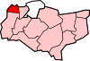
 Bean Location within Kent | |
| Population | 1,643 (civil parish 2011)[1] |
| OS grid reference | TQ590722 |
| Civil parish |
|
| District | |
| Shire county |
|
| Region |
|
| Country | England |
| Sovereign state | United Kingdom |
| Post town | Dartford |
| Postcode district | DA2 |
| Dialling code | 01474 |
| Police | Kent |
| Fire | Kent |
| Ambulance | South East Coast |
| UK Parliament |
|
The Area
The parish is bounded on the north by the A2 road (the Roman Watling Street), and on the other three sides by ancient woodlands. It is the most recently formed of Kent parishes, although the village itself has been recorded since at least the 13th century. Bean was formerly part of the parish of Stone, but the boundary was such that it was connected to the rest of Stone by only a narrow neck of land at Watling Street (A2). In 1797 this part of the parish of Stone is described as having great tract of woodland which reached almost to Green Street Green,[2] adjoining to Darenth parish. Along the northern boundary of these woods, runs the ancient Roman road to Rochester (now the A2) and not far from this road were the two small hamlets of Bean and Stonewood. On the hill above Green Street Green, among the woods, were the remains of a camp and fortifications, thrown up in ancient times, but then so overgrown with wood and rubbish, as to be impenetrable.[3]
Transport
Rail
The nearest National Rail stations to Bean are Longfield, located 2.2 miles away and Greenhithe, located 2.4 miles away.
Buses
Bean is served by Go Coach routes 474 & 475, connecting it with Bluewater.
Notes
- "Civil Parish population 2011". Neighbourhood Statistics. Office for National Statistics. Retrieved 11 September 2016.
- Vision of Britain http://www.visionofbritain.org.uk/place/23341
- The History and Topographical Survey of the County of Kent: Volume 2 (1797),by Edward Hasted. See section on the parish of Stone under Axstane Hundred
External links
- Notes on Bean parish[permanent dead link]
Towns and villages in the Borough of Dartford, Kent, England | ||
|---|---|---|
 |
| |
List of places in Kent | ||
This Kent location article is a stub. You can help Wikipedia by expanding it. |
Другой контент может иметь иную лицензию. Перед использованием материалов сайта WikiSort.org внимательно изучите правила лицензирования конкретных элементов наполнения сайта.
WikiSort.org - проект по пересортировке и дополнению контента Википедии