world.wikisort.org - United_Kingdom
Betsham is a hamlet in the parish of Southfleet in Kent, England.[1] [2]
| Betsham | |
|---|---|
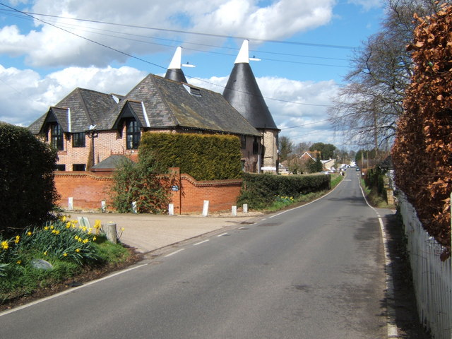 The Hop House, Betsham | |
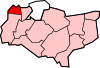
 Betsham Location within Kent | |
| District |
|
| Shire county |
|
| Region |
|
| Country | England |
| Sovereign state | United Kingdom |
| Post town | Gravesend |
| Postcode district | DA13 |
| Police | Kent |
| Fire | Kent |
| Ambulance | South East Coast |
| UK Parliament |
|
Betsham is a mile north-west from the village of Southfleet, which is situated nearly in the middle of the parish. The hamlet was formerly called Bedesham and lies on the road that leads from Green Street Green (formerly Greensted-green) in the parish of Darenth to Southfleet railway station and thence to Wingfield-bank, Northfleet where it meets the ancient Roman highway Watling Street (A2 motorway), which runs along the northern side of this parish.[3]
Westwood Road links Betsham with Westwood to the south.
References
- Parish of Southfleet in Imperial Gazetteer of England and Wales, by John Marius Wilson,publ. Fullarton, London, 1870-72
- Parish Council web site www.southfleetpc.kentparishes.gov.uk/history-of-the-parish-of-southfleet/ retrieved Sept 2018
- see Edward Hasted (1797). The History and Topographical Survey of the County of Kent: Volume 1.
External links
![]() Media related to Betsham at Wikimedia Commons
Media related to Betsham at Wikimedia Commons
Towns and villages in the Borough of Dartford, Kent, England | ||
|---|---|---|
 |
| |
List of places in Kent | ||
This Kent location article is a stub. You can help Wikipedia by expanding it. |
Текст в блоке "Читать" взят с сайта "Википедия" и доступен по лицензии Creative Commons Attribution-ShareAlike; в отдельных случаях могут действовать дополнительные условия.
Другой контент может иметь иную лицензию. Перед использованием материалов сайта WikiSort.org внимательно изучите правила лицензирования конкретных элементов наполнения сайта.
Другой контент может иметь иную лицензию. Перед использованием материалов сайта WikiSort.org внимательно изучите правила лицензирования конкретных элементов наполнения сайта.
2019-2026
WikiSort.org - проект по пересортировке и дополнению контента Википедии
WikiSort.org - проект по пересортировке и дополнению контента Википедии