world.wikisort.org - United_Kingdom
Aberaeron, previously anglicised as Aberayron, is a town, community, and electoral ward between Aberystwyth and Cardigan, in Ceredigion, Wales. Ceredigion County Council offices are in Aberaeron. The name of the town is Welsh for mouth of the Aeron, derived from the Middle Welsh aer, "slaughter",[1] which gave its name to Aeron, who is believed to have been a Welsh god of war.[2]
| Aberaeron | |
|---|---|
 Houses on the quay | |
 Aberaeron Location within Ceredigion | |
| Population | 1,422 |
| OS grid reference | SN458628 |
| Principal area | |
| Ceremonial county |
|
| Country | Wales |
| Sovereign state | United Kingdom |
| Post town | ABERAERON |
| Postcode district | SA46 |
| Dialling code | 01545 |
| Police | Dyfed-Powys |
| Fire | Mid and West Wales |
| Ambulance | Welsh |
| UK Parliament |
|
| Senedd Cymru – Welsh Parliament |
|
The population was 1,520 in 2001,[3] and 1,422 in 2011.[4]
History and design
In 1800, there was no significant coastal settlement here.[5] The present town was planned and developed from 1805 by the Rev. Alban Thomas Jones Gwynne. He built a harbour which operated as a port and supported a shipbuilding industry in the 19th century. A group of workmen's houses and a school were built on the harbour's north side, but these were reclaimed by the sea.[6] Steam ships continued to visit the harbour until the 1920s but, in later years, it evolved into a small half-tide harbour for recreational craft. The estuary is also crossed by a wooden pedestrian bridge.
Crafts were an important part of village life. Information recorded in trade directories shows that in 1830, although it was not yet fully developed as a port, in Aberaeron there were one woollen manufacturer, one bootmaker, one baker, one corn miller, one blacksmith, one blacksmith and shovel maker, two shipwrights, one carpenter and one hatmaker.[7]
In the late 1890s, a hand-powered cable car, the Aeron Express, was built to ferry workers across the harbour when the bridge was demolished by floods. The structure was recreated in 1988 as a tourist attraction that ran until the end of summer 1994, when it was closed under health and safety regulations.[8]
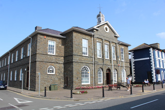
The architecture of Aberaeron is unusual in this part of rural Wales, being constructed around a principal square, Alban Square, of Regency style buildings grouped around the harbour. This was the work of Edward Haycock Sr., an architect from Shrewsbury. His designs also included the former Aberaeron Town Hall, which was completed in 1846 and became County Hall, Aberaeron in 1910.[9] Some of the architecture was of sufficient interest to feature on British postage stamps.[6]
Aberaeron Golf Club (now defunct) was founded in 1923. It continued until the Second World War when the course was turned over to agriculture to aid the war effort. Post-war attempts to reinstate the club failed.[10]
Castell Cadwgan
Castell Cadwgan, a 12th-century ringwork fortification around a probable wooden structure, was by the shore at Aberaeron, but has long since been claimed by the sea. Of the few traces left are some mounds of earth, the remains of the enclosure bank, most of the site having been eroded.[11][12]
Henry Gastineau's Wales Illustrated in a Series of Views (1810) mentions the site: "Near the town are some remains of an ancient fortress called Castell Cadwgan, thought to have been erected by King Cadwgan, about the year 1148."[citation needed] However, Cadwgan is recorded as having been killed in 1111. Welsh Minstrelsy: Containing the Land beneath the Sea (1824) says "Just where Sarn Ddewi juts out from the shore is an old fort, called Castell Cadwgan."[citation needed]
Local government

Aberaeron is a relatively new settlement and lacked borough status like other towns in the county. In 1894, the town achieved the status of being an urban district until the local government reorganisation of 1974.
The first representative for Aberayron on the Cardiganshire County Council from 1889 was John Morgan Howell, who became a prominent figure in the political life of the county. Following his election in January 1889, bonfires were lit to celebrate his victory.[13] Since 1995 the Aberaeron ward has elected one councillor to Ceredigion County Council. Since 2008 the ward has been represented by Elizabeth Evans for the Welsh Liberal Democrats.[14][15]
Education
The town and surrounding areas are served by Ysgol Gyfun Aberaeron, a bi-lingual secondary comprehensive school. Although there is no provision for higher education in the town, three university towns are within easy travelling range, namely Aberystwyth (13 mi (21 km) away), Lampeter (16 mi (26 km)), and Carmarthen (33 mi (53 km)).
Location and features
Aberaeron is located between Cardigan and Aberystwyth on the A487, at a junction with the A482 leading south-east to the university town of Lampeter. It lies on the Ceredigion Coast Path, part of the Wales Coast Path.
The shoreline consists of generally steep storm beaches of pebbles, although fine sand is visible at low tide levels. Aberaeron south beach was awarded the Blue Flag rural beach award in 2005.[16] It contains the Harbourmaster Hotel.
The climate is mild and temperate, largely conditioned by the proximity of the relatively shallow sea. However, Aberaeron can suffer from occasional winter frosts when cold air descends the Aeron valley from the upland parts of Ceredigion.
Dylan Thomas's links with Aberaeron, New Quay and Talsarn have been documented.[17] The Dylan Thomas Trail runs through Ceredigion, passing through Aberaeron and ending in New Quay.[18]
There are 248 listed buildings in Aberaeron community, most in the town itself.[19]
An annual festival of Welsh ponies and cobs is held on Alban Square Field every August.[20] A life-sized statue of a Welsh cob stallion, sculpted by David Mayer, was donated to the town in 2005 by the festival. An annual carnival takes place on the Monday bank holiday in August, with a procession of floats and a carnival queen moving from the Quay to Alban Square.[21][22]
Public transport

In 1866, transport in Lampeter was greatly improved with the opening of the railway linking Carmarthen and Aberystwyth. In 1911, a branch line, the Lampeter, Aberayron and New Quay Light Railway, opened to Aberaeron. Following the nationalisation of the railways, the passenger service to and from Aberaeron ceased in 1951 and it closed to freight in 1965.
A regular bus service links the town with Aberystwyth, Lampeter and Carmarthen, with several daily through services to Swansea, Bridgend and Cardiff.[23][24] Another service connects with New Quay, Aberporth and Cardigan from Monday to Saturday.[25]
Notable people
- Ron Davies, photographer
- Sir Geraint Evans, opera singer, had a home in Aberaeron for more than 30 years
- Seirian Sumner, entomologist and behavioural ecologist, professor at University College London
- Eleri Siôn, BBC Radio Wales presenter
See also
- Aberaeron Broth
- Aberaeron Urban District
Gallery
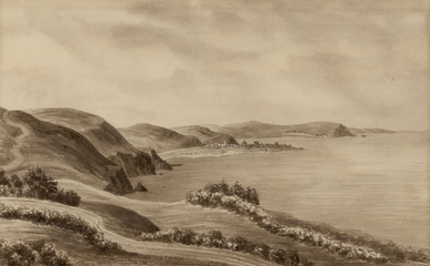 Early 19th-century sketch of Aberaeron
 River Aeron
 Black Lion Hotel on Alban Square
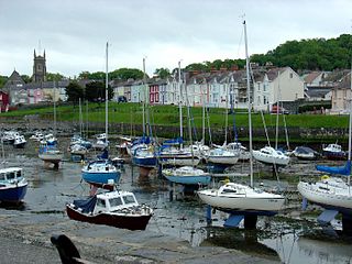 Harbour at low tide
 Footbridge over the Aeron
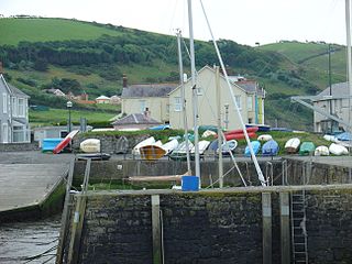 Harbour and hills
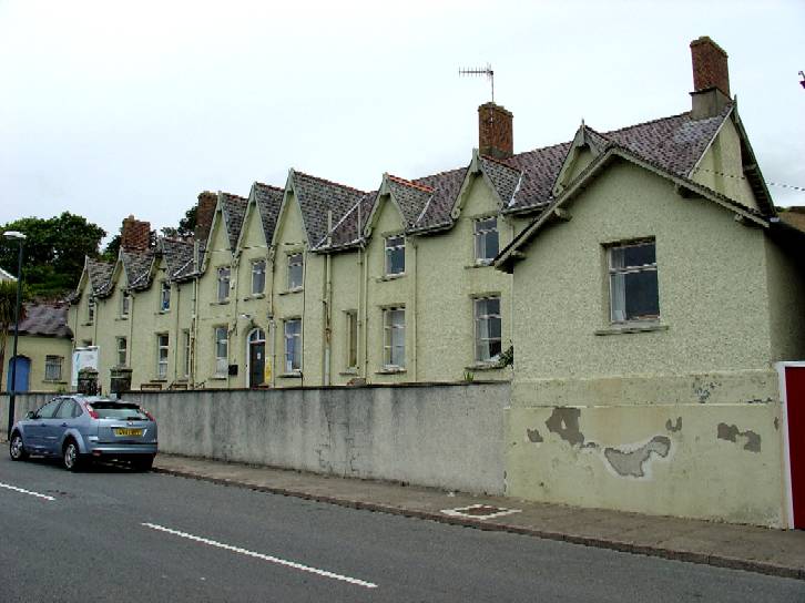
 Former workhouse
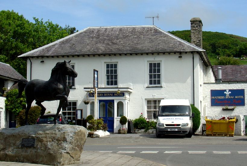
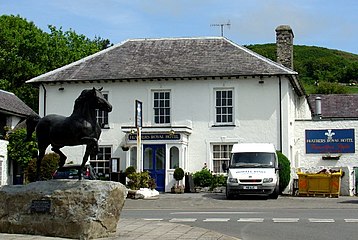 Feathers Royal Hotel (former coaching inn)
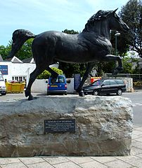 Welsh cob statue
 Castle Hotel and Market Street
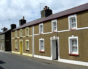 Georgian houses
 Northgate Toll House, c. 1785
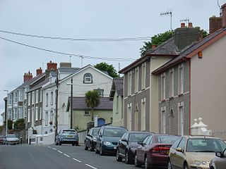 Prince's Avenue


References
- Sheard, K. M. (2011). Llewellyn's Complete Book of Names. Llewellyn Worldwide. p. 36. ISBN 978-0-738-72368-6.
- p.144 A Wander Around the Coast of Wales by Steve Plant, FastPrint Publishing, 2014
- "Parish Headcounts : Ceredigion". Census 2001. Office for National Statistics.
- "Community population 2011". Archived from the original on 4 March 2016. Retrieved 10 May 2015.
- Aberaeron Archived 2014-08-26 at the Wayback Machine at Ceredigion County Council website
- Aberaeron 1807–2007: Aberaeron Town Trail, celebrating our heritage Archived March 13, 2012, at the Wayback Machine Heritage Treftadaeth, 2007 (under building 1 - General Storehouse)
- Jenkins, J. Geraint. Ceredigion: Interpreting an Ancient County. Gwasg Careg Gwalch (2005) pg. 83.
- Price M. R. C. "The Lampeter, Aberayron and New Quay Light Railway", Oakwood Press 2011, p.104
- Lloyd, Thomas; Orbach, Julian; Scourfield, Robert; Avent, Richard (2006). Carmarthenshire and Ceredigion (Buildings of Wales Series). Yale University Press. p. 394. ISBN 978-0300101799.
- “Aberaeron Golf Club”, “Golf’s Missing Links”.
- "Aberaeron". Cymru Hanes (in Welsh). BBC.
- Lewis, Samuel (1849). "Aberaeron, or Aberayron (Aberaeron)". A Topographical Dictionary of Wales. British History Online.
- "Cardiganshire County Council". Cambrian News. 25 January 1889. Retrieved 4 December 2013.
- "Ceredigion County Council Election Results 1995-2012" (PDF). The Elections Centre. Retrieved 19 November 2018.
- "Ceredigion County Council Election 2017: The Results". Cambrian News. 5 May 2017. Retrieved 19 November 2018.
- Blue Flag website Archived October 22, 2007, at the Wayback Machine
- Thomas, David N. "Dylan Thomas: A Farm, Two Mansions and a Bungalow". Seren 2000. Also see https://sites.google.com/site/dylanthomasandnewquay/
- Thomas, David N. "The Dylan Thomas Trail". Y Lolfa, 2002
- "British Listed Buildings: Aberaeron". Retrieved 12 December 2019.
- www.aberaeronfesival.co.uk
- Aberaeron Carnival at aberaeron.info website
- Aberaeron Carnival 2009 pictures at BBC West Wales
- Arriva Cymru timetable [dead link]
- Aberystwyth to Cardiff four days weekly by coach Archived May 29, 2013, at the Wayback Machine by Coach Travel Wales
- Arriva Cymru (ARR) - Brodyr Richards/Richards Bros (RB) [dead link] at ceredigion.gov.uk
External links
- Aberaeron Town Council website
- Cymdeithas Aberaeron Society
- Official tourism website Archived 6 July 2007 at the Wayback Machine

Authority control | |
|---|---|
| General | |
| National libraries | |
На других языках
[de] Aberaeron
Aberaeron ist eine Küstenstadt in Ceredigion, Wales und Verwaltungssitz der Principal Area Ceredigion. Sie liegt zwischen den Orten Aberystwyth und Cardigan. Die Bevölkerung betrug 2011 nach den Ergebnissen der Volkszählung 1422 Personen.[1] Der Name des Ortes leitet sich vom Walisischen Aber Aeron her und bedeutet Mündung des Flusses Aeron. In den Namen von Stadt und Fluss ist das mittelalterliche walisische Wort aer (deutsch in etwa Gemetzel) enthalten,[2] das sich auch in den örtlichen Namen keltischer Götter finden lässt.- [en] Aberaeron
[ru] Аберайрон
Абера́йрон[1][2], также Абере́йрон[3] (англ. Aberaeron, валл. Aberaeron) — город в историческом и современном графстве Кередигион, в Уэльсе, расположенный на побережье Кардиганского залива между Аберистуитом и Кардиганом. Административный центр графства.Другой контент может иметь иную лицензию. Перед использованием материалов сайта WikiSort.org внимательно изучите правила лицензирования конкретных элементов наполнения сайта.
WikiSort.org - проект по пересортировке и дополнению контента Википедии