world.wikisort.org - Turkey
Kırıkhan is a town and district in the northeastern part of Hatay Province, Turkey. The name Kırıkhan means "broken inn" in the Turkish language, perhaps a reference to one of the many lodgings that once lined the road. The town stands at the intersection of the route between İskenderun and Aleppo, and the major east-west road between Antakya and Kahramanmaraş.
Kırıkhan | |
|---|---|
 Kırıkhan | |
| Coordinates: 36°29′51″N 36°21′39″E | |
| Country | Turkey |
| Province | Hatay |
| Government | |
| • Mayor | Ayhan Yavuz (AKP) |
| • Kaymakam | Zafer Karamehmetoğlu |
| Area | |
| • District | 843.35 km2 (325.62 sq mi) |
| Elevation | 151 m (495 ft) |
| Population (2012)[2] | |
| • Urban | 74,717 |
| • District | 106,452 |
| • District density | 130/km2 (330/sq mi) |
| Post code | 31440 |
| Website | www |
The town was once part of the district of Belen, but became a district in its own right in 1923 at the time of the French Mandate. Kırıkhan was annexed to Turkey in 1939 with the rest of Hatay.
It has 687.73 km2 acreage, 32.3 °C of average summer temperature and 7.31 °C of average winter temperature.
The district’s major religious and touristic site is the Beyazid-i Bestami Külliyesi (Complex) on Darb-ı Sak Castle at Alabeyli village, which contains the tomb or maqam of Bayazid Bastami.[3]
See also
- Trapessac
References
- "Area of regions (including lakes), km²". Regional Statistics Database. Turkish Statistical Institute. 2002. Retrieved 2013-03-05.
- "Population of province/district centers and towns/villages by districts - 2012". Address Based Population Registration System (ABPRS) Database. Turkish Statistical Institute. Retrieved 2013-02-27.
- "Kırıkhan'da Darb-ı Sak Kalesi üzerine inşa edilmiş Beyazid-i Bestami Külliyesi". www.dunyabizim.com/ (in Turkish). Retrieved 2021-09-12.
Kırıkhan in Hatay Province of Turkey | |||||||||||||||||||||||||||
|---|---|---|---|---|---|---|---|---|---|---|---|---|---|---|---|---|---|---|---|---|---|---|---|---|---|---|---|
| Districts |  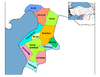 | ||||||||||||||||||||||||||
|
Metropolitan municipalities are bolded. | |||||||||||||||||||||||||||
This article about a Mediterranean Region of Turkey location is a stub. You can help Wikipedia by expanding it. |
На других языках
- [en] Kırıkhan
[ru] Кырыкхан
Кырыкхан (тур. Kırıkhan) — город и район в провинции Хатай (Турция).Другой контент может иметь иную лицензию. Перед использованием материалов сайта WikiSort.org внимательно изучите правила лицензирования конкретных элементов наполнения сайта.
WikiSort.org - проект по пересортировке и дополнению контента Википедии