world.wikisort.org - Thailand
Wat Sing (Thai: วัดสิงห์, pronounced [wát sǐŋ]) is a district (amphoe) in the northern part of Chai Nat province, central Thailand.
Wat Sing
วัดสิงห์ | |
|---|---|
District | |
 Wat Pak Khlong Makham Thao in tambon Makham Thao | |
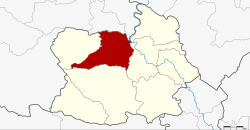 District location in Chai Nat province | |
| Coordinates: 15°15′19″N 100°2′17″E | |
| Country | Thailand |
| Province | Chai Nat |
| Seat | Makham Thao |
| Area | |
| • Total | 315.318 km2 (121.745 sq mi) |
| Population (2008) | |
| • Total | 26,389 |
| • Density | 83.5/km2 (216/sq mi) |
| Time zone | UTC+7 (ICT) |
| Postal code | 17120 |
| Geocode | 1803 |
Geography
Neighboring districts are (from the northeast clockwise) Manorom, Mueang Chai Nat, Hankha and Nong Mamong of Chai Nat Province; Nong Khayang and Mueang Uthai Thani of Uthai Thani province.
Administration
The district is divided into seven sub-districts (tambons), which are further subdivided into 47 villages (mubans). Wat Sing is a sub-district municipality (thesaban tambon) which covers tambon Wat Sing. There are a further six tambon administrative organizations (TAO).
| No. | Name | Thai | Villages | Pop.[1] |
|---|---|---|---|---|
| 1. | Wat Sing | วัดสิงห์ | - | 4,028 |
| 2. | Makham Thao | มะขามเฒ่า | 11 | 5,174 |
| 3. | Nong Noi | หนองน้อย | 8 | 3,744 |
| 4. | Nong Bua | หนองบัว | 5 | 2,755 |
| 6. | Nong Khun | หนองขุ่น | 8 | 3,443 |
| 7. | Bo Rae | บ่อแร่ | 7 | 2,886 |
| 11. | Wang Man | วังหมัน | 8 | 4,359 |
Missing numbers are tambon which now form Nong Mamong District.
References
- "Population statistics 2008". Department of Provincial Administration.
External links
- amphoe.com (Thai)
This Chainat Province location article is a stub. You can help Wikipedia by expanding it. |
На других языках
[de] Amphoe Wat Sing
Amphoe Wat Sing (Thai: อำเภอ วัดสิงห์) ist ein Landkreis (Amphoe – Verwaltungs-Distrikt) im nördlichen Teil der Provinz Chai Nat. Die Provinz Chai Nat liegt im nördlichen Teil der Zentralregion von Thailand.- [en] Wat Sing district
Текст в блоке "Читать" взят с сайта "Википедия" и доступен по лицензии Creative Commons Attribution-ShareAlike; в отдельных случаях могут действовать дополнительные условия.
Другой контент может иметь иную лицензию. Перед использованием материалов сайта WikiSort.org внимательно изучите правила лицензирования конкретных элементов наполнения сайта.
Другой контент может иметь иную лицензию. Перед использованием материалов сайта WikiSort.org внимательно изучите правила лицензирования конкретных элементов наполнения сайта.
2019-2026
WikiSort.org - проект по пересортировке и дополнению контента Википедии
WikiSort.org - проект по пересортировке и дополнению контента Википедии