world.wikisort.org - Thailand
Wapi Pathum (Thai: วาปีปทุม, pronounced [wāː.pīː pā.tʰūm]) is a district (amphoe) of Maha Sarakham province, northeastern Thailand.
Wapi Pathum
วาปีปทุม | |
|---|---|
District | |
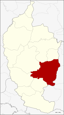 District location in Maha Sarakham province | |
| Coordinates: 15°50′48″N 103°22′48″E | |
| Country | Thailand |
| Province | Maha Sarakham |
| Seat | Nong Saeng |
| Area | |
| • Total | 605.77 km2 (233.89 sq mi) |
| Population (2008) | |
| • Total | 114,020 |
| • Density | 188.1/km2 (487/sq mi) |
| Time zone | UTC+7 (ICT) |
| Postal code | 44120 |
| Geocode | 4409 |
Geography
Neighbouring districts are (from the south clockwise): Na Dun, Na Chueak, Borabue, Mueang Maha Sarakham, and Kae Dam of Maha Sarakham Province; Si Somdet, Chaturaphak Phiman, Kaset Wisai, and Pathum Rat of Roi Et province.
History
The district dates back to Mueang Wapi Pathum, which was converted into a district around 1900.
Administration
The district is divided into 15 sub-districts (tambons), which are further subdivided into 240 villages (mubans). Nong Saeng is a sub-district municipality (thesaban tambon) which covers parts of tambon Nong Saeng. There are a further 15 tambon administrative organizations (TAO).
| No. | Name | Thai | Villages | Pop.[1] |
|---|---|---|---|---|
| 1. | Nong Saeng | หนองแสง | 28 | 21,063 |
| 2. | Kham Pom | ขามป้อม | 16 | 6,589 |
| 3. | Suea Kok | เสือโก้ก | 19 | 10,319 |
| 4. | Dong Yai | ดงใหญ่ | 16 | 5,013 |
| 5. | Pho Chai | โพธิ์ชัย | 12 | 4,500 |
| 6. | Hua Ruea | หัวเรือ | 21 | 10,486 |
| 7. | Khaen | แคน | 17 | 6,727 |
| 8. | Ngua Ba | งัวบา | 19 | 8,069 |
| 9. | Na Kha | นาข่า | 16 | 8,823 |
| 10. | Ban Wai | บ้านหวาย | 17 | 7,410 |
| 11. | Nong Hai | หนองไฮ | 17 | 7,855 |
| 12. | Pracha Phatthana | ประชาพัฒนา | 11 | 4,487 |
| 13. | Nong Thum | หนองทุ่ม | 10 | 3,987 |
| 14. | Nong Saen | หนองแสน | 10 | 4,319 |
| 15. | Khok Si Thonglang | โคกสีทองหลาง | 11 | 4,373 |
References
- "Population statistics 2008". Department of Provincial Administration.
External links
- amphoe.com (Thai)
Authority control | |
|---|---|
| General |
|
| National libraries | |
Текст в блоке "Читать" взят с сайта "Википедия" и доступен по лицензии Creative Commons Attribution-ShareAlike; в отдельных случаях могут действовать дополнительные условия.
Другой контент может иметь иную лицензию. Перед использованием материалов сайта WikiSort.org внимательно изучите правила лицензирования конкретных элементов наполнения сайта.
Другой контент может иметь иную лицензию. Перед использованием материалов сайта WikiSort.org внимательно изучите правила лицензирования конкретных элементов наполнения сайта.
2019-2026
WikiSort.org - проект по пересортировке и дополнению контента Википедии
WikiSort.org - проект по пересортировке и дополнению контента Википедии