world.wikisort.org - Thailand
U Thong (Thai: อู่ทอง, pronounced [ʔùː tʰɔ̄ːŋ]) is the district (amphoe) in the western part of Suphan Buri province, north of Bangkok.[1]
U Thong
อู่ทอง | |
|---|---|
District | |
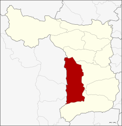 District location in Suphan Buri province | |
| Coordinates: 14°22′32″N 99°53′32″E | |
| Country | Thailand |
| Province | Suphan Buri |
| Area | |
| • Total | 630.29 km2 (243.36 sq mi) |
| Population (2013) | |
| • Total | 121,421 |
| Time zone | UTC+7 (ICT) |
| Postal code | 72160 |
| Geocode | 7209 |
History
![Bronze double denarius of the Gallic Roman emperor Victorinus (269-271 CE) found at U Thong.[2]: 300](http://upload.wikimedia.org/wikipedia/commons/thumb/c/cc/IMP_C_VICTORINVS_PF_AVG.tif/lossless-page1-220px-IMP_C_VICTORINVS_PF_AVG.tif.png)
Higham states, "U-Thong was occupied for many centuries prior to the development of the Dvaravati state. Radiocarbon determinations from the sites of U-Thong and Chansen suggest that the transition into complex state societies in the Chao Phraya basin took place between about 300-600 AD." A copper inscription from the mid-7th century states, "Sri Harshavarman, grandson of Ishanavarman, having expanded his sphere of glory, obtained the lion throne through regular succession," and mentions gifts to a linga. The site includes a moat, 1,690 by 840 m, and the Pra Paton caitya.[2]: 300, 302, 306–307
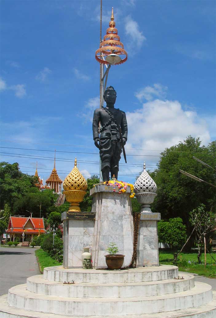
It also became the origin of the Ayutthaya Kingdom, as the first King of Ayutthaya, Ramathibodi, was prince of U Thong when the city was struck by an epidemic, prompting him to relocate east and found Ayutthaya.[3]
U Thong district was created with the name Chorakhe Sam Phan in 1905. In 1939 the district was renamed U Thong.[4] In 1944, the government moved the centre of the district from Ban Chorakhe Sam Phan to the area of the ancient city.[5]
Geography
Neighbouring districts are (from the north clockwise): Don Chedi, Mueang Suphan Buri, Bang Pla Ma, Song Phi Nong of Suphan Buri Province; Lao Khwan, Huai Krachao, and Phanom Thuan of Kanchanaburi province.

Administration
Central administration
U Thong district is divided into 13 sub-districts (tambons), which are further subdivided into 154 administrative villages (mubans).
| No. | Name | Thai | Villages | Pop.[6] |
|---|---|---|---|---|
| 1. | U Thong | อู่ทอง | 11 | 23,868 |
| 2. | Sa Yai Som | สระยายโสม | 10 | 8,352 |
| 3. | Chorakhe Sam Phan | จรเข้สามพัน | 15 | 13,105 |
| 4. | Ban Don | บ้านดอน | 9 | 7,710 |
| 5. | Yung Thalai | ยุ้งทะลาย | 7 | 4,497 |
| 6. | Don Makluea | ดอนมะเกลือ | 12 | 4,548 |
| 7. | Nong Ong | หนองโอ่ง | 14 | 9,859 |
| 8. | Don Kha | ดอนคา | 20 | 13,245 |
| 9. | Phlapphla Chai | พลับพลาไชย | 14 | 11,854 |
| 10. | Ban Khong | บ้านโข้ง | 14 | 8,855 |
| 11. | Chedi | เจดีย์ | 8 | 3,076 |
| 12. | Sa Phang Lan | สระพังลาน | 10 | 5,203 |
| 13. | Krachan | กระจัน | 10 | 7,249 |
Local administration
There are nine sub-district municipalities (thesaban tambons) in the district:
- Chorakhe Sam Phan (Thai: เทศบาลตำบลจรเข้สามพัน) consists of sub-district Chorakhe Sam Phan.
- Chedi (Thai: เทศบาลตำบลเจดีย์) consists of sub-district Chedi.
- Sa Yai Som (Thai: เทศบาลตำบลสระยายโสม) consists of parts of the sub-district Sa Yai Som.
- U Thong (Thai: เทศบาลตำบลอู่ทอง) consists of parts of the sub-district U Thong.
- Khun Phat Pheng (Thai: เทศบาลตำบลขุนพัดเพ็ง) consists of parts of the sub-district Sa Yai Som.
- Ban Don (Thai: เทศบาลตำบลบ้านดอน) consists of sub-district Ban Don.
- Ban Khong (Thai: เทศบาลตำบลบ้านโข้ง) consists of sub-district Ban Khong.
- Krachan (Thai: เทศบาลตำบลกระจัน) consists of sub-district, Krachan.
- Thao U Thong (Thai: เทศบาลตำบลท้าวอู่ทอง) consists of parts of sub-district U Thong.
There are six sub-district administrative organizations (SAO) in the district:
- Yung Thalai (Thai: องค์การบริหารส่วนตำบลยุ้งทะลาย) consists of sub-district Yung Thalai.
- Don Makluea (Thai: องค์การบริหารส่วนตำบลดอนมะเกลือ) consists of sub-district Don Makluea.
- Nong Ong (Thai: องค์การบริหารส่วนตำบลหนองโอ่ง) consists of sub-district Nong Ong.
- Don Kha (Thai: องค์การบริหารส่วนตำบลดอนคา) consists of sub-district Don Kha.
- Phlapphla Chai (Thai: องค์การบริหารส่วนตำบลพลับพลาไชย) consists of sub-district Phlapphla Chai.
- Sa Phang Lan (Thai: องค์การบริหารส่วนตำบลสระพังลาน) consists of sub-district Sa Phang Lan.
References
- Karnjanatawe, Karnjana (17 November 2016). "The lost world rediscovered". Bangkok Post. Retrieved 17 November 2016.
- Higham, C., 2014, Early Mainland Southeast Asia, Bangkok: River Books Co., Ltd., ISBN 9786167339443
- H. R. H. Prince Damrong (1904). "The Foundation of Ayuthia" (PDF). Journal of the Siam Society. Siam Heritage Trust. 1.0e.
There is an old city ... called by the people Müang U Thong (the city of King U Thong) and there is a tradition that Thao U Thong reigned over this city until an epidemic broke out and the people died in great numbers. He then abandoned the city and turning to the East looked out for another place to establish the capital; but the epidemic did not abate. He then crossed the Suphan (Tachin) river to escape the ravages of the epidemic, and even at the present time near the Suphan river there is a place called "Tha Thao U Thong" 'i.e.' the crossing of King U Thong.
- พระราชกฤษฎีกาเปลี่ยนนามอำเภอ กิ่งอำเภอ และตำบลบางแห่ง พุทธศักราช ๒๔๘๒ (PDF). Royal Gazette (in Thai). 56 (ก): 354–364. April 17, 1939.
- ประกาศกระทรวงมหาดไทย เรื่อง ย้ายที่ว่าการอำเภออู่ทอง จังหวัดสุพรรณบุรี (PDF). Royal Gazette (in Thai). 61 (12 ง): 369. 1944-02-22.
- "Population statistics 2013" (in Thai). Department of Provincial Administration. Retrieved 2014-10-04.
External links
На других языках
[de] Amphoe U Thong
Amphoe U Thong (Thai: อำเภอ อู่ทอง, Aussprache: .mw-parser-output .IPA a{text-decoration:none}ʔāmpʰɤ̄ː ʔùː tʰɔ̄ːŋ, etwa: Goldene Wiege) ist ein Landkreis (Amphoe – Verwaltungs-Distrikt) im Westen der Provinz Suphan Buri. Die Provinz Suphan Buri liegt im westlichen Teil der Zentralregion von Thailand.- [en] U Thong district
Другой контент может иметь иную лицензию. Перед использованием материалов сайта WikiSort.org внимательно изучите правила лицензирования конкретных элементов наполнения сайта.
WikiSort.org - проект по пересортировке и дополнению контента Википедии