world.wikisort.org - Thailand
Dan Chang (Thai: ด่านช้าง, pronounced [dàːn t͡ɕʰáːŋ]) is the northwesternmost district (amphoe) of Suphan Buri province, central Thailand.
Dan Chang
ด่านช้าง | |
|---|---|
District | |
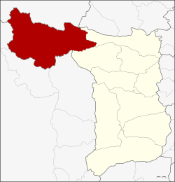 District location in Suphan Buri province | |
| Coordinates: 14°50′30″N 99°41′50″E | |
| Country | Thailand |
| Province | Suphan Buri |
| Area | |
| • Total | 1,193.6 km2 (460.9 sq mi) |
| Population (2013) | |
| • Total | 67,011 |
| • Density | 54.0/km2 (140/sq mi) |
| Time zone | UTC+7 (ICT) |
| Postal code | 72180 |
| Geocode | 7203 |
History
Dan Chang was created as a minor district (king amphoe) on 30 August 1974 by splitting off three tambons, Dan Chang, Ong Phra, and Huai Khamin, from Doem Bang Nang Buat district.[1] The next year, subdistrict Nong Makha Mong was transferred from Doem Bang Nang Buat to the minor district.[2] The minor district was upgraded to a full district on 13 July 1981.[3]
Lauda Air Flight 004 crashed at a site three nautical miles north of Phu Toei, Huai Khamin, Dan Chang in 1991.[4]
Geography
Neighboring districts are (from the north clockwise): Ban Rai of Uthai Thani province; Noen Kham of Chainat province; Doem Bang Nang Buat and Nong Ya Sai of Suphan Buri Province; and Lao Khwan, Nong Prue, and Si Sawat of Kanchanaburi province.
Phu Toei National Park is in Dan Chang District. The important water resource of Dan Chang is the Krasiao River which is impounded by the district's Krasiao Dam in Huai Khamin Subdistrict.
Administration
Central administration
Dan Chang is divided into seven subdistricts (tambons), which are further subdivided into 93 administrative villages (mubans).
| No. | Name | Thai | Villages | Pop.[5] |
|---|---|---|---|---|
| 1. | Nong Makha Mong | หนองมะค่าโมง | 21 | 17,782 |
| 2. | Dan Chang | ด่านช้าง | 21 | 16,007 |
| 3. | Huai Khamin | ห้วยขมิ้น | 16 | 9,259 |
| 4. | Ong Phra | องค์พระ | 9 | 7,133 |
| 5. | Wang Khan | วังคัน | 11 | 6,531 |
| 6. | Nikhom Krasiao | นิคมกระเสียว | 6 | 5,346 |
| 7. | Wang Yao | วังยาว | 9 | 4,953 |
Local administration
There is one subdistrict municipality (thesaban tambon) in the district:
- Dan Chang (Thai: เทศบาลตำบลด่านช้าง) consisting of parts of subdistricts Nong Makha Mong and Dan Chang.
There are seven subdistrict administrative organizations (SAO) in the district:
- Nong Makha Mong (Thai: องค์การบริหารส่วนตำบลหนองมะค่าโมง) consisting of parts of subdistrict Nong Makha Mong.
- Dan Chang (Thai: องค์การบริหารส่วนตำบลด่านช้าง) consisting of parts of subdistrict Dan Chang.
- Huai Khamin (Thai: องค์การบริหารส่วนตำบลห้วยขมิ้น) consisting of subdistrict Huai Khamin.
- Ong Phra (Thai: องค์การบริหารส่วนตำบลองค์พระ) consisting of subdistrict Ong Phra.
- Wang Khan (Thai: องค์การบริหารส่วนตำบลวังคัน) consisting of subdistrict Wang Khan.
- Nikhom Krasiao (Thai: องค์การบริหารส่วนตำบลนิคมกระเสียว) consisting of subdistrict Nikhom Krasiao.
- Wang Yao (Thai: องค์การบริหารส่วนตำบลวังยาว) consisting of subdistrict Wang Yao.
References
- ประกาศกระทรวงมหาดไทย เรื่อง แบ่งท้องที่อำเภอเดิมบางนางบวช จังหวัดสุพรรณบุรี ตั้งเป็นกิ่งอำเภอด่านช้าง (PDF). Royal Gazette (in Thai). 91 (144 ง): 3286. August 27, 1974.
- ประกาศกระทรวงมหาดไทย เรื่อง เปลี่ยนแปลงเขตกิ่งอำเภอด่านช้าง อำเภอเดิมบางนางบวช จังหวัดสุพรรณบุรี (PDF). Royal Gazette (in Thai). 92 (112 ง): 1475–1476. 1975-06-17.
- พระราชกฤษฎีกาตั้งอำเภอหนองใหญ่ อำเภอบ่อไร่ อำเภอพรหมคีรี อำเภอนาบอน อำเภอบางสะพานน้อย อำเภอนาดี อำเภอกงหรา อำเภอวังทรายพูน อำเภอธารโต อำเภอคำตากล้า อำเภอศรีนคร อำเภอด่านช้าง อำเภอพรเจริญ อำเภอวังสามหมอ และอำเภอลานสัก พ.ศ. ๒๕๒๔ (PDF). Royal Gazette (in Thai). 98 (115 ก Special): 7–10. July 13, 1981.
- Accident Report - Lauda Air Flight 004 (Archived 2011-06-07 at the Wayback Machine) - Aircraft Accident Investigation Committee, Ministry of Transport and Communications Thailand, Prepared for World Wide Web usage by Hiroshi Sogame (十亀 洋 Sogame Hiroshi), a member of the Safety Promotion Committee (総合安全推進) of All Nippon Airways. Retrieved on July 1, 2011. "This was in mountainous jungle terrain approximately 3 nautical miles north northeast of Phu Toey village of Tambol Huay Kamin in the Ban Dan Chang district of Suphan Buri Province, Kingdom of Thailand. The average elevation of the wreckage area was estimated to be 600 metres."
- "Population statistics 2013" (in Thai). Department of Provincial Administration. Retrieved 2014-10-04.
External links
Другой контент может иметь иную лицензию. Перед использованием материалов сайта WikiSort.org внимательно изучите правила лицензирования конкретных элементов наполнения сайта.
WikiSort.org - проект по пересортировке и дополнению контента Википедии