world.wikisort.org - Thailand
Ban Muang (Thai: บ้านม่วง, pronounced [bâːn mûa̯ŋ]) is a district (amphoe) of Sakon Nakhon province, northeast Thailand.
Ban Muang
บ้านม่วง | |
|---|---|
District | |
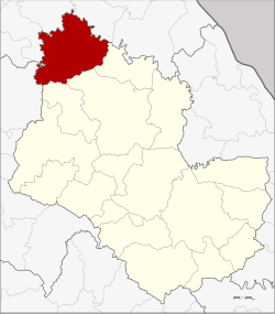 District location in Sakon Nakhon province | |
| Coordinates: 17°51′4″N 103°34′12″E | |
| Country | |
| Province | Sakon Nakhon |
| Seat | Muang |
| Area | |
| • Total | 850.0 km2 (328.2 sq mi) |
| Population (2005) | |
| • Total | 67,196 |
| • Density | 79.1/km2 (205/sq mi) |
| Time zone | UTC+7 (ICT) |
| Postal code | 47140 |
| Geocode | 4710 |
Geography
Neighboring districts are (from the west clockwise) Ban Dung of Udon Thani province, Fao Rai of Nong Khai province, So Phisai and Phon Charoen of Bueng Kan province, Kham Ta Kla, Wanon Niwat and Charoen Sin of Sakon Nakhon Province.
The Songkhram River marks the boundary of the district to the west.
History
The minor district (king amphoe) was created on 20 March 1968, when the three tambons Mai, Muang, and Dong Mo Thong were split off from Wanon Niwat district.[1] It was upgraded to a full district on 16 November 1971.[2]
Administration
The district is divided into nine sub-districts (tambons), which are further subdivided into 92 villages (mubans). The sub-district municipality (thesaban tambon) Ban Muang covers parts of tambon Muang. There are a further nine tambon administrative organizations (TAO).
| No. | Name | Thai name | Villages | Pop. | |
|---|---|---|---|---|---|
| 1. | Muang | ม่วง | 11 | 8,205 | |
| 2. | Mai | มาย | 9 | 5,974 | |
| 3. | Dong Mo Thong | ดงหม้อทอง | 11 | 7,083 | |
| 4. | Dong Nuea | ดงเหนือ | 12 | 7,125 | |
| 5. | Dong Mo Thong Tai | ดงหม้อทองใต้ | 9 | 8,174 | |
| 6. | Huai Lua | ห้วยหลัว | 9 | 7,192 | |
| 7. | Non Sa-at | โนนสะอาด | 9 | 5,321 | |
| 8. | Nong Kwang | หนองกวั่ง | 11 | 9,118 | |
| 9. | Bo Kaeo | บ่อแก้ว | 11 | 9,004 |
References
- ประกาศกระทรวงมหาดไทย เรื่อง แบ่งท้องที่ตั้งเป็นกิ่งอำเภอ (PDF). Royal Gazette (in Thai). 85 (25 ง): 836. 1968-03-19.
- พระราชกฤษฎีกาตั้งอำเภอปลาปาก อำเภอเชียงกลาง อำเภอปากชม อำเภอบ้านม่วง อำเภอพังโคน อำเภอดอนสัก อำเภอพนม อำเภอเวียงสระ อำเภอสังคม และอำเภอหัวตะพาน พ.ศ. ๒๕๑๔ (PDF). Royal Gazette (in Thai). 88 (123 ก): 745–748. November 16, 1971.
External links
This Sakon Nakhon Province location article is a stub. You can help Wikipedia by expanding it. |
Другой контент может иметь иную лицензию. Перед использованием материалов сайта WikiSort.org внимательно изучите правила лицензирования конкретных элементов наполнения сайта.
WikiSort.org - проект по пересортировке и дополнению контента Википедии