world.wikisort.org - Thailand
Kham Ta Kla (Thai: คำตากล้า, pronounced [kʰām tāː klâː]) is a district (amphoe) in the northern part of Sakon Nakhon province, northeast Thailand.
Kham Ta Kla
คำตากล้า | |
|---|---|
District | |
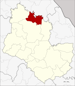 District location in Sakon Nakhon province | |
| Coordinates: 17°50′58″N 103°45′18″E | |
| Country | |
| Province | Sakon Nakhon |
| Seat | Kham Ta Kla |
| Area | |
| • Total | 402.0 km2 (155.2 sq mi) |
| Population (2005) | |
| • Total | 37,902 |
| • Density | 94.3/km2 (244/sq mi) |
| Time zone | UTC+7 (ICT) |
| Postal code | 47250 |
| Geocode | 4709 |
Geography
Neighboring districts are (from the southeast clockwise) Akat Amnuai, Wanon Niwat, Ban Muang of Sakon Nakhon Province, Phon Charoen and Seka of Bueng Kan province.
History
The minor district (king amphoe) was created on 15 September 1976, when the three tambons Kham Ta Kla, Nong Bua Sim, and Na Tae were split off from Wanon Niwat district.[1] It was upgraded to a full district on 13 July 1981.[2]
Administration
The district is divided into four sub-districts (tambons), which are further subdivided into 57 villages (mubans). Kham Ta Kla is a sub-district municipality (thesaban tambon) which covers parts of tambon Kham Ta Kla. There are a further four tambon administrative organizations (TAO).
| No. | Name | Thai name | Villages | Pop. | |
|---|---|---|---|---|---|
| 1. | Kham Ta Kla | คำตากล้า | 15 | 11,259 | |
| 2. | Nong Bua Sim | หนองบัวสิม | 15 | 8,473 | |
| 3. | Na Tae | นาแต้ | 12 | 8,254 | |
| 4. | Phaet | แพด | 15 | 9,916 |
References
- ประกาศกระทรวงมหาดไทย เรื่อง แบ่งท้องที่อำเภอวานรนิวาส จังหวัดสกลนคร ตั้งเป็นกิ่งอำเภอคำตากล้า (PDF). Royal Gazette (in Thai). 93 (110 ง): 2461. September 14, 1976.
- พระราชกฤษฎีกาตั้งอำเภอหนองใหญ่ อำเภอบ่อไร่ อำเภอพรหมคีรี อำเภอนาบอน อำเภอบางสะพานน้อย อำเภอนาดี อำเภอกงหรา อำเภอวังทรายพูน อำเภอธารโต อำเภอคำตากล้า อำเภอศรีนคร อำเภอด่านช้าง อำเภอพรเจริญ อำเภอวังสามหมอ และอำเภอลานสัก พ.ศ. ๒๕๒๔ (PDF). Royal Gazette (in Thai). 98 (115 ก Special): 7–10. July 13, 1981.
External links
This Sakon Nakhon Province location article is a stub. You can help Wikipedia by expanding it. |
Другой контент может иметь иную лицензию. Перед использованием материалов сайта WikiSort.org внимательно изучите правила лицензирования конкретных элементов наполнения сайта.
WikiSort.org - проект по пересортировке и дополнению контента Википедии