world.wikisort.org - Syria
Ithriya (Arabic: أثريا), Roman "Seriana". is a Syrian village located in Al-Saan Nahiyah in Salamiyah District, Hama. According to the Syria Central Bureau of Statistics (CBS), Ithriya had a population of 2118 in the 2004 census.[1]
Ithriya
أثريا | |
|---|---|
Village | |
 Ithriya Location in Syria | |
| Coordinates: 35.3692°N 37.7859°E | |
| Country | |
| Governorate | Hama |
| District | Salamiyah District |
| Subdistrict | Al-Saan Nahiyah |
| Population (2004) | |
| • Total | 2,118 |
| Time zone | UTC+2 (EET) |
| • Summer (DST) | UTC+3 (EEST) |
| City Qrya Pcode | C3273 |
History
In Roman times in Near Antiquity, Seriana housed a temple, known as the Church of Seriana.
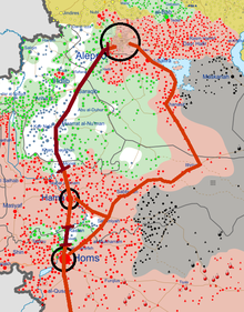
During the Syrian Civil War, Ithriyah became a strategically important point. It lays on the last highway under government control connecting the city of Aleppo to Khanasir and the Salamiyah region. In the Ithriyah-Raqqa offensive (February–March 2016) and Ithriyah-Raqqa offensive (June 2016), the town was used as a launching point for offensives against IS.
References
- "General Census of Population 2004". Retrieved 2014-07-10.
|  | ||||||||||||||
|
| |||||||||||||||
| |||||||||||||||
| |||||||||||||||
This article about a location in Hama Governorate, Syria is a stub. You can help Wikipedia by expanding it. |
Другой контент может иметь иную лицензию. Перед использованием материалов сайта WikiSort.org внимательно изучите правила лицензирования конкретных элементов наполнения сайта.
WikiSort.org - проект по пересортировке и дополнению контента Википедии