world.wikisort.org - Syria
Hama Governorate (Arabic: مُحافظة حماة / ALA-LC: Muḥāfaẓat Ḥamā) is one of the 14 governorates of Syria. It is situated in western-central Syria, bordering Idlib and Aleppo Governorates to the south, Raqqa Governorate to the west, Homs Governorate to the north, and Tartus and Latakia Governorate to the east. It is the only Governorate (excluding Damascus) that does not border a foreign country. Measures of its area vary from 8,844 km2[2] to 8,883 km2,[3] with its capital being the city of Hama.
Hama
مُحافظة حماة Ḥamā | |
|---|---|
Governorate | |
 Map of Syria with Hama highlighted | |
| Coordinates (Hama): 35.2°N 37.2°E | |
| Country | |
| Capital | Hama |
| Manatiq (Districts) | 5 |
| Government | |
| • Governor | Mahmoud Zanubua[1] |
| Area | |
| • Total | 8,883 km2 (3,430 sq mi) |
| Estimates range between 8,844 km² and 8,883 km² | |
| Population (2011) | |
| • Total | 1,628,000 |
| • Density | 180/km2 (470/sq mi) |
| Time zone | UTC+2 (EET) |
| • Summer (DST) | UTC+3 (EEST) |
| ISO 3166 code | SY-HM |
| Main language(s) | Arabic |
History
Archaeological sites
- Al Qubays - medieval castle
- Apamea - Graeco-Roman city
- Bourzey castle - Byzantine castle
- Masyaf Castle - medieval castle
- Shmemis - Ayyubid castle
- Tell Asharneh - possible site of Bronze Age Tunip
- Tell Qarqur - ancient settlement
Modern Syria
Hama has historically been a centre of opposition to the Assad regime, and it was the centre of an uprising in the late 1970s to the early 1980s that resulted in the 1982 Hama massacre.[4][5]
Syrian Civil War
The city was one of several that saw anti-Assad protests in 2011, the violent suppression of which ultimately led to the outbreak of civil war.[6] Despite this, for the most part the governorate has stayed under the Syrian Government's control, with exceptions of parts of the north-west in the early years of the conflict.[7] The eastern desert regions of the governorate fell under the control of Islamic State of Iraq and the Levant by 2016,[8] but by September 2017 the Syrian Army had managed to oust them.[9]
Geography
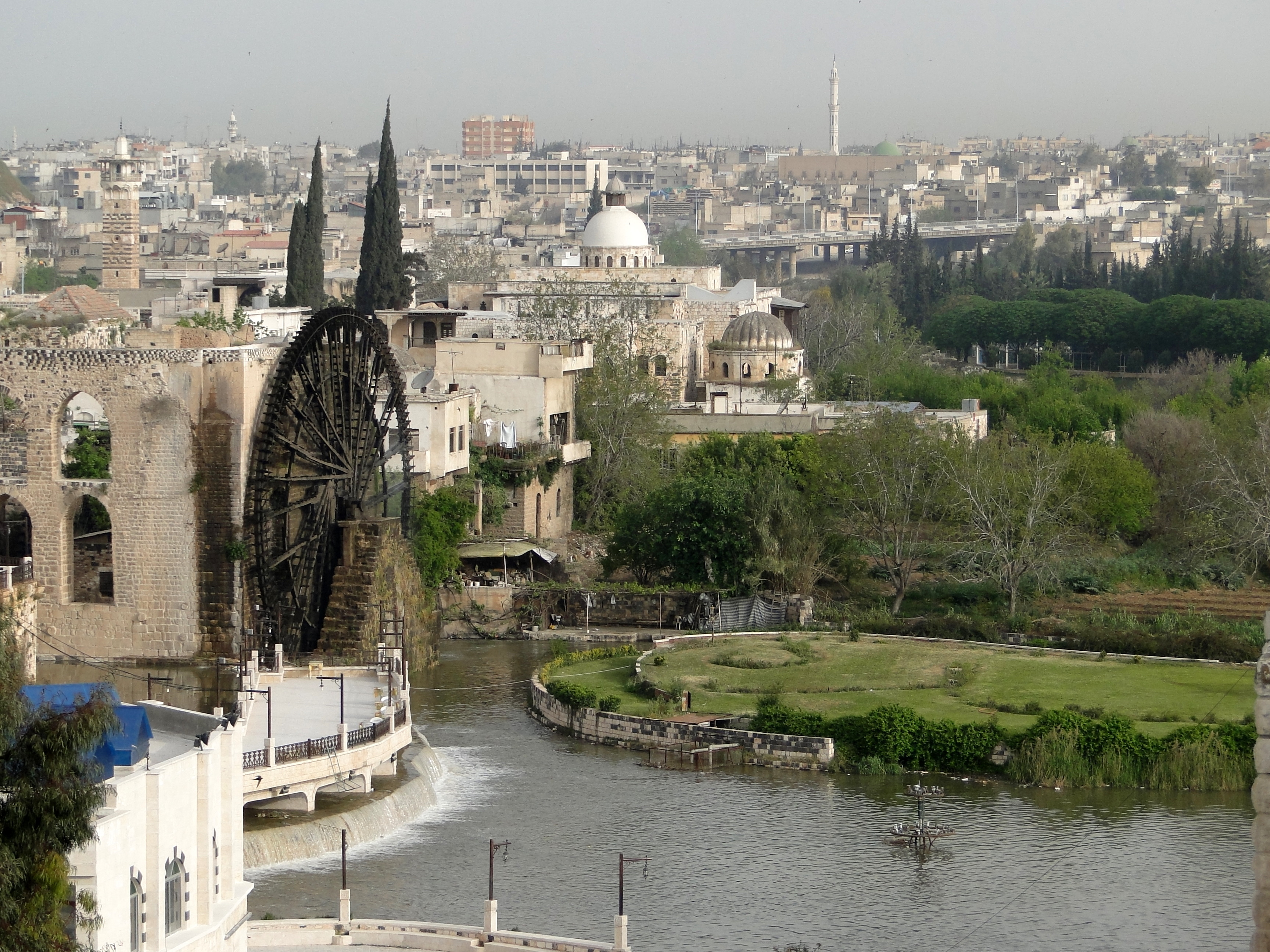
The western regions of the governorate are part of the Syrian Coastal Mountain Range (Nusayriyah Mountains), running north to south.[10] Roughly parallel with the mountains to the east is the Al-Ghab Plain, with the Orontes river flowing through it, Hama city lies on this river.[11] The central and eastern regions of the governorate consists of flatter desert terrain.
Settlements
The provincial capital is Hama; other major settlements include Akakir, Al-Hamraa, Al Qastal, Al-Saan, Aqarib as Safi, At Tammazah, Ithriya, Kafr Buhum, Karnaz, Mahardah, Masyaf, Murak, Qalaat al-Madiq, Qasr Ibn Wardan, Sabburah, Salamiyah, Shaykh Hilal, Shaytalun, Suran and Tayyibat at Turki.
Districts
The governorate is divided into five districts (manatiq). The districts are further divided into 22 sub-districts (nawahi):
|
|
Economy
Agriculture dominates the labor force of Hama Governorate, with 48% of employment ocurring within this sector. The remaining employment is spread between industry (22%) and trade and other services (30%). The main agricultural crops are wheat, barley, cotton, beetroot, onion, tobacco, and various vegetables. Fruit trees such as olive, pistachio, apple, pear, plum and peach are also commonly grown here. Animal breeding of sheeps, goats, poultry and bees are prevalent in Hama.[12]
Between 1926–1949, Hama witnessed developments in its public sector with industry expanding on sugar plants, onion drying, oils manufacturing, cotton grinning factories, and cement production and processing. Other manufacturing industry that was expanded include soda, ice cream, candy, textile, wool, cotton, rugs, carpets, gowns, and horse saddles. The region is also Syria's center of its chemical and manufacturing industry.[12]
Demographics
As per the 2004 Syrian census the population was 1,385,000.[2] A 2011 UNOCHA estimate put the population at 1,628,000, though this has likely changed since the start of the war.[13]
Sunni Muslims form the majority at 61%, followed by Alawites (19%), Ismailis (12%), Christian (7%) and Shi'ite Muslims (1%).[14]
Gallery
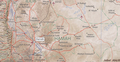 Map of Hama Governorate
 Abu Qubays castle
 Salamiyyah
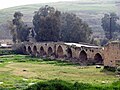 Roman bridge in Mahardah
 Shayzar
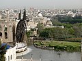 Hama
Hama


References
- "President al-Assad issues decrees on appointing new governors for eight Syrian provinces". Syrian Arab News Agency. 20 July 2022. Retrieved 15 August 2022.
- "Syria Provinces". www.statoids.com.
- "Syria: Governorates, Major Cities & Localities - Population Statistics, Maps, Charts, Weather and Web Information".
- "Syria: Bloody Challenge to Assad". Time. 8 March 1982. Archived from the original on October 15, 2010.
- JOHN KIFNER (12 February 1982). "Syrian Troops Are Said To Battle Rebels Encircled in Central City". The New York Times. Hama (Syria); Syria. Retrieved 20 January 2012.
- "'Half a million' protest on streets of Hama - Middle East". Al Jazeera English. 8 July 2011. Retrieved 3 August 2011.
- "Rebels seize towns in central Syria". Reuters. 19 December 2012. Archived from the original on 19 December 2012. Retrieved 20 December 2012.
- "Syrian Army begins new offensive to liberate Raqqa". Al-Masdar news. 2 June 2016. Archived from the original on 8 May 2019. Retrieved 23 March 2020.
- "Breaking: ISIS agrees to surrender all its territory in rural Hama to the Syrian Army". AMN - Al-Masdar News | المصدر نيوز. 2017-09-21. Retrieved 2017-09-21.
- Federal Research Division, Library of Congress (2005) "Country Profile: Syria" page 5
- "Asi-Orontes Basin". Food and Agriculture Organization of the United Nations. 2016. Retrieved 18 March 2018.
- "Economics of Hama countryside" (PDF). syrianef.org. Syrian Economic Forum. July 2015. Retrieved 29 October 2022.
{{cite web}}: CS1 maint: url-status (link) - Syrian Arab Republic - Governorates profile (PDF), UNOCHA, June 2014, retrieved 20 March 2020
- Hussain Ibrahim Qutrib (2016), "Useful Syria" and Demographic Changes in Syria (PDF), King Faisal Center for Research and Islamic Studies, retrieved 20 March 2020
External links
- ehama The First Complete website for hama news and services
На других языках
[de] Gouvernement Hama
Das Gouvernement Hama (arabisch محافظة حماة, DMG Muḥāfaẓat Ḥamāh) ist eines der 14 syrischen Gouvernements und liegt im westlich-zentralen Teil des Landes. Die Fläche ist je nach Quelle zwischen 8.844 km² und 8.883 km² groß. Die Bevölkerung beträgt 1.416.000 Menschen (Stand 2005). Der Verwaltungssitz ist Hama, eine weitere bedeutende Stadt in diesem Gouvernement ist Kafr Buhum.- [en] Hama Governorate
Другой контент может иметь иную лицензию. Перед использованием материалов сайта WikiSort.org внимательно изучите правила лицензирования конкретных элементов наполнения сайта.
WikiSort.org - проект по пересортировке и дополнению контента Википедии