world.wikisort.org - Sweden
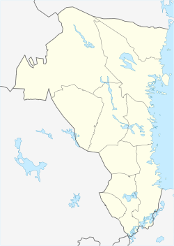
Åmot is a locality situated in Ockelbo Municipality, Gävleborg County, Sweden with 277 inhabitants in 2010.[1]
Åmot | |
|---|---|
 | |
 Åmot  Åmot | |
| Coordinates: 60°58′N 16°27′E | |
| Country | Sweden |
| Province | Gästrikland |
| County | Gävleborg County |
| Municipality | Ockelbo Municipality |
| Area | |
| • Total | 1.44 km2 (0.56 sq mi) |
| Population (31 December 2010)[1] | |
| • Total | 277 |
| • Density | 192/km2 (500/sq mi) |
| Time zone | UTC+1 (CET) |
| • Summer (DST) | UTC+2 (CEST) |
Climate
Åmot has a climate in the boundary zone between continental and subarctic.
| Climate data for Åmot 2002–2021 (extremes since 1951) | |||||||||||||
|---|---|---|---|---|---|---|---|---|---|---|---|---|---|
| Month | Jan | Feb | Mar | Apr | May | Jun | Jul | Aug | Sep | Oct | Nov | Dec | Year |
| Record high °C (°F) | 9.4 (48.9) |
12.3 (54.1) |
17.7 (63.9) |
25.6 (78.1) |
29.4 (84.9) |
31.0 (87.8) |
32.3 (90.1) |
32.6 (90.7) |
27.0 (80.6) |
21.0 (69.8) |
15.5 (59.9) |
11.8 (53.2) |
32.6 (90.7) |
| Mean maximum °C (°F) | 5.3 (41.5) |
6.8 (44.2) |
12.4 (54.3) |
17.8 (64.0) |
23.3 (73.9) |
26.7 (80.1) |
28.1 (82.6) |
26.6 (79.9) |
21.3 (70.3) |
14.9 (58.8) |
10.3 (50.5) |
6.4 (43.5) |
29.4 (84.9) |
| Average high °C (°F) | −1.6 (29.1) |
−0.2 (31.6) |
3.9 (39.0) |
9.9 (49.8) |
15.2 (59.4) |
19.5 (67.1) |
21.9 (71.4) |
20.1 (68.2) |
15.4 (59.7) |
8.6 (47.5) |
3.3 (37.9) |
0.0 (32.0) |
9.7 (49.4) |
| Daily mean °C (°F) | −5.4 (22.3) |
−4.4 (24.1) |
−1.2 (29.8) |
3.8 (38.8) |
8.8 (47.8) |
12.2 (54.0) |
15.7 (60.3) |
14.3 (57.7) |
10.1 (50.2) |
4.4 (39.9) |
0.1 (32.2) |
−3.5 (25.7) |
4.6 (40.2) |
| Average low °C (°F) | −9.2 (15.4) |
−8.6 (16.5) |
−6.3 (20.7) |
−2.3 (27.9) |
2.4 (36.3) |
6.9 (44.4) |
9.4 (48.9) |
8.4 (47.1) |
4.7 (40.5) |
0.2 (32.4) |
−3.1 (26.4) |
−7.0 (19.4) |
−0.4 (31.3) |
| Mean minimum °C (°F) | −22.2 (−8.0) |
−22.0 (−7.6) |
−17.9 (−0.2) |
−9.2 (15.4) |
−4.7 (23.5) |
−0.1 (31.8) |
3.1 (37.6) |
0.6 (33.1) |
−3.0 (26.6) |
−8.8 (16.2) |
−13.5 (7.7) |
−18.5 (−1.3) |
−25.5 (−13.9) |
| Record low °C (°F) | −32.5 (−26.5) |
−35.5 (−31.9) |
−31.3 (−24.3) |
−23.6 (−10.5) |
−12.7 (9.1) |
−3.4 (25.9) |
0.1 (32.2) |
−2.5 (27.5) |
−7.8 (18.0) |
−17.6 (0.3) |
−25.6 (−14.1) |
−31.8 (−25.2) |
−35.5 (−31.9) |
| Average precipitation mm (inches) | 42.1 (1.66) |
27.6 (1.09) |
24.4 (0.96) |
24.3 (0.96) |
45.1 (1.78) |
63.0 (2.48) |
74.0 (2.91) |
89.4 (3.52) |
42.1 (1.66) |
62.3 (2.45) |
45.8 (1.80) |
42.8 (1.69) |
582.9 (22.96) |
| Source 1: SMHI Open Data for Åmot A, temperature[2] | |||||||||||||
| Source 2: SMHI Open Data for Åmot A, precipitation[3] | |||||||||||||
References
- "Tätorternas landareal, folkmängd och invånare per km2 2005 och 2010" (in Swedish). Statistics Sweden. 14 December 2011. Archived from the original on 27 January 2012. Retrieved 10 January 2012.
- "Open Data for Åmot A" (in Swedish). Swedish Meteorological and Hydrological Institute. Retrieved 3 June 2022.
- "Open Data for Åmot A" (in Swedish). Swedish Meteorological and Hydrological Institute. Retrieved 3 June 2022.
Текст в блоке "Читать" взят с сайта "Википедия" и доступен по лицензии Creative Commons Attribution-ShareAlike; в отдельных случаях могут действовать дополнительные условия.
Другой контент может иметь иную лицензию. Перед использованием материалов сайта WikiSort.org внимательно изучите правила лицензирования конкретных элементов наполнения сайта.
Другой контент может иметь иную лицензию. Перед использованием материалов сайта WikiSort.org внимательно изучите правила лицензирования конкретных элементов наполнения сайта.
2019-2025
WikiSort.org - проект по пересортировке и дополнению контента Википедии
WikiSort.org - проект по пересортировке и дополнению контента Википедии