world.wikisort.org - Suriname
Houttuin is a resort in Suriname, located in the Wanica District. Its population at the 2012 census was 15,656. The largest ethnic group are the Indo-Surinamese.[1] The resort is named after the sugar plantation Houttuyn which was founded in 1737.[2] The resort was mainly agricultural,[3] and is planned to remain an agricultural centre.[4] In the early 21st century, it has seen a steady population growth, and is becoming suburban with housing projects like Tout Lui Faut.[4]
Houttuin | |
|---|---|
Resort | |
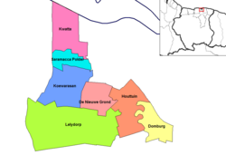 Map showing the resorts of Wanica District. Houttuin | |
| Country | |
| District | Wanica District |
| Area | |
| • Total | 58 km2 (22 sq mi) |
| Population (2012)[1] | |
| • Total | 15,656 |
| • Density | 270/km2 (700/sq mi) |
| Time zone | UTC-3 (AST) |
Staatsolie is operating an oil refinery,[5] and a thermal power plant in Houttuin.[6]
References
- "Resorts in Suriname Census 2012" (PDF). Retrieved 23 May 2020.
- "Plantage Houttuin". Suriname Plantages (in Dutch). Retrieved 23 May 2020.
- "Geschiedenis". Wanica.nl (in Dutch). Retrieved 23 May 2020.
- "Structuur Analyse IV" (PDF). Planning Office Suriname (in Dutch). Retrieved 23 May 2020.
- "Staatsolie's Tout Lui Faut Refinery Expansion". Hydro Carbons Technology. Retrieved 23 May 2020.
- "Bruto Omzet Staatsolie US 500 miljoen in 2019". Suriname.nu (in Dutch). Retrieved 23 May 2020.
This Suriname location article is a stub. You can help Wikipedia by expanding it. |
| Brokopondo District |
|  |
|---|---|---|
| Commewijne District |
| |
| Coronie District |
| |
| Marowijne District |
| |
| Nickerie District |
| |
| Para District |
| |
| Paramaribo District |
| |
| Saramacca District |
| |
| Sipaliwini District |
| |
| Wanica District |
| |
Текст в блоке "Читать" взят с сайта "Википедия" и доступен по лицензии Creative Commons Attribution-ShareAlike; в отдельных случаях могут действовать дополнительные условия.
Другой контент может иметь иную лицензию. Перед использованием материалов сайта WikiSort.org внимательно изучите правила лицензирования конкретных элементов наполнения сайта.
Другой контент может иметь иную лицензию. Перед использованием материалов сайта WikiSort.org внимательно изучите правила лицензирования конкретных элементов наполнения сайта.
2019-2026
WikiSort.org - проект по пересортировке и дополнению контента Википедии
WikiSort.org - проект по пересортировке и дополнению контента Википедии