world.wikisort.org - Spain
Serra de Daró is a municipality in Catalonia, Spain. Documented since 1017, it is located in the Daró river valley.
Serra de Daró | |
|---|---|
Municipality | |
 Serra de Daró with the Montgrí Massif in the background. | |
 Flag  Coat of arms | |
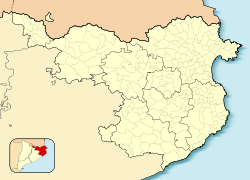 Serra de Daró Location in Catalonia  Serra de Daró Serra de Daró (Spain) | |
| Coordinates: 42°1′46″N 3°04′25″E | |
| Country | |
| Community | |
| Province | Girona |
| Comarca | Baix Empordà |
| Government | |
| • Mayor | Josep Puig Ribas (2015)[1] |
| Area | |
| • Total | 7.9 km2 (3.1 sq mi) |
| Elevation | 15 m (49 ft) |
| Population (2018)[3] | |
| • Total | 210 |
| • Density | 27/km2 (69/sq mi) |
| Demonym(s) | Serranenc |
| Website | www |
References
- "Ajuntament de Serra de Daró". Generalitat of Catalonia. Retrieved 2015-11-13.
- "El municipi en xifres: Serra de Daró". Statistical Institute of Catalonia. Retrieved 2015-11-23.
- Municipal Register of Spain 2018. National Statistics Institute.
External links
- Government data pages (in Catalan)
Places adjacent to Serra de Daró | ||||||||||||||||
|---|---|---|---|---|---|---|---|---|---|---|---|---|---|---|---|---|
| ||||||||||||||||
Municipalities of Baix Empordà | ||
|---|---|---|
| ||
Municipalities of the province of Girona | ||
|---|---|---|
| ||
| Authority control |
|
|---|
This Province of Girona location article is a stub. You can help Wikipedia by expanding it. |
На других языках
- [en] Serra de Daró
[es] Serra de Daró
Serra de Daró es un municipio español del Bajo Ampurdán, en la provincia de Gerona, comunidad autónoma de Cataluña.[ru] Серра-де-Даро
Серра-де-Даро (исп. Serra de Daró, баск. Serra de Daro, кат. Serra de Daró) — населённый пункт и муниципалитет в Испании, входит в провинцию Жирона в составе автономного сообщества Каталония. Муниципалитет находится в составе района (комарки) Баш-Эмпорда. Занимает площадь 23,72 км². Население — 209 человек (на 2010 год).Текст в блоке "Читать" взят с сайта "Википедия" и доступен по лицензии Creative Commons Attribution-ShareAlike; в отдельных случаях могут действовать дополнительные условия.
Другой контент может иметь иную лицензию. Перед использованием материалов сайта WikiSort.org внимательно изучите правила лицензирования конкретных элементов наполнения сайта.
Другой контент может иметь иную лицензию. Перед использованием материалов сайта WikiSort.org внимательно изучите правила лицензирования конкретных элементов наполнения сайта.
2019-2026
WikiSort.org - проект по пересортировке и дополнению контента Википедии
WikiSort.org - проект по пересортировке и дополнению контента Википедии