world.wikisort.org - South_Korea
Inje County (Inje-gun) is a county in Gangwon Province, South Korea. It has the lowest population density of any South Korean county.
Inje
인제군 | |
|---|---|
County | |
| Korean transcription(s) | |
| • Hangul | 인제군 |
| • Hanja | 麟蹄郡 |
| • Revised Romanization | Inje-gun |
| • McCune-Reischauer | Inje-gun |
 Flag  Emblem of Inje | |
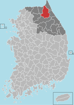 Location in South Korea | |
| Country | |
| Region | Gwandong |
| Administrative divisions | 1 eup, 5 myeon |
| Area | |
| • Total | 1,646.33 km2 (635.65 sq mi) |
| Population (2000) | |
| • Total | 34,120 |
| • Density | 21/km2 (50/sq mi) |
| • Dialect | Gangwon |
History
Since the first inhabitants came to the Korean peninsula, there have been people living in Inje county. Surrounded by clear and clean rivers and streams and magnificent Soraksan. Inje is located in the mid-east of Gangwon-do, it was at first called Jeojokhyeon in the Goguryeo Kingdom, Heejaehyeon in the Silla Kingdom, Inje in the Goryeo Dynasty, Youngsohyeon and again later Inje in the Joseon Dynasty and finally raised to the status of Inje county in August 1896.[1]
Korean War
The Republic of Korea Army ROK) 5th Infantry Division recaptured Inje town in Operation Rugged in April 1951 as the UN Forces advanced to the Kansas Line, north of the 38th Parallel.[2]
Inje town was lost again to the Chinese People's Volunteer Army during the Fifth Phase Offensive in late April 1951 and was recaptured in the UN May-June 1951 counteroffensive.[2]: 474–5
In 1951 the US Marine Corps 1st Medical Battalion operated a field hospital in Inje town.
The 40th Infantry Division assumed responsibility for the defense of the Kansas Line from the 24th Infantry Division from February 1952 supported by the ROK 3rd Infantry Division.
After the war ended, Inje County continued to be a strategic location for the military. The Korea Combat Training Center is located there. The Republic of Korea Army's III Corps headquarters and its subordinate units are scattered in bases throughout the county.
Environment
Inje is located in the Taebaek Mountains and has a landscape dominated by flora. Many species inhabit several areas of the county, not only mountains but rivers also.
Fauna
- Asiatic Black Bear : It populates a wide area from Siberia to Afghanistan and Thailand as well as certain Asian islands such as Taiwan and Japan. In Korea, the Asiatic Black Bear can be found in the areas of Paekdusan, Seoraksan, Jirisan The Asiatic Black Bear is becoming rare in South Korea. It usually lives in broadleaf forest on peaks higher than 1,500m, finding fruits such as wild grapes, wild berries, fruits of Acfinidia arguta, especially with acorns. The Asiatic Black Bear has developed a good sense of smell and hearing however cannot see very well.[3]
- Musk deer : Among the Musk deer in the northern hemisphere, this species in the North-East is divided into seven subspecies. This subspecies found in the mountains around Mokpo and Jeonranamdo is also reported to be distributed Manchuria, Amur, Ussuri and Eastern Siberia as well as South Korea.
Flora
- Senecio koreanus : The Senecio Koreanus is a Korean Endemic Species.
- Carex chordorhiza : The Carex Chordorhiza is a perennial plant growing with sphagnum in a swamp, at first grows straight and then crawls laterally to take root. From its joint it grows a flower stem of up to 20 cm. Its leaves are flat and 1~1.5 cm wide with colors of gray and green. The heads are egg-like and numbered 2~4 which are 5~7 cm long. Male flowers come out upward but female ones downward without any bracts.
- Megaleranthis saniculifolia : Megaleranthis Saniculifolia is also a Korean Endemic Species and clings to Ranunculaceae. It inhabits the Jeombongsan, Sobaeksan, Jirisan and Taebaeksan areas. Living in the swamps or ridges in deep mountains, the perennial plant sprouts in stubbles. It's between 30 and 40 cm tall. Leaves come from the root of the plant and are divided into three parts at the end, a long leafstalk may be split into two or three parts again.
Climate
| Climate data for Inje (1991–2020 normals, extremes 1971–present) | |||||||||||||
|---|---|---|---|---|---|---|---|---|---|---|---|---|---|
| Month | Jan | Feb | Mar | Apr | May | Jun | Jul | Aug | Sep | Oct | Nov | Dec | Year |
| Record high °C (°F) | 13.2 (55.8) |
18.9 (66.0) |
23.5 (74.3) |
31.2 (88.2) |
33.0 (91.4) |
35.4 (95.7) |
36.8 (98.2) |
37.7 (99.9) |
33.2 (91.8) |
28.6 (83.5) |
24.2 (75.6) |
16.3 (61.3) |
37.7 (99.9) |
| Average high °C (°F) | 1.5 (34.7) |
4.7 (40.5) |
10.5 (50.9) |
17.8 (64.0) |
23.2 (73.8) |
27.0 (80.6) |
28.2 (82.8) |
28.8 (83.8) |
24.7 (76.5) |
19.1 (66.4) |
11.0 (51.8) |
3.5 (38.3) |
16.7 (62.1) |
| Daily mean °C (°F) | −4.7 (23.5) |
−1.8 (28.8) |
4.0 (39.2) |
10.6 (51.1) |
16.1 (61.0) |
20.4 (68.7) |
23.3 (73.9) |
23.4 (74.1) |
18.4 (65.1) |
11.8 (53.2) |
4.8 (40.6) |
−2.1 (28.2) |
10.4 (50.7) |
| Average low °C (°F) | −10.4 (13.3) |
−7.7 (18.1) |
−1.9 (28.6) |
3.8 (38.8) |
9.6 (49.3) |
15.1 (59.2) |
19.6 (67.3) |
19.7 (67.5) |
14.0 (57.2) |
6.4 (43.5) |
−0.4 (31.3) |
−7.3 (18.9) |
5.0 (41.0) |
| Record low °C (°F) | −25.9 (−14.6) |
−24.5 (−12.1) |
−14.9 (5.2) |
−7.0 (19.4) |
0.1 (32.2) |
3.4 (38.1) |
9.8 (49.6) |
9.0 (48.2) |
0.7 (33.3) |
−6.5 (20.3) |
−14.0 (6.8) |
−22.8 (−9.0) |
−25.9 (−14.6) |
| Average precipitation mm (inches) | 16.6 (0.65) |
22.8 (0.90) |
32.1 (1.26) |
69.8 (2.75) |
92.6 (3.65) |
116.8 (4.60) |
332.4 (13.09) |
287.6 (11.32) |
127.4 (5.02) |
44.8 (1.76) |
40.9 (1.61) |
20.8 (0.82) |
1,204.6 (47.43) |
| Average precipitation days (≥ 0.1 mm) | 5.9 | 5.7 | 7.8 | 8.7 | 9.4 | 10.3 | 15.2 | 14.0 | 8.9 | 5.8 | 7.5 | 5.9 | 105.1 |
| Average snowy days | 9.4 | 7.4 | 4.9 | 0.7 | 0.0 | 0.0 | 0.0 | 0.0 | 0.0 | 0.1 | 2.1 | 6.5 | 30.8 |
| Average relative humidity (%) | 65.0 | 61.1 | 58.4 | 56.4 | 63.7 | 69.7 | 78.5 | 79.0 | 76.8 | 72.9 | 69.0 | 67.3 | 68.2 |
| Mean monthly sunshine hours | 158.8 | 158.3 | 187.5 | 199.4 | 215.6 | 199.2 | 144.9 | 159.7 | 165.0 | 166.9 | 136.1 | 147.1 | 2,038.5 |
| Percent possible sunshine | 52.5 | 52.6 | 51.8 | 53.6 | 50.8 | 46.3 | 35.3 | 41.3 | 47.1 | 50.5 | 45.8 | 49.3 | 47.8 |
| Source: Korea Meteorological Administration (snow and percent sunshine 1981–2010)[4][5][6][7][8] | |||||||||||||
Daecheong peak
Daecheong Peak is the highest peak in the Mt. Seorak ranges and is located near at the boundary of Inje county and Yangyang county with an altitude of 1,708m.[9]
The beautiful snow scenes around Daecheong peak are widely known. Inje county is quite cold from early November, with snow falling around its higher peaks. In 2007, the first heavy snow of the year was recorded as early as 16 November.[10]
Tourism
Inje is a modest tourist destination for outdoor activities. It is home to the highest bungee jump in South Korea.[11] It also host the Inje Speedium Resort Circuit.[12]
Ice fishing festival
Because of its cold climate, many ice-fishing festivals often occur in Inje and the wider Gangwon-do area. However, the ice fishing in Inje is one of the main attractions in winter with 6,000 tourists per weekday and over 10,000 on weekends.[13]
References
- Official page
- Mossman, Billy (1988). United States Army in the Korean War: Ebb and Flow November 1950-July 1951. United States Army Center of Military History. p. 349.
 This article incorporates text from this source, which is in the public domain.
 - Inje Official website
- "Climatological Normals of Korea (1991 ~ 2020)" (PDF) (in Korean). Korea Meteorological Administration. Archived from the original (PDF) on 29 January 2022. Retrieved 4 April 2022.
- 우리나라 기후평년값 - 파일셋 (in Korean). Korea Meteorological Administration. Retrieved 4 April 2022.
- 우리나라 기후평년값 - 그래프 (in Korean). Korea Meteorological Administration. Retrieved 4 April 2022.
- 순위값 - 구역별조회 (in Korean). Korea Meteorological Administration. Retrieved 4 April 2022.
- "Climatological Normals of Korea" (PDF). Korea Meteorological Administration. 2011. Archived from the original (PDF) on 7 December 2016. Retrieved 8 December 2016.
- Official page concerning Tour
- Daecheongbong peak is in the very winter (대청봉은 한겨울)2007.11.16 (금)
- "Bungee Jumping: Korea". ASCENDIA SPORTS. Retrieved 2020-02-20.
- "Inje Speedium Resort Circuit (인제스피디움리조트 서킷) | Official Korea Tourism Organization". english.visitkorea.or.kr. Retrieved 2020-02-20.
- http://www.ytn.co.kr/_ln/0103_200801260111142622 겨울의 절정...얼음 낚시 릴레이 2008-01-26
External links
Chuncheon (capital) | ||
 | Cities | |
| Counties | ||
Authority control | |
|---|---|
| General | |
| National libraries | |
| Other | |
На других языках
- [en] Inje County
[ru] Индже
Индже́ (кор. 인제군?, 麟蹄郡?, Inje-gun) — уезд в провинции Канвондо, Южная Корея.Другой контент может иметь иную лицензию. Перед использованием материалов сайта WikiSort.org внимательно изучите правила лицензирования конкретных элементов наполнения сайта.
WikiSort.org - проект по пересортировке и дополнению контента Википедии