world.wikisort.org - South_Africa
West Driefontein was a South African gold mining company belonging to the Goldfields Group (now Sibanye Gold).
West Driefontein | |
|---|---|
 West Driefontein  West Driefontein | |
| Coordinates: 26°23′S 27°26′E | |
| Country | South Africa |
| Province | Gauteng |
| District | West Rand |
| Municipality | Merafong City |
| Area | |
| • Total | 47.54 km2 (18.36 sq mi) |
| Population (2011)[1] | |
| • Total | 2,857 |
| • Density | 60/km2 (160/sq mi) |
| Racial makeup (2011) | |
| • Black African | 97.1% |
| • Coloured | 1.3% |
| • Indian/Asian | 0.4% |
| • White | 1.2% |
| First languages (2011) | |
| • Sotho | 28.4% |
| • Xhosa | 27.2% |
| • Tsonga | 15.0% |
| • Zulu | 13.8% |
| • Other | 15.6% |
| Time zone | UTC+2 (SAST) |

It lies approximately 10 kilometres (6.2 mi) outside Carletonville next to Blyvooruitsig and East Driefontein. It used to be the richest gold mine in the world before it was flooded by water.
References
- "Main Place West Driefontein". Census 2011.
Municipalities and communities of West Rand District Municipality, Gauteng | ||
|---|---|---|
District seat: Randfontein | ||
| Mogale City | 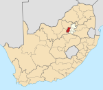 | |
| Merafong City |
| |
| Rand West City |
| |
This Gauteng location article is a stub. You can help Wikipedia by expanding it. |
Текст в блоке "Читать" взят с сайта "Википедия" и доступен по лицензии Creative Commons Attribution-ShareAlike; в отдельных случаях могут действовать дополнительные условия.
Другой контент может иметь иную лицензию. Перед использованием материалов сайта WikiSort.org внимательно изучите правила лицензирования конкретных элементов наполнения сайта.
Другой контент может иметь иную лицензию. Перед использованием материалов сайта WikiSort.org внимательно изучите правила лицензирования конкретных элементов наполнения сайта.
2019-2025
WikiSort.org - проект по пересортировке и дополнению контента Википедии
WikiSort.org - проект по пересортировке и дополнению контента Википедии