world.wikisort.org - South_Africa
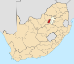
Westonaria is a town in the west of Gauteng province of South Africa. It is situated in the Rand West City Local Municipality, part of the West Rand District Municipality. During the apartheid era, Africans lived outside town in Bekkersdal. The town is some 45 km west of Johannesburg and 18 km south of Randfontein.
Westonaria | |
|---|---|
 Westonaria  Westonaria | |
| Coordinates: 26°19′4″S 27°39′2″E | |
| Country | South Africa |
| Province | Gauteng |
| District | West Rand |
| Municipality | Rand West City |
| Established | 1948 |
| Area | |
| • Total | 12.65 km2 (4.88 sq mi) |
| Population (2011)[1] | |
| • Total | 10,259 |
| • Density | 810/km2 (2,100/sq mi) |
| Racial makeup (2011) | |
| • Black African | 65.5% |
| • Coloured | 1.4% |
| • Indian/Asian | 1.0% |
| • White | 31.9% |
| • Other | 0.2% |
| First languages (2011) | |
| • Afrikaans | 28.8% |
| • Xhosa | 16.6% |
| • Sotho | 14.0% |
| • Tswana | 13.4% |
| • Other | 27.1% |
| Time zone | UTC+2 (SAST) |
| Postal code (street) | 1779 |
| PO box | 1780 |
| Area code | 011 |
| Website | http://westonaria.co.za/ |
History
It was formed in 1948 by the amalgamation of the townships Venterspost, proclaimed in 1937, and Westonaria, proclaimed in 1938.[2] First called Venterspost, the name was changed to Westonaria when municipal status was attained in 1952.[2] The name is a homophone of ‘western area’, after the township developing company Western Areas Ltd.[3]
References
- "Main Place Westonaria". Census 2011.
- Raper, Peter E.; Moller, Lucie A.; du Plessis, Theodorus L. (2014). Dictionary of Southern African Place Names. Jonathan Ball Publishers. p. 1412. ISBN 9781868425501.
- "Dictionary of Southern African Place Names (Public Domain)". Human Science Research Council. p. 473.
Municipalities and communities of West Rand District Municipality, Gauteng | ||
|---|---|---|
District seat: Randfontein | ||
| Mogale City |
|  |
| Merafong City |
| |
| Rand West City |
| |
This Gauteng location article is a stub. You can help Wikipedia by expanding it. |
На других языках
- [en] Westonaria
[ru] Вестонария
Вестонария (Westonaria) — административный центр местного муниципалитета Вестонария в районе Уэст-Ранд провинции Гаутенг (ЮАР).Текст в блоке "Читать" взят с сайта "Википедия" и доступен по лицензии Creative Commons Attribution-ShareAlike; в отдельных случаях могут действовать дополнительные условия.
Другой контент может иметь иную лицензию. Перед использованием материалов сайта WikiSort.org внимательно изучите правила лицензирования конкретных элементов наполнения сайта.
Другой контент может иметь иную лицензию. Перед использованием материалов сайта WikiSort.org внимательно изучите правила лицензирования конкретных элементов наполнения сайта.
2019-2025
WikiSort.org - проект по пересортировке и дополнению контента Википедии
WikiSort.org - проект по пересортировке и дополнению контента Википедии