world.wikisort.org - South_Africa
Sebayeng is a township in the Polokwane Local Municipality of the Capricorn District Municipality of the Limpopo province of South Africa. It is located about 37 km east of the city of Polokwane on the R81 road.
Sebayeng
Solomondale | |
|---|---|
 Sebayeng  Sebayeng | |
| Coordinates: 23.885°S 29.718°E | |
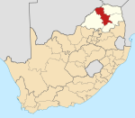
| Country | South Africa |
| Province | Limpopo |
| District | Capricorn |
| Municipality | Polokwane |
| Area | |
| • Total | 6.92 km2 (2.67 sq mi) |
| Elevation | 1,086 m (3,563 ft) |
| Population (2011)[1] | |
| • Total | 13,826 |
| • Density | 2,000/km2 (5,200/sq mi) |
| Racial makeup (2011) | |
| • Black African | 99.6% |
| • Indian/Asian | 0.1% |
| • Other | 0.2% |
| First languages (2011) | |
| • Northern Sotho | 92.6% |
| • Tsonga | 3.0% |
| • Other | 4.4% |
| Time zone | UTC+2 (SAST) |
| Postal code (street) | 0964 |
| PO box | 0752 |
| Area code | +27 (0)15 |
Education
- Sebayeng Primary School.
- Mafolofolo High School.
References
- "Main Place Sebayeng". Census 2011.
Municipalities and communities of Capricorn District Municipality, Limpopo | ||
|---|---|---|
District seat: Polokwane | ||
| Blouberg |
|  |
| Molemole | ||
| Polokwane |
| |
| Lepelle-Nkumpi |
| |
Текст в блоке "Читать" взят с сайта "Википедия" и доступен по лицензии Creative Commons Attribution-ShareAlike; в отдельных случаях могут действовать дополнительные условия.
Другой контент может иметь иную лицензию. Перед использованием материалов сайта WikiSort.org внимательно изучите правила лицензирования конкретных элементов наполнения сайта.
Другой контент может иметь иную лицензию. Перед использованием материалов сайта WikiSort.org внимательно изучите правила лицензирования конкретных элементов наполнения сайта.
2019-2025
WikiSort.org - проект по пересортировке и дополнению контента Википедии
WikiSort.org - проект по пересортировке и дополнению контента Википедии