world.wikisort.org - South_Africa
Blouberg Local Municipality is a municipality in the Limpopo Province, northern South Africa, bordering Botswana. It takes its name from the Blouberg (literally meaning blue mountain),[3] a mountain range located to the west of the western end of the Soutpansberg mountain range, north west of the town of Vivo. Blouberg is home to some of the most spectacular rock climbing in South Africa. The rock climbing destination is famous for its big wall natural climbing with route lengths up to 350m. The vegetation ranges from sub-tropical savanna at the base, to alpine near the summit.
This article needs additional citations for verification. (December 2009) |
Blouberg | |
|---|---|
Local municipality | |
 Seal | |
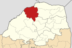 Location in Limpopo | |
| Country | South Africa |
| Province | Limpopo |
| District | Capricorn |
| Seat | Senwabarwana |
| Wards | 22 |
| Government | |
| • Type | Municipal council |
| • Mayor | Maseka Solomon Pheedi |
| Area | |
| • Total | 9,248 km2 (3,571 sq mi) |
| Population (2011)[2] | |
| • Total | 162,629 |
| • Density | 18/km2 (46/sq mi) |
| Racial makeup (2011) | |
| • Black African | 99.0% |
| • Coloured | 0.0% |
| • Indian/Asian | 0.1% |
| • White | 0.6% |
| First languages (2011) | |
| • Northern Sotho | 93.8% |
| • Other | 6.2% |
| Time zone | UTC+2 (SAST) |
| Municipal code | LIM351 |
Demography
According to the 2001 census conducted by Statistics South Africa, the population of the greater Blouberg municipality was 161,314, of whom 99.4% are African, 0.5% white, 0.1% Coloured and 0.1% Asian.


Main places
The 2001 census divided the municipality into the following main places:[4]
| Place | Code | Area (km2) | Population | Most spoken language |
|---|---|---|---|---|
| Alldays | 90901 | 11.75 | 385 | Northern Sotho |
| Bahanawa | 90902 | 390.17 | 19,068 | Northern Sotho |
| Bahanawa-Ba-Kibi | 90903 | 163.78 | 7,763 | Northern Sotho |
| Bochum Part 1 | 90912 | 4.33 | 8,501 | Northern Sotho |
| Bochum Part 2 | 90905 | 182.33 | 15,911 | Northern Sotho |
| Dichoeng | 90906 | 58.29 | 17,347 | Northern Sotho |
| Ga-Manthata | 90907 | 1,335.47 | 72,175 | Northern Sotho |
| Ga-Matlala | 90908 | 180.83 | 8,697 | Northern Sotho |
| Ga-Ramutla | 90910 | 7.81 | 1,047 | Northern Sotho |
| Remainder of the municipality | 90904 | 2,198.72 | 5,539 | Northern Sotho |
Politics
The municipal council consists of forty-four members elected by mixed-member proportional representation. Twenty-two councillors are elected by first-past-the-post voting in twenty-two wards, while the remaining twenty-two are chosen from party lists so that the total number of party representatives is proportional to the number of votes received. In the election of 3 August 2016 the African National Congress (ANC) won a majority of thirty-three seats on the council. The following table shows the results of the election.[5][6]
| Party | Votes | Seats | ||||||
|---|---|---|---|---|---|---|---|---|
| Ward | List | Total | % | Ward | List | Total | ||
| ANC | 30,986 | 31,347 | 62,333 | 73.8 | 22 | 11 | 33 | |
| EFF | 7,450 | 7,277 | 14,727 | 17.4 | 0 | 8 | 8 | |
| Democratic Alliance | 2,279 | 2,229 | 4,508 | 5.3 | 0 | 2 | 2 | |
| COPE | 843 | 781 | 1,624 | 1.9 | 0 | 1 | 1 | |
| Agang SA | 273 | 291 | 564 | 0.7 | 0 | 0 | 0 | |
| ACDP | 253 | 241 | 494 | 0.6 | 0 | 0 | 0 | |
| UDM | 97 | 111 | 208 | 0.3 | 0 | 0 | 0 | |
| Total | 42,181 | 42,277 | 84,458 | 100.0 | 22 | 22 | 44 | |
| Spoilt votes | 574 | 552 | 1,126 | |||||
References
- "Contact list: Executive Mayors". Government Communication & Information System. Archived from the original on 14 July 2010. Retrieved 22 February 2012.
- "Statistics by place". Statistics South Africa. Retrieved 27 September 2015.
- "Seraki Blouberg Route - South Africa - Open Africa". Archived from the original on 5 January 2012. Retrieved 22 March 2012.
- Lookup Tables - Statistics South Africa[permanent dead link]
- "Results Summary – All Ballots: Blouberg" (PDF). Independent Electoral Commission. Retrieved 20 January 2017.
- "Seat Calculation Detail: Blouberg" (PDF). Independent Electoral Commission. Retrieved 20 January 2017.
External links
Municipalities of Limpopo | ||||||||||||
|---|---|---|---|---|---|---|---|---|---|---|---|---|
| District and local |
|  | ||||||||||
List of municipalities in Limpopo | ||||||||||||
This Limpopo location article is a stub. You can help Wikipedia by expanding it. |
На других языках
- [en] Blouberg Local Municipality
[es] Municipio local de Blouberg
Blouberg (que significa literalmente montaña azul) es un municipio en el norte de Sudáfrica, que limita con Zimbabue y Botsuana. Su nombre proviene de una montaña justo pasado el extremo occidental de la cordillera de Soutpansberg en la provincia de Limpopo, Sudáfrica, al noroeste de la ciudad de Vivo. Blouberg es el lugar en el que se encuentran algunas escaladas espectaculares en Sudáfrica. Este lugar de escalada en roca es famosa por su gran pared natural de escalada con longitudes de ruta de hasta 350 m. La vegetación va desde la sabana sub-tropical en la base hasta la de tipo alpino cerca de la cumbre.Другой контент может иметь иную лицензию. Перед использованием материалов сайта WikiSort.org внимательно изучите правила лицензирования конкретных элементов наполнения сайта.
WikiSort.org - проект по пересортировке и дополнению контента Википедии