world.wikisort.org - South_Africa
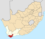
Hotagterklip is a small hamlet on the South African coast, close to the village of Struisbaai in the Western Cape.
This article needs additional citations for verification. (April 2007) |
Hotagterklip | |
|---|---|
 Hotagterklip  Hotagterklip | |
| Coordinates: 34°47′53″S 20°2′44″E | |
| Country | South Africa |
| Province | Western Cape |
| District | Overberg |
| Municipality | Cape Agulhas |
| Time zone | UTC+2 (SAST) |
‘Hotagterklip’ is the Afrikaans for 'left rear stone'. The unusual name of this little place comes from the days of the first ox wagon trek, when a stone outcrop imposed a sharp detour on travelers.
The fishermen's cottages in Hotagterklip have been declared provincial heritage sites. They are featured in the paintings of a number of South African artists. Many of the old cottages fell into ruin, until original cottages were restored in the 1990s.
External links
Текст в блоке "Читать" взят с сайта "Википедия" и доступен по лицензии Creative Commons Attribution-ShareAlike; в отдельных случаях могут действовать дополнительные условия.
Другой контент может иметь иную лицензию. Перед использованием материалов сайта WikiSort.org внимательно изучите правила лицензирования конкретных элементов наполнения сайта.
Другой контент может иметь иную лицензию. Перед использованием материалов сайта WikiSort.org внимательно изучите правила лицензирования конкретных элементов наполнения сайта.
2019-2025
WikiSort.org - проект по пересортировке и дополнению контента Википедии
WikiSort.org - проект по пересортировке и дополнению контента Википедии
