world.wikisort.org - Slovenia
Žirovski Vrh Svetega Antona (pronounced [ʒiˈɾoːu̯ski ˈʋəɾx ˈsʋeːtɛɡa anˈtoːna]) is a dispersed settlement above Gorenja Vas in the Municipality of Gorenja Vas–Poljane in the Upper Carniola region of Slovenia.[2]
Žirovski Vrh Svetega Antona
Žirovski Vrh nad Gorenjo vasjo (1955–1994) | |
|---|---|
 The hamlet of Kolišar in Žirovski Vrh Svetega Antona | |
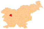
 Žirovski Vrh Svetega Antona Location in Slovenia | |
| Coordinates: 46°5′5.28″N 14°7′54.16″E | |
| Country | |
| Traditional region | Upper Carniola |
| Statistical region | Upper Carniola |
| Municipality | Gorenja Vas–Poljane |
| Area | |
| • Total | 2.72 km2 (1.05 sq mi) |
| Elevation | 693.3 m (2,274.6 ft) |
| Population (2020) | |
| • Total | 58 |
| • Density | 21/km2 (55/sq mi) |
| [1] | |
Name
The name of the settlement was changed from Žirovski Vrh Svetega Antona (literally, 'Žiri Peak of Saint Anthony') to Žirovski Vrh nad Gorenjo vasjo (literally, 'Žiri Peak above Gorenja Vas') in 1955. The name was changed on the basis of the 1948 Law on Names of Settlements and Designations of Squares, Streets, and Buildings as part of efforts by Slovenia's postwar communist government to remove religious elements from toponyms.[3][4] The name Žirovski Vrh Svetega Antona was restored in 1994.[5]
History

The Rupnik Line, a line of fortifications and weapons installations, was built in the area in the 1930s. Several pillboxes from the line are preserved in the village's territory.
References
- Statistical Office of the Republic of Slovenia
- Gorenja Vas–Poljane municipal site
- Spremembe naselij 1948–95. 1996. Database. Ljubljana: Geografski inštitut ZRC SAZU, DZS.
- Premk, F. 2004. Slovenska versko-krščanska terminologija v zemljepisnih imenih in spremembe za čas 1921–1967/68. Besedoslovne lastnosti slovenskega jezika: slovenska zemljepisna imena. Ljubljana: Slavistično društvo Slovenije, pp. 113–132.
- Urbanc, Mimi, & Matej Gabrovec. 2005. Krajevna imena: poligon za dokazovanje moči in odraz lokalne identitete. Geografski vestnik 77(2): 25–43.
External links
 Media related to Žirovski Vrh Svetega Antona at Wikimedia Commons
- Žirovski Vrh Svetega Antona on Geopedia
This article about the Municipality of Gorenja vas-Poljane in Slovenia is a stub. You can help Wikipedia by expanding it. |
Другой контент может иметь иную лицензию. Перед использованием материалов сайта WikiSort.org внимательно изучите правила лицензирования конкретных элементов наполнения сайта.
WikiSort.org - проект по пересортировке и дополнению контента Википедии