world.wikisort.org - Slovenia
Volaka (pronounced [ʋɔˈlaːka]) is a dispersed settlement in the hills north of Hotavlje in the Municipality of Gorenja Vas–Poljane in the Upper Carniola region of Slovenia.[2]
Volaka | |
|---|---|
 | |
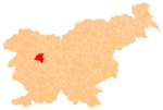
 Volaka Location in Slovenia | |
| Coordinates: 46°7′45.1″N 14°6′46.43″E | |
| Country | |
| Traditional region | Upper Carniola |
| Statistical region | Upper Carniola |
| Municipality | Gorenja Vas–Poljane |
| Area | |
| • Total | 1.5 km2 (0.6 sq mi) |
| Elevation | 459.6 m (1,507.9 ft) |
| Population (2020) | |
| • Total | 98 |
| • Density | 65/km2 (170/sq mi) |
| [1] | |
Name
The name Volaka is believed to refer to early foreign-born residents of the settlement, related to the word Vlach.[3]
History
Volaščica Creek, which runs through the settlement, was set as the original border of the Dominion of Freising in AD 973. Oral tradition states that in the 11th century a castle owned by Hemma of Gurk stood on Gradišče Hill above the settlement. In the 17th century, iron ore was dug in the area and carried across the hills to Potok and Železniki for processing. For a number of years a foundry operated in Volaka.[3]
References
- Statistical Office of the Republic of Slovenia
- Gorenja Vas–Poljane municipal site
- Savnik, Roman (1968). Krajevni leksikon Slovenije, vol. 1. Ljubljana: Državna založba Slovenije. p. 384.
External links
 Media related to Volaka at Wikimedia Commons
- Volaka on Geopedia
This article about the Municipality of Gorenja vas-Poljane in Slovenia is a stub. You can help Wikipedia by expanding it. |
Другой контент может иметь иную лицензию. Перед использованием материалов сайта WikiSort.org внимательно изучите правила лицензирования конкретных элементов наполнения сайта.
WikiSort.org - проект по пересортировке и дополнению контента Википедии