world.wikisort.org - Slovenia
Vojsko (pronounced [ˈʋoːi̯skɔ] or [ˈʋɔːi̯skɔ], German: Woiska[2]) is a dispersed settlement in the hills west of Idrija in the traditional Inner Carniola region of Slovenia.[2] It has a cluster of buildings centered on the parish church at its centre, and includes a number of smaller hamlets as well as remote farmsteads in the surrounding hills.[3]
Vojsko | |
|---|---|
 Vojsko (1959) | |
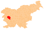
 Vojsko Location in Slovenia | |
| Coordinates: 46°1′25.09″N 13°54′12.25″E | |
| Country | |
| Traditional region | Inner Carniola |
| Statistical region | Gorizia |
| Municipality | Idrija |
| Area | |
| • Total | 41.22 km2 (15.92 sq mi) |
| Elevation | 1,083.3 m (3,554.1 ft) |
| Population (2002) | |
| • Total | 197 |
| [1] | |
The parish church is dedicated to Saint Joseph and belongs to the Koper Diocese.[4]
Weather station
A weather station was installed at Vojsko in July 1928. Initially, it was used solely for measuring precipitation, but since November 1958 it has recorded all common meteorological observations.[5]
| Climate data for Vojsko (elevation 1,068 m; 1957–2022) | |||||||||||||
|---|---|---|---|---|---|---|---|---|---|---|---|---|---|
| Month | Jan | Feb | Mar | Apr | May | Jun | Jul | Aug | Sep | Oct | Nov | Dec | Year |
| Record high °C (°F) | 14.6 (58.3) |
16.7 (62.1) |
19.7 (67.5) |
22.9 (73.2) |
27.5 (81.5) |
31.0 (87.8) |
30.5 (86.9) |
31.7 (89.1) |
27.5 (81.5) |
22.1 (71.8) |
21.6 (70.9) |
17.1 (62.8) |
31.7 (89.1) |
| Average high °C (°F) | 0.52 (32.94) |
1.72 (35.10) |
5.25 (41.45) |
9.57 (49.23) |
14.52 (58.14) |
18.44 (65.19) |
20.67 (69.21) |
20.16 (68.29) |
15.73 (60.31) |
10.74 (51.33) |
5.37 (41.67) |
1.6 (34.9) |
10.36 (50.65) |
| Daily mean °C (°F) | −2.34 (27.79) |
−1.56 (29.19) |
1.53 (34.75) |
5.6 (42.1) |
10.34 (50.61) |
14.01 (57.22) |
16.04 (60.87) |
15.51 (59.92) |
11.62 (52.92) |
7.23 (45.01) |
2.58 (36.64) |
−1.1 (30.0) |
6.62 (43.92) |
| Average low °C (°F) | −5.0 (23.0) |
−4.43 (24.03) |
−1.58 (29.16) |
2.17 (35.91) |
6.58 (43.84) |
9.99 (49.98) |
11.8 (53.2) |
11.64 (52.95) |
8.3 (46.9) |
4.36 (39.85) |
0.07 (32.13) |
−3.69 (25.36) |
3.35 (38.03) |
| Record low °C (°F) | −20.5 (−4.9) |
−18.7 (−1.7) |
−20.0 (−4.0) |
−10.2 (13.6) |
−4.5 (23.9) |
0.5 (32.9) |
2.0 (35.6) |
1.4 (34.5) |
−1.3 (29.7) |
−8.3 (17.1) |
−14.5 (5.9) |
−18.4 (−1.1) |
−20.5 (−4.9) |
| Average precipitation mm (inches) | 166.07 (6.54) |
157.1 (6.19) |
174.72 (6.88) |
181.44 (7.14) |
177.1 (6.97) |
185.44 (7.30) |
161.47 (6.36) |
162.85 (6.41) |
213.79 (8.42) |
236.69 (9.32) |
311.68 (12.27) |
235.99 (9.29) |
2,364.34 (93.09) |
| Average extreme snow depth cm (inches) | 66.28 (26.09) |
81.8 (32.2) |
82.06 (32.31) |
44.13 (17.37) |
8.06 (3.17) |
0.0 (0.0) |
0.0 (0.0) |
0.0 (0.0) |
7.75 (3.05) |
8.06 (3.17) |
30.07 (11.84) |
50.0 (19.7) |
82.06 (32.31) |
| Average precipitation days (≥ 0.1 mm) | 11.37 | 10.85 | 11.85 | 14.42 | 15.46 | 15.23 | 13.12 | 12.45 | 11.52 | 12.88 | 13.97 | 12.2 | 155.32 |
| Average rainy days (≥ 0.1 mm) | 5.49 | 5.71 | 7.43 | 12.22 | 15.18 | 15.23 | 13.11 | 12.45 | 11.48 | 12.29 | 11.75 | 7.46 | 129.8 |
| Average snowy days (≥ 0.1 mm) | 7.83 | 7.2 | 6.6 | 4.51 | 0.78 | 0.05 | 0.0 | 0.0 | 0.06 | 0.91 | 4.02 | 6.95 | 38.91 |
| Average relative humidity (%) | 82.07 | 79.5 | 75.33 | 74.16 | 74.9 | 74.77 | 73.13 | 76.33 | 81.53 | 85.0 | 84.62 | 83.73 | 78.76 |
| Average afternoon relative humidity (%) | 77.6 | 72.73 | 64.7 | 62.97 | 63.52 | 63.23 | 60.6 | 62.0 | 69.03 | 75.97 | 79.83 | 79.97 | 69.35 |
| Mean monthly sunshine hours | 85.49 | 98.07 | 123.69 | 158.59 | 191.52 | 211.03 | 255.22 | 224.19 | 172.36 | 143.41 | 89.29 | 80.37 | 1,833.23 |
| Source: National Meteorological Service of Slovenia – Archive[6] | |||||||||||||
References
- Statistical Office of the Republic of Slovenia
- Leksikon občin kraljestev in dežel zastopanih v državnem zboru, vol. 6: Kranjsko. Vienna: C. Kr. Dvorna in Državna Tiskarna. 1906. p. 126.
- Idrija municipal site
- "Koper Diocese list of churches" (PDF). Archived from the original (PDF) on 2009-03-06. Retrieved 2009-03-06.
- "Meteoroloska opazovanja" (PDF). Slovenian Environment Agency. Retrieved 2022-07-27.
{{cite web}}: CS1 maint: url-status (link) - "meteo.si - Uradna vremenska napoved za Slovenijo - Državna meteorološka služba RS - Državna meteorološka služba". meteo.arso.gov.si. Retrieved 2022-07-27.
External links
Municipality of Idrija | ||
|---|---|---|
| Settlements | Administrative seat: Idrija
|  |
| Landmarks |
| |
| Notable people |
| |
Authority control | |
|---|---|
| General |
|
| National libraries | |
This article about the Municipality of Idrija in Slovenia is a stub. You can help Wikipedia by expanding it. |
Текст в блоке "Читать" взят с сайта "Википедия" и доступен по лицензии Creative Commons Attribution-ShareAlike; в отдельных случаях могут действовать дополнительные условия.
Другой контент может иметь иную лицензию. Перед использованием материалов сайта WikiSort.org внимательно изучите правила лицензирования конкретных элементов наполнения сайта.
Другой контент может иметь иную лицензию. Перед использованием материалов сайта WikiSort.org внимательно изучите правила лицензирования конкретных элементов наполнения сайта.
2019-2025
WikiSort.org - проект по пересортировке и дополнению контента Википедии
WikiSort.org - проект по пересортировке и дополнению контента Википедии