world.wikisort.org - Slovenia
Razpotje (pronounced [ˈɾaːspɔtjɛ]) south of Srednja Kanomlja in the Municipality of Idrija, Slovenia.[3] It is a popular excursion destination.[2]
Razpotje | |
|---|---|
 Razpotje Location in Slovenia | |
| Coordinates: 46°0′36.80″N 14°0′1.32″E | |
| Country | |
| Traditional region | Inner Carniola |
| Statistical region | Gorizia |
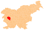
| Municipality | Idrija |
| Area | |
| • Total | 7.1 km2 (2.7 sq mi) |
| Elevation | 550 m (1,800 ft) |
| Population (2015)[1] | |
| • Total | 70 |
Name
The name Razpotje literally means 'crossroads'; routes to Srednja Kanomlja, Idrija, and various hamlets meet in the village. The village was formerly known as Kanomeljsko Razpotje (literally, 'Kanomlja crossroads') when it was a hamlet of Srednja Kanomlja.[2]
History
The territory of Razpotje was part of Spodnja Kanomlja and Srednja Kanomlja until 2006, when it was made a separate village.[1]
References
- Statistical Office of the Republic of Slovenia: Razpotje, Idrija.
- Savnik, Roman (1968). Krajevni leksikon Slovenije, vol. 1. Ljubljana: Državna založba Slovenije. p. 79.
- Idrija municipal site
External links
Municipality of Idrija | ||
|---|---|---|
| Settlements | Administrative seat: Idrija
|  |
| Landmarks |
| |
| Notable people |
| |
This article about the Municipality of Idrija in Slovenia is a stub. You can help Wikipedia by expanding it. |
Текст в блоке "Читать" взят с сайта "Википедия" и доступен по лицензии Creative Commons Attribution-ShareAlike; в отдельных случаях могут действовать дополнительные условия.
Другой контент может иметь иную лицензию. Перед использованием материалов сайта WikiSort.org внимательно изучите правила лицензирования конкретных элементов наполнения сайта.
Другой контент может иметь иную лицензию. Перед использованием материалов сайта WikiSort.org внимательно изучите правила лицензирования конкретных элементов наполнения сайта.
2019-2025
WikiSort.org - проект по пересортировке и дополнению контента Википедии
WikiSort.org - проект по пересортировке и дополнению контента Википедии