world.wikisort.org - Slovenia
Trstenik (pronounced [təɾstɛˈniːk]) is a settlement in the Municipality of Benedikt in the Slovene Hills (Slovene: Slovenske gorice) in northeastern Slovenia. The area is part of the traditional region of Styria. It is now included in the Drava Statistical Region.[2]
Trstenik | |
|---|---|
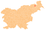
 Trstenik Location in Slovenia | |
| Coordinates: 46°37′32.64″N 15°53′48.81″E | |
| Country | |
| Traditional region | Styria |
| Statistical region | Drava |
| Municipality | Benedikt |
| Area | |
| • Total | 1.37 km2 (0.53 sq mi) |
| Elevation | 280.4 m (919.9 ft) |
| Population (2020) | |
| • Total | 107 |
| • Density | 78/km2 (200/sq mi) |
| [1] | |
There are two small chapel-shrines south of the main settlement. Both were built in the early 20th century.[3]
Seven relatively intact tumuli from the Roman period have been identified near the settlement. Such burials are fairly common in the area with an extensive burial ground near Trotkova south of Trstenik.[4]
References
- Statistical Office of the Republic of Slovenia
- Benedikt municipal site
- Slovenian Ministry of Culture register of national heritage reference numbers ešd 11717 & 11718
- Slovenian Ministry of Culture register of national heritage reference number ešd 1032
External links
Municipality of Benedikt | ||||||
|---|---|---|---|---|---|---|
| Settlements | Administrative seat: Benedikt
|  | ||||
This article about the Municipality of Benedikt in Slovenia is a stub. You can help Wikipedia by expanding it. |
Текст в блоке "Читать" взят с сайта "Википедия" и доступен по лицензии Creative Commons Attribution-ShareAlike; в отдельных случаях могут действовать дополнительные условия.
Другой контент может иметь иную лицензию. Перед использованием материалов сайта WikiSort.org внимательно изучите правила лицензирования конкретных элементов наполнения сайта.
Другой контент может иметь иную лицензию. Перед использованием материалов сайта WikiSort.org внимательно изучите правила лицензирования конкретных элементов наполнения сайта.
2019-2025
WikiSort.org - проект по пересортировке и дополнению контента Википедии
WikiSort.org - проект по пересортировке и дополнению контента Википедии