world.wikisort.org - Slovenia
Spodnja Ročica (pronounced [ˈspoːdnja ɾɔˈtʃiːtsa]) is a settlement in the Municipality of Benedikt in northeastern Slovenia. It lies in the Slovene Hills (Slovene: Slovenske gorice). The area is part of the traditional region of Styria and is now included in the Drava Statistical Region.[2]
Spodnja Ročica | |
|---|---|
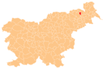
 Spodnja Ročica Location in Slovenia | |
| Coordinates: 46°37′14.99″N 15°51′21.39″E | |
| Country | |
| Traditional region | Styria |
| Statistical region | Drava |
| Municipality | Benedikt |
| Area | |
| • Total | 1.7 km2 (0.7 sq mi) |
| Elevation | 308.9 m (1,013.5 ft) |
| Population (2020) | |
| • Total | 124 |
| • Density | 73/km2 (190/sq mi) |
| [1] | |
Fourteen partly destroyed Roman-period burial mounds have been identified near the settlement.[3]
References
External links
Municipality of Benedikt | ||||||
|---|---|---|---|---|---|---|
| Settlements | Administrative seat: Benedikt
|  | ||||
This article about the Municipality of Benedikt in Slovenia is a stub. You can help Wikipedia by expanding it. |
Текст в блоке "Читать" взят с сайта "Википедия" и доступен по лицензии Creative Commons Attribution-ShareAlike; в отдельных случаях могут действовать дополнительные условия.
Другой контент может иметь иную лицензию. Перед использованием материалов сайта WikiSort.org внимательно изучите правила лицензирования конкретных элементов наполнения сайта.
Другой контент может иметь иную лицензию. Перед использованием материалов сайта WikiSort.org внимательно изучите правила лицензирования конкретных элементов наполнения сайта.
2019-2025
WikiSort.org - проект по пересортировке и дополнению контента Википедии
WikiSort.org - проект по пересортировке и дополнению контента Википедии