world.wikisort.org - Slovenia
Pristava pri Mestinju (pronounced [ˈpɾiːstaʋa pɾi mɛˈstiːnju]) is a settlement in the Municipality of Podčetrtek in eastern Slovenia. It lies on the main road from Podčetrtek to Rogaška Slatina. The area is part of the traditional region of Styria. It is now included in the Savinja Statistical Region.[2]
Pristava pri Mestinju | |
|---|---|
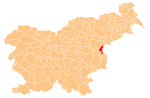
 Pristava pri Mestinju Location in Slovenia | |
| Coordinates: 46°11′46.01″N 15°35′43.29″E | |
| Country | |
| Traditional region | Styria |
| Statistical region | Savinja |
| Municipality | Podčetrtek |
| Area | |
| • Total | 1.62 km2 (0.63 sq mi) |
| Elevation | 204.4 m (670.6 ft) |
| Population (2002) | |
| • Total | 194 |
| [1] | |
Name
The name of the settlement was changed from Pristava to Pristava pri Mestinju in 1953.[3]
References
- Statistical Office of the Republic of Slovenia
- Podčetrtek municipal site
- Spremembe naselij 1948–95. 1996. Database. Ljubljana: Geografski inštitut ZRC SAZU, DZS.
External links
Municipality of Podčetrtek | ||||||
|---|---|---|---|---|---|---|
| Settlements | Administrative seat: Podčetrtek
|  | ||||
| Landmarks |
| |||||
This article about the Municipality of Podčetrtek in Slovenia is a stub. You can help Wikipedia by expanding it. |
Текст в блоке "Читать" взят с сайта "Википедия" и доступен по лицензии Creative Commons Attribution-ShareAlike; в отдельных случаях могут действовать дополнительные условия.
Другой контент может иметь иную лицензию. Перед использованием материалов сайта WikiSort.org внимательно изучите правила лицензирования конкретных элементов наполнения сайта.
Другой контент может иметь иную лицензию. Перед использованием материалов сайта WikiSort.org внимательно изучите правила лицензирования конкретных элементов наполнения сайта.
2019-2025
WikiSort.org - проект по пересортировке и дополнению контента Википедии
WikiSort.org - проект по пересортировке и дополнению контента Википедии