world.wikisort.org - Slovenia
Javornik (pronounced [ˈjaːʋɔɾnik]) is a small dispersed settlement on the slopes of Javornik Hill south of Črni Vrh in the Municipality of Idrija[2] in the traditional Inner Carniola region of Slovenia.[3] Its remoteness and high elevation have resulted in people moving away from their farms, and there is only a single resident in the settlement.
Javornik | |
|---|---|
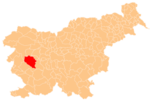
 Javornik Location in Slovenia | |
| Coordinates: 45°53′36.97″N 14°4′29.63″E | |
| Country | |
| Traditional region | Inner Carniola |
| Statistical region | Gorizia |
| Municipality | Idrija |
| Area | |
| • Total | 7.46 km2 (2.88 sq mi) |
| Elevation | 1,139.9 m (3,739.8 ft) |
| Population (2014) | |
| • Total | 1 |
| [1] | |
References
- Statistical Office of the Republic of Slovenia
- Idrija municipal site
- Leksikon občin kraljestev in dežel zastopanih v državnem zboru, vol. 6: Kranjsko. Vienna: C. Kr. Dvorna in Državna Tiskarna. 1906. p. 125.
External links
Municipality of Idrija | ||
|---|---|---|
| Settlements | Administrative seat: Idrija
|  |
| Landmarks |
| |
| Notable people |
| |
This article about the Municipality of Idrija in Slovenia is a stub. You can help Wikipedia by expanding it. |
Текст в блоке "Читать" взят с сайта "Википедия" и доступен по лицензии Creative Commons Attribution-ShareAlike; в отдельных случаях могут действовать дополнительные условия.
Другой контент может иметь иную лицензию. Перед использованием материалов сайта WikiSort.org внимательно изучите правила лицензирования конкретных элементов наполнения сайта.
Другой контент может иметь иную лицензию. Перед использованием материалов сайта WikiSort.org внимательно изучите правила лицензирования конкретных элементов наполнения сайта.
2019-2025
WikiSort.org - проект по пересортировке и дополнению контента Википедии
WikiSort.org - проект по пересортировке и дополнению контента Википедии