world.wikisort.org - Slovenia
Bela Cerkev (pronounced [ˈbeːla ˈtseːɾkɛu̯]) is a settlement on the right bank of the Krka River in the Municipality of Šmarješke Toplice in southeastern Slovenia. The area is part of the historical region of Lower Carniola. The municipality is now included in the Southeast Slovenia Statistical Region.[2]
Bela Cerkev | |
|---|---|
 | |
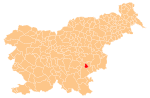
 Bela Cerkev Location in Slovenia | |
| Coordinates: 45°52′0.02″N 15°16′30.84″E | |
| Country | |
| Traditional region | Lower Carniola |
| Statistical region | Southeast Slovenia |
| Municipality | Šmarješke Toplice |
| Area | |
| • Total | 0.74 km2 (0.29 sq mi) |
| Elevation | 190.4 m (624.7 ft) |
| Population (2002) | |
| • Total | 107 |
| [1] | |
Name
Bela Cerkev was attested as Alba eccclesia in 1283 and Weysenchirchen in 1296, among other spellings of these names.[3] All these names mean 'white church'.
Church
The local parish church is dedicated to Saint Andrew and belongs to the Roman Catholic Diocese of Novo Mesto. It was built in 1813 on the site of an earlier building.[4]
References
- Statistical Office of the Republic of Slovenia
- Šmarješke Toplice municipal site
- "Bela Cerkev". Slovenska historična topografija. ZRC SAZU Zgodovinski inštitut Milka Kosa. Retrieved February 7, 2021.
- "EŠD 1620". Registry of Immovable Cultural Heritage (in Slovenian). Ministry of Culture of the Republic of Slovenia. Archived from the original on 17 August 2011. Retrieved 23 May 2011.
External links
- Bela Cerkev at Geopedia
 Media related to Bela Cerkev at Wikimedia Commons
Municipality of Šmarješke Toplice | ||||||
|---|---|---|---|---|---|---|
| Settlements | Administrative seat: Šmarješke Toplice
|  | ||||
| Landmarks |
| |||||
Authority control | |
|---|---|
| General |
|
| National libraries | |
This article about the Municipality of Šmarješke Toplice in Slovenia is a stub. You can help Wikipedia by expanding it. |
Другой контент может иметь иную лицензию. Перед использованием материалов сайта WikiSort.org внимательно изучите правила лицензирования конкретных элементов наполнения сайта.
WikiSort.org - проект по пересортировке и дополнению контента Википедии