world.wikisort.org - Slovenia
Orešje (pronounced [ɔˈɾeːʃjɛ]) is a settlement east of Šmarjeta in the Municipality of Šmarješke Toplice in southeastern Slovenia. The area is part of the historical region of Lower Carniola. The municipality is now included in the Southeast Slovenia Statistical Region.[2]
Orešje | |
|---|---|
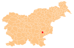
 Orešje Location in Slovenia | |
| Coordinates: 45°53′11.66″N 15°16′7.07″E | |
| Country | |
| Traditional region | Lower Carniola |
| Statistical region | Southeast Slovenia |
| Municipality | Šmarješke Toplice |
| Area | |
| • Total | 1.73 km2 (0.67 sq mi) |
| Elevation | 269.2 m (883.2 ft) |
| Population (2002) | |
| • Total | 104 |
| [1] | |
References
- Statistical Office of the Republic of Slovenia Archived November 18, 2008, at the Wayback Machine
- Šmarješke Toplice municipal site
External links
Municipality of Šmarješke Toplice | ||||||
|---|---|---|---|---|---|---|
| Settlements | Administrative seat: Šmarješke Toplice
|  | ||||
| Landmarks |
| |||||
This article about the Municipality of Šmarješke Toplice in Slovenia is a stub. You can help Wikipedia by expanding it. |
Текст в блоке "Читать" взят с сайта "Википедия" и доступен по лицензии Creative Commons Attribution-ShareAlike; в отдельных случаях могут действовать дополнительные условия.
Другой контент может иметь иную лицензию. Перед использованием материалов сайта WikiSort.org внимательно изучите правила лицензирования конкретных элементов наполнения сайта.
Другой контент может иметь иную лицензию. Перед использованием материалов сайта WikiSort.org внимательно изучите правила лицензирования конкретных элементов наполнения сайта.
2019-2025
WikiSort.org - проект по пересортировке и дополнению контента Википедии
WikiSort.org - проект по пересортировке и дополнению контента Википедии