world.wikisort.org - Philippines
Samal, officially the Municipality of Samal (Tagalog: Bayan ng Samal), is a 4th class municipality in the province of Bataan, Philippines. According to the 2020 census, it has a population of 38,302 people. [3]
Samal | |
|---|---|
Municipality | |
| Municipality of Samal | |
 | |
 Flag  Seal | |
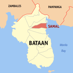 Map of Bataan with Samal highlighted | |
OpenStreetMap  | |
 Samal Location within the Philippines | |
| Coordinates: 14°46′04″N 120°32′35″E | |
| Country | Philippines |
| Region | Central Luzon |
| Province | Bataan |
| District | 1st district |
| Founded | 1699 |
| Barangays | 14 (see Barangays) |
| Government | |
| • Type | Sangguniang Bayan |
| • Mayor | Aida DG. Macalinao |
| • Vice Mayor | Felix A. Espino, Jr. |
| • Representative | Geraldine B. Roman |
| • Municipal Council | Members |
| • Electorate | 29,669 voters (2022) |
| Area | |
| • Total | 56.30 km2 (21.74 sq mi) |
| Elevation | 15 m (49 ft) |
| Highest elevation | 133 m (436 ft) |
| Lowest elevation | 0 m (0 ft) |
| Population | |
| • Total | 38,302 |
| • Density | 680/km2 (1,800/sq mi) |
| • Households | 9,185 |
| Economy | |
| • Income class | 4th municipal income class |
| • Poverty incidence | 7.27% (2018)[4] |
| • Revenue | ₱168,820,598.60 (2020) |
| • Assets | ₱295,875,614.24 (2020) |
| • Expenditure | ₱169,248,104.92 (2020) |
| • Liabilities | ₱141,191,934.55 (2020) |
| Service provider | |
| • Electricity | Peninsula Electric Cooperative (PENELCO) |
| Time zone | UTC+8 (PST) |
| ZIP code | 2101 |
| PSGC | |
| IDD : area code | +63 (0)47 |
| Native languages | Mariveleño Tagalog |
Samal is 11 kilometres (6.8 mi) from Balanga and 113 kilometres (70 mi) from Manila. It has a total land area of 56.30 square kilometres (21.74 sq mi).
Etymology
Samal originated from samel, a covering attached to a banca to protect the passengers from the sun and rain, made of nipa leaves and woven together.
History

Saint Catherine of Sienna became the patron of Samal, which was founded as a municipality on April 20, 1641.[5]
"Sea gypsies" of Mindanao settlers ("Badjaos" who resided for many years in Maubac, Lambayung, Tanjung, Pata, Tapul, Lugus, Bangos, Pagasinan, Parang, Maimbung, Karugdung and Talipaw, Mindanao) migrated to Luzon in the early 14th century and settled in Bataan. In Samal, they propagated the pearl and capiz culture.
Samal was the second town founded by the Dominican friars in Bataan and is composed of four barrios: Calaguiman, Santa Lucia, Poblacion and Lalawigan.
Geography
Samal is located in the eastern part of Bataan Peninsula, bordering Abucay to the south, Orani to the north and northwest, Morong to the west, and Manila Bay to the east.
According to the Philippine Statistics Authority, the municipality has a land area of 56.30 square kilometres (21.74 sq mi) [6] constituting 4.10% of the 1,372.98-square-kilometre- (530.11 sq mi) total area of Bataan.
Climate
| Climate data for Samal, Bataan | |||||||||||||
|---|---|---|---|---|---|---|---|---|---|---|---|---|---|
| Month | Jan | Feb | Mar | Apr | May | Jun | Jul | Aug | Sep | Oct | Nov | Dec | Year |
| Average high °C (°F) | 31 (88) |
32 (90) |
34 (93) |
35 (95) |
33 (91) |
31 (88) |
29 (84) |
29 (84) |
29 (84) |
29 (84) |
30 (86) |
31 (88) |
31 (88) |
| Average low °C (°F) | 19 (66) |
19 (66) |
20 (68) |
23 (73) |
25 (77) |
25 (77) |
24 (75) |
25 (77) |
25 (77) |
24 (75) |
23 (73) |
20 (68) |
23 (73) |
| Average precipitation mm (inches) | 7 (0.3) |
8 (0.3) |
14 (0.6) |
26 (1.0) |
127 (5.0) |
210 (8.3) |
263 (10.4) |
272 (10.7) |
218 (8.6) |
114 (4.5) |
46 (1.8) |
21 (0.8) |
1,326 (52.3) |
| Average rainy days | 4.0 | 4.0 | 6.9 | 11.2 | 21.0 | 24.5 | 27.4 | 26.9 | 25.9 | 21.9 | 13.4 | 6.3 | 193.4 |
| Source: Meteoblue (modeled/calculated data, not measured locally)[7] | |||||||||||||
Barangays
Samal is politically subdivided into 14 barangays.[8]
| PSGC | Barangay | Population | ±% p.a. | |||
|---|---|---|---|---|---|---|
| 2020 [3] | 2010 [9] | |||||
| 030812001 | East Calaguiman (Poblacion) | 6.7% | 2,573 | 2,744 | −0.61% | |
| 030812002 | East Daang Bago (Poblacion) | 3.1% | 1,169 | 1,195 | −0.21% | |
| 030812013 | Gugo | 9.8% | 3,756 | 2,965 | 2.27% | |
| 030812003 | Ibaba (Poblacion) | 8.4% | 3,210 | 3,153 | 0.17% | |
| 030812004 | Imelda | 7.0% | 2,665 | 2,324 | 1.31% | |
| 030812005 | Lalawigan | 10.3% | 3,926 | 3,799 | 0.31% | |
| 030812006 | Palili | 5.5% | 2,092 | 1,865 | 1.09% | |
| 030812008 | San Juan (Poblacion) | 11.0% | 4,230 | 4,089 | 0.32% | |
| 030812009 | San Roque (Poblacion) | 3.0% | 1,159 | 1,154 | 0.04% | |
| 030812010 | Santa Lucia | 6.5% | 2,480 | 2,459 | 0.08% | |
| 030812011 | Sapa | 9.6% | 3,682 | 3,407 | 0.74% | |
| 030812012 | Tabing Ilog | 5.7% | 2,184 | 2,121 | 0.28% | |
| 030812014 | West Calaguiman (Poblacion) | 3.7% | 1,419 | 1,449 | −0.20% | |
| 030812015 | West Daang Bago (Poblacion) | 2.0% | 753 | 854 | −1.19% | |
| Total | 38,302 | 33,578 | 1.25% | |||
Demographics
|
|
| ||||||||||||||||||||||||||||||||||||||||||||||||||||||
| Source: Philippine Statistics Authority [10] [9] [11][12] | ||||||||||||||||||||||||||||||||||||||||||||||||||||||||
In the 2020 census, Samal had a population of 38,302. [3] The population density was 680 inhabitants per square kilometre (1,800/sq mi).
Economy

Composed largely of uplands and hills with some lowlands and plains, Samal's main produce are palay, corn, vegetable, fruits rootcrops, coffee and cutflowers, including livestock, poultry and aquatic resources such as shellfish, crabs, prawns, shrimps and different species of fish.
Joaquin Ma. Joson of Bataan established the first ice plant. Wooden shoe (bakya) making, and pulp mills (Bataan Pulp and Paper Mills, Inc. in the scenic slope of Mount Natib) are some of the industries of the natives. It also manufactures banana chips and arrow root flour through native processes, then made into cookies called araro as pasalubong. Samal is also rich is marine aquatic resources and highly productive farmlands.
Garments manufacturing in Samal is engaged in by five (5) firms already engaged in exports.[vague][20]
In the Town Hall of Samal and along the streets, Capiz shells are displayed to show that the town residents manufacture this commodity.
Government

Pursuant to the Local government in the Philippines",[21][22] the political seat of the municipal government is located at the Municipal Hall. In the History of the Philippines (1521–1898), the Gobernadorcillo was the Chief Executive who held office in the Presidencia. During the American rule (1898–1946) (History of the Philippines (1898-1946)), the elected Mayor and local officials, including the appointed ones held office at the Municipal Hall. The legislative and executive departments perform their functions in the Sangguniang Bayan (Session Hall) and Municipal Trial Court, respectively, and are located in the Town Hall.
Elected officials
Samal's incumbent elected officials are - Mayor Mayor Generosa "Gene" Malibiran Dela Fuente (Liberal) and Vice Mayor Emmanuel R. Cortez (Liberal).
The Sangguniang Bayan Members are: Aida De Guia Macalinao, Madell Tagorio Bathan, Amelia Yabut Dela Rosa, Roman, Jr. Estrella Lazarte, Eduardo Alipio De Castro, Ricky Bugay Santos, John Samson Mateo and Eduardo Bugay De Leon.[20] They hold office at the second floor of the Town Hall, particularly the Office of the Mayor and Sangguniang Bayan Session Hall, respectively.
The 2nd Municipal Circuit Trial Court of Orani-Samal MCTC Judge Ma. Cristina J. Mendoza-Pizzaro holds office in her sala located at the second floor of the MTC building at the back of the Orani Town hall.
Tourism
Samal's attractions, events and historical landmarks include:
- Senakulo sa Calaguiman during Holy Week
- Town Hall of Samal
- Samal Capiz shell industry
- Fish ponds, mangrove, mussels and seafoods in Samal bay
Parish Church of Saint Catherine of Siena

The 1596 Parish Church of Saint Catherine of Siena belongs to the Roman Catholic Diocese of Balanga[23][24][25] (Dioecesis Balangensis - Suffragan of the Archdiocese of San Fernando, Pampanga).[26][27]
The Parish has a Catholic population of 11,581, under Titular of St. Catherine of Siena, with Feast day on April 30. Its former Parish Priest is Monsignor Edilfredo Cruz of the[24] Vicariate of St. Dominic de Guzman.[28] As of June 2011, Fr. Antonio David Bernaldo was assigned as new Parish Priest of the church.[29]
The Dominicans in 1596 directed the spirituality of Samal. Attacked by Dutch invaders in April 1647, the local garrison of Pampanga under Alejo Aguas ousted the Dutch forces. Rev. Jeromino Belen, O.P. rebuilt the ruined church and the convent. In 1896 the Katipuneros burned the church and convent which were rebuilt by Rev. Justo Quesada in 1903.
Gallery
 Jose Rizal Samal Park and Plaza
 Post office, rear facade of Town hall
 Public market
 Capiz shells street lights surround downtown
 Banca transportation


References
- Municipality of Samal | (DILG)
- "2015 Census of Population, Report No. 3 – Population, Land Area, and Population Density" (PDF). Philippine Statistics Authority. Quezon City, Philippines. August 2016. ISSN 0117-1453. Archived (PDF) from the original on May 25, 2021. Retrieved July 16, 2021.
- Census of Population (2020). "Region III (Central Luzon)". Total Population by Province, City, Municipality and Barangay. PSA. Retrieved 8 July 2021.
- "PSA Releases the 2018 Municipal and City Level Poverty Estimates". Philippine Statistics Authority. 15 December 2021. Retrieved 22 January 2022.
- "Official Website of the Municipality of Samal Province of Bataan - MUNICIPAL PROFILE". Archived from the original on 2014-04-23. Retrieved 2013-01-23.
- "Province: Bataan". PSGC Interactive. Quezon City, Philippines: Philippine Statistics Authority. Retrieved 12 November 2016.
- "Samal: Average Temperatures and Rainfall". Meteoblue. Retrieved 26 April 2020.
- "Municipal: Samal, Bataan". PSGC Interactive. Quezon City, Philippines: Philippine Statistics Authority. Retrieved 8 January 2016.
- Census of Population and Housing (2010). "Region III (Central Luzon)". Total Population by Province, City, Municipality and Barangay. NSO. Retrieved 29 June 2016.
- Census of Population (2015). "Region III (Central Luzon)". Total Population by Province, City, Municipality and Barangay. PSA. Retrieved 20 June 2016.
- Censuses of Population (1903–2007). "Region III (Central Luzon)". Table 1. Population Enumerated in Various Censuses by Province/Highly Urbanized City: 1903 to 2007. NSO.
- "Province of Bataan". Municipality Population Data. Local Water Utilities Administration Research Division. Retrieved 17 December 2016.
- "Poverty incidence (PI):". Philippine Statistics Authority. Retrieved 28 December 2020.
- https://psa.gov.ph/sites/default/files/NSCB_LocalPovertyPhilippines_0.pdf; publication date: 29 November 2005; publisher: Philippine Statistics Authority.
- https://psa.gov.ph/sites/default/files/2003%20SAE%20of%20poverty%20%28Full%20Report%29_1.pdf; publication date: 23 March 2009; publisher: Philippine Statistics Authority.
- https://psa.gov.ph/sites/default/files/2006%20and%202009%20City%20and%20Municipal%20Level%20Poverty%20Estimates_0_1.pdf; publication date: 3 August 2012; publisher: Philippine Statistics Authority.
- https://psa.gov.ph/sites/default/files/2012%20Municipal%20and%20City%20Level%20Poverty%20Estima7tes%20Publication%20%281%29.pdf; publication date: 31 May 2016; publisher: Philippine Statistics Authority.
- https://psa.gov.ph/sites/default/files/City%20and%20Municipal-level%20Small%20Area%20Poverty%20Estimates_%202009%2C%202012%20and%202015_0.xlsx; publication date: 10 July 2019; publisher: Philippine Statistics Authority.
- "PSA Releases the 2018 Municipal and City Level Poverty Estimates". Philippine Statistics Authority. 15 December 2021. Retrieved 22 January 2022.
- "Municipality of Samal". Archived from the original on 2013-03-11. Retrieved 2013-01-23.
- "the 1987 Constitution of the Republic of the Philippines". Official Gazette of the Republic of the Philippines. Archived from the original on 22 January 2009. Retrieved 19 January 2021.
- "The Local Government Code Of The Philippines - Chan Robles Virtual Law Library". Chanrobles.com. Retrieved 2016-11-21.
- "ParishesV1". Balangadiocese.com. Retrieved 2016-11-22.
- "Diocese of Balanga". Archived from the original on 2012-09-06. Retrieved 2013-01-27.
- "Diocese of Balanga". Archived from the original on 2014-05-17. Retrieved 2013-01-27.
- "List of Parishes of the Roman Catholic Diocese of Balanga | Philippine Churches". Church.nfo.ph. 2012-06-27. Archived from the original on 2016-03-03. Retrieved 2016-11-22.
- "Parishes". Cbcponline.net. Retrieved 2016-11-22.
- "Department of Tourism - The Philippines Ultimate Travel Guide for Tourist". Visitmyphilippines.com. Retrieved 2016-11-22.
- "NewAssignsJune6". Balangadiocese.com. 2011-06-06. Retrieved 2016-11-22.
External links
Places adjacent to Samal, Bataan | ||||||||||||||||
|---|---|---|---|---|---|---|---|---|---|---|---|---|---|---|---|---|
| ||||||||||||||||
Balanga (capital) | |
| Municipalities | |
| Component city | |
| Authority control |
|
|---|
На других языках
[de] Samal (Bataan)
Samal ist eine philippinische Stadtgemeinde in der Provinz Bataan. Sie hat 35.298 Einwohner (Zensus 1. August 2015).- [en] Samal, Bataan
Другой контент может иметь иную лицензию. Перед использованием материалов сайта WikiSort.org внимательно изучите правила лицензирования конкретных элементов наполнения сайта.
WikiSort.org - проект по пересортировке и дополнению контента Википедии