world.wikisort.org - Philippines
Rizal, officially the Municipality of Jose P. Rizal,[5][6] (Tagalog: Bayan ng Rizal), is a 1st class municipality in the province of Palawan, Philippines. According to the 2020 census, it has a population of 56,162 people. [3]
Rizal | |
|---|---|
Municipality | |
| Municipality of Jose P. Rizal | |
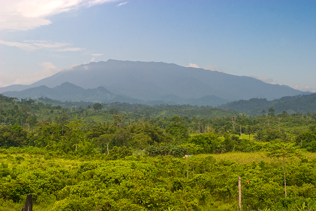 Mount Mantalingajan as seen from Ransang, Rizal | |
 Map of Palawan with Rizal highlighted | |
OpenStreetMap  | |
 Rizal Location within the Philippines | |
| Coordinates: 8°41′N 117°20′E | |
| Country | Philippines |
| Region | Mimaropa |
| Province | Palawan |
| District | 2nd district |
| Founded | April 14, 1983 |
| Renamed | April 17, 1988 |
| Named for | Dr. José Rizal |
| Barangays | 11 (see Barangays) |
| Government | |
| • Type | Sangguniang Bayan |
| • Mayor | Norman S. Ong |
| • Vice Mayor | Maria Gracia M. Zapanta |
| • Representative | Jose C. Alvarez |
| • Municipal Council | Members |
| • Electorate | 26,692 voters (2019) |
| Area | |
| • Total | 1,256.47 km2 (485.13 sq mi) |
| Elevation | 17 m (56 ft) |
| Highest elevation | 160 m (520 ft) |
| Lowest elevation | 0 m (0 ft) |
| Population | |
| • Total | 56,162 |
| • Density | 45/km2 (120/sq mi) |
| • Households | 12,731 |
| Economy | |
| • Income class | 1st municipal income class |
| • Poverty incidence | 20.13% (2018)[4] |
| • Revenue | ₱379,814,655.40 (2020) |
| • Assets | ₱863,804,551.63 (2020) |
| • Expenditure | ₱302,989,153.90 (2020) |
| • Liabilities | ₱293,837,947.08 (2020) |
| Service provider | |
| • Electricity | Palawan Electric Cooperative (PALECO) |
| Time zone | UTC+8 (PST) |
| ZIP code | 5323 |
| PSGC | |
| IDD : area code | +63 (0)48 |
| Native languages | Palawano Tagalog |
Prior to its formation as a separate municipality, the place was known as Tarumpitao Point and was part of the Municipality of Quezon. By virtue of Batas Pambansa Blg. 386, it was formed as a municipality on April 14, 1983, called Marcos.[7] It was renamed after José Rizal in 1987 through Republic Act No. 6652.[8][6]
The municipality is home to the Singnapan charcoal petrographs.
Geography
Barangays
Rizal is politically subdivided into 11 barangays.
- Bunog
- Campong Ulay
- Candawaga
- Canipaan
- Culasian
- Iraan
- Latud
- Panalingaan
- Punta Baja
- Ransang
- Taburi
Climate
| Climate data for Rizal, Palawan | |||||||||||||
|---|---|---|---|---|---|---|---|---|---|---|---|---|---|
| Month | Jan | Feb | Mar | Apr | May | Jun | Jul | Aug | Sep | Oct | Nov | Dec | Year |
| Average high °C (°F) | 30 (86) |
31 (88) |
31 (88) |
31 (88) |
31 (88) |
31 (88) |
30 (86) |
29 (84) |
29 (84) |
29 (84) |
30 (86) |
30 (86) |
30 (86) |
| Average low °C (°F) | 23 (73) |
23 (73) |
24 (75) |
25 (77) |
25 (77) |
25 (77) |
25 (77) |
25 (77) |
25 (77) |
25 (77) |
25 (77) |
24 (75) |
25 (76) |
| Average precipitation mm (inches) | 69 (2.7) |
55 (2.2) |
87 (3.4) |
97 (3.8) |
190 (7.5) |
263 (10.4) |
259 (10.2) |
239 (9.4) |
256 (10.1) |
260 (10.2) |
218 (8.6) |
131 (5.2) |
2,124 (83.7) |
| Average rainy days | 13.4 | 11.6 | 16.9 | 19.1 | 27.6 | 28.5 | 29.2 | 28.8 | 28.7 | 28.9 | 25.7 | 20.1 | 278.5 |
| Source: Meteoblue[9] | |||||||||||||
Demographics
| Year | Pop. | ±% p.a. |
|---|---|---|
| 1990 | 16,819 | — |
| 1995 | 31,745 | +12.64% |
| 2000 | 21,876 | −7.67% |
| 2007 | 35,487 | +6.90% |
| 2010 | 42,759 | +7.02% |
| 2015 | 50,096 | +3.06% |
| 2020 | 56,162 | +2.27% |
| Source: Philippine Statistics Authority [10] [11] [12][13] | ||
In the 2020 census, the population of Rizal, Palawan, was 56,162 people, [3] with a density of 45 inhabitants per square kilometre or 120 inhabitants per square mile.
Among the ethnic groups in Rizal are the Tao't Bato people. These people settle in caves during the rainy season and resides at Singnapan Valley area in Barangay Ransang.[5]
Economy
Singnapan Cave Petrographs
The charcoal-drawn petrographs of the Singnapan Valley are one of the most important ancient paintings in the country. The date of the paintings have yet to be scientifically established. Due to its high significance, it was submitted by the National Commission for Culture and the Arts of the Philippines to the UNESCO Tentative List of Heritage Sites in 2006, pending its inclusion in the World Heritage List along with the Alab petroglyphs of Mountain Province, Angono Petroglyphs of Rizal province, charcoal-drawn Penablanca petrographs of Cagayan, and the Anda red hermatite print petrographs of Bohol.[21]
References
- Municipality of Jose P. Rizal | (DILG)
- "2015 Census of Population, Report No. 3 – Population, Land Area, and Population Density" (PDF). Philippine Statistics Authority. Quezon City, Philippines. August 2016. ISSN 0117-1453. Archived (PDF) from the original on May 25, 2021. Retrieved July 16, 2021.
- Census of Population (2020). "MIMAROPA". Total Population by Province, City, Municipality and Barangay. PSA. Retrieved 8 July 2021.
- "PSA Releases the 2018 Municipal and City Level Poverty Estimates". Philippine Statistics Authority. 15 December 2021. Retrieved 22 January 2022.
- "History of Rizal Municipality". Official Website of Rizal Palawan. Rizal, Palawan Municipal Government. Retrieved 31 January 2016.
- "Republic Act No. 6652 - An Act Changing the Name of the Municipality of Marcos, Province of Palawan, to Municipality of Dr. Jose P. Rizal". Chan Robles Virtual Law Library. Retrieved 2 March 2016.
- "Batas Pambansa Bilang 386 - An Act Creating the Municipality of Marcos in the Province of Palawan". Chan Robles Virtual Law Library. 14 April 1983. Retrieved 2 March 2016.
- "Municipal Profile". Municipality of Jose P. Rizal. Archived from the original on 21 December 2012. Retrieved 22 November 2012.
- "Rizal, Palawan: Average Temperatures and Rainfall". Meteoblue. Retrieved 17 November 2019.
- Census of Population (2015). "Region IV-B (Mimaropa)". Total Population by Province, City, Municipality and Barangay. PSA. Retrieved 20 June 2016.
- Census of Population and Housing (2010). "Region IV-B (Mimaropa)". Total Population by Province, City, Municipality and Barangay. NSO. Retrieved 29 June 2016.
- Censuses of Population (1903–2007). "Region IV-B (Mimaropa)". Table 1. Population Enumerated in Various Censuses by Province/Highly Urbanized City: 1903 to 2007. NSO.
- "Province of Palawan". Municipality Population Data. Local Water Utilities Administration Research Division. Retrieved 17 December 2016.
- "Poverty incidence (PI):". Philippine Statistics Authority. Retrieved 28 December 2020.
- https://psa.gov.ph/sites/default/files/NSCB_LocalPovertyPhilippines_0.pdf; publication date: 29 November 2005; publisher: Philippine Statistics Authority.
- https://psa.gov.ph/sites/default/files/2003%20SAE%20of%20poverty%20%28Full%20Report%29_1.pdf; publication date: 23 March 2009; publisher: Philippine Statistics Authority.
- https://psa.gov.ph/sites/default/files/2006%20and%202009%20City%20and%20Municipal%20Level%20Poverty%20Estimates_0_1.pdf; publication date: 3 August 2012; publisher: Philippine Statistics Authority.
- https://psa.gov.ph/sites/default/files/2012%20Municipal%20and%20City%20Level%20Poverty%20Estima7tes%20Publication%20%281%29.pdf; publication date: 31 May 2016; publisher: Philippine Statistics Authority.
- https://psa.gov.ph/sites/default/files/City%20and%20Municipal-level%20Small%20Area%20Poverty%20Estimates_%202009%2C%202012%20and%202015_0.xlsx; publication date: 10 July 2019; publisher: Philippine Statistics Authority.
- "PSA Releases the 2018 Municipal and City Level Poverty Estimates". Philippine Statistics Authority. 15 December 2021. Retrieved 22 January 2022.
- "Petroglyphs and Petrographs of the Philippines". whc.unesco.org. UNESCO World Heritage Centre. Retrieved 23 March 2018.
External links
- Rizal Profile at PhilAtlas.com
- Philippine Standard Geographic Code
- Philippine Census Information
- Local Governance Performance Management System
Places adjacent to Rizal, Palawan | ||||||||||||||||
|---|---|---|---|---|---|---|---|---|---|---|---|---|---|---|---|---|
| ||||||||||||||||
Puerto Princesa (capital) | |
| Municipalities | |
| Highly urbanized city |
|
На других языках
[de] Rizal (Palawan)
Rizal (Marcos) ist eine philippinische Stadtgemeinde in der Provinz Palawan. Sie hat 50.096 Einwohner (Zensus 1. August 2015). In der Gemeinde befindet sich ein Campus der Palawan State University.- [en] Rizal, Palawan
Другой контент может иметь иную лицензию. Перед использованием материалов сайта WikiSort.org внимательно изучите правила лицензирования конкретных элементов наполнения сайта.
WikiSort.org - проект по пересортировке и дополнению контента Википедии